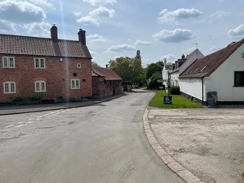
After a few days of yet more rain (when will we get a more settled period of weather I ask myself??) today is a rare dry day. Unfortunately, although we would have liked to have had a trip to the Peak District, morning commitments meant we had to stay put and so in the afternoon we decided to visit Dunham Massey – a local National Trust property close to Manchester that we regularly visit-for a 5 mile walk. https://www.nationaltrust.org.uk/visit/cheshire-greater-manchester/dunham-massey
We were hopeful that the park would be relatively quiet because Manchester United and Manchester City were playing in the FA Cup final at Wembley ( United won 2-1). It turned out that the park was quiet so that was a good call.
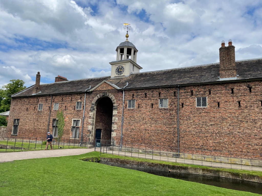
A quiet pathway in Dunham ParkEntrance into the stable block
Myself and Angela had a walk around the park footpaths, looked at some deer and enjoyed the sun on our faces. It makes a world of difference having nice weather.
Angela suggested a walk around the gardens so we did that and admired all the wonderful shrubs and plants growing there.
The old OrangeryThe house viewed from the garden
‘Do you fancy a coffee?’ asked Angela. Most certainly, so we visited the café and relaxed outside with our coffees watching the world go by.
After coffee, a visit to the second hand books section was productive with myself buying three interesting books. I find that I am always lucky with finding good books here.
I have 2 peak District walks planned and I am hoping that the opportunity to do these will arise this week. The first is Alport Castles and the second Cubar Edge / Froggatt Edge. Fingers crossed for relatively dry days.
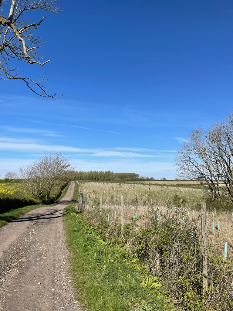
Following a very wet start to the day the rain eventually stopped and myself and Mick were able to enjoy a lovely 10 mile circular walk.
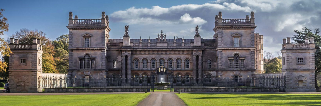
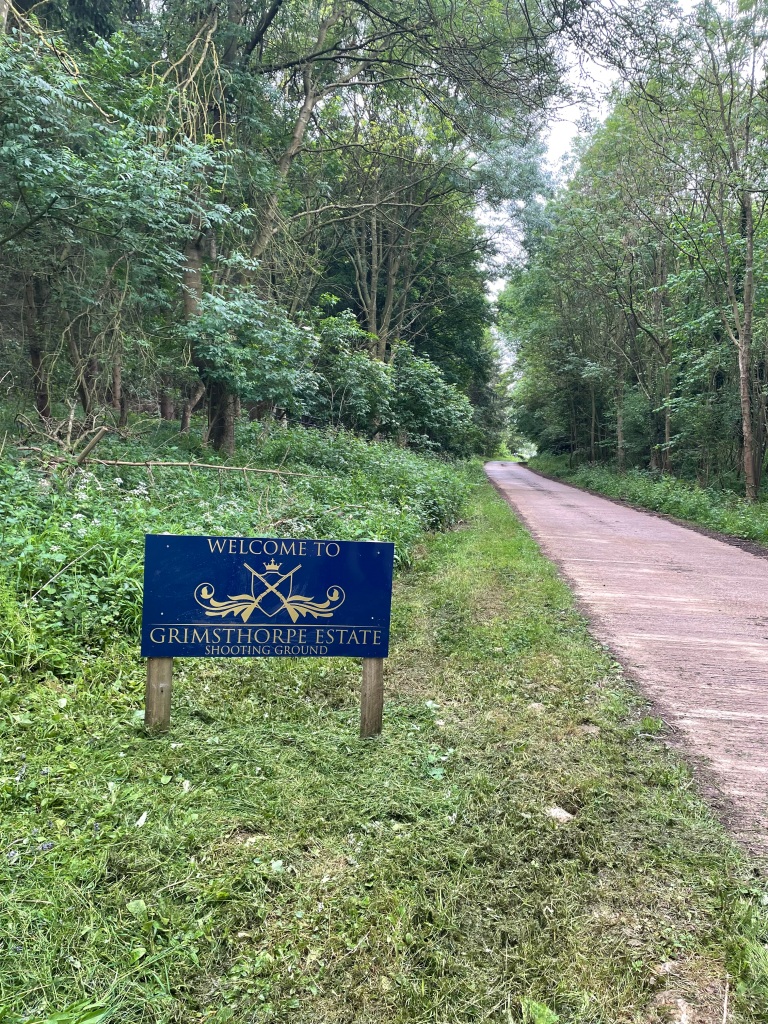
We drove down the A1 and ended up stuck in a traffic jam for about a mile – the A1 is a notorious accident prone road through Lincolnshire. Parking in the Lincolnshire village of Swinstead our walk would take us to Creeton, Scottlethorpe and Edenham. A good deal of the walk today was across the Grimsthorpe Castle Estate. https://grimsthorpe.co.uk/
What was particularly nice about the walk, for us, was that we weren’t expecting a large estate with castle and so this was a pleasant surprise.
Grimsthorpe Castle
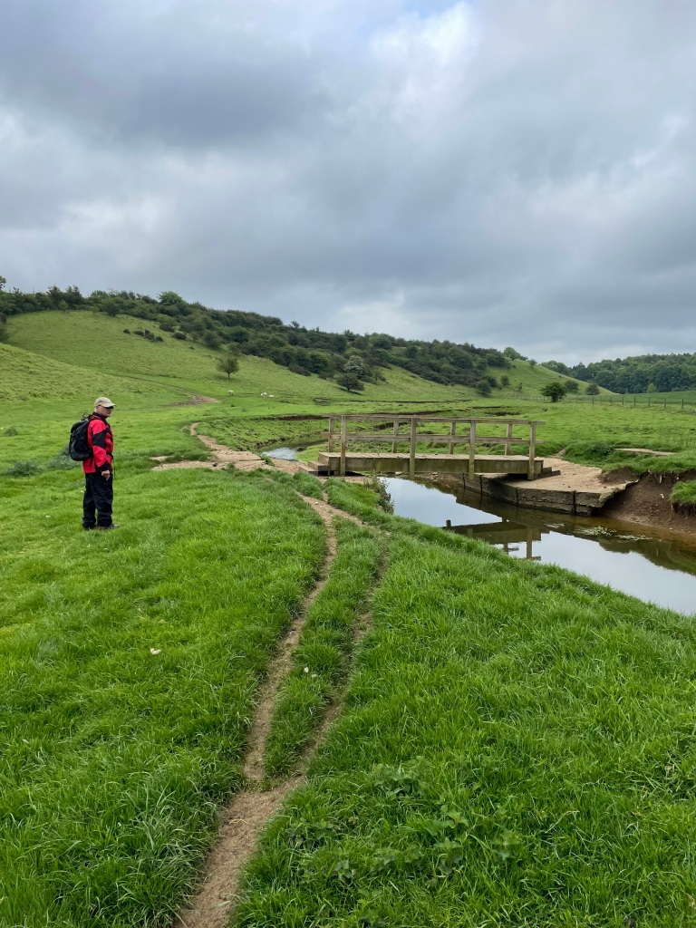
Leaving Swinstead we took paths across fields and reached a valley with a small stream running through it which we crossed via a wooden bridge.
We were pleased that there were no wet crops in the fields – we had got quite wet on our last walk .
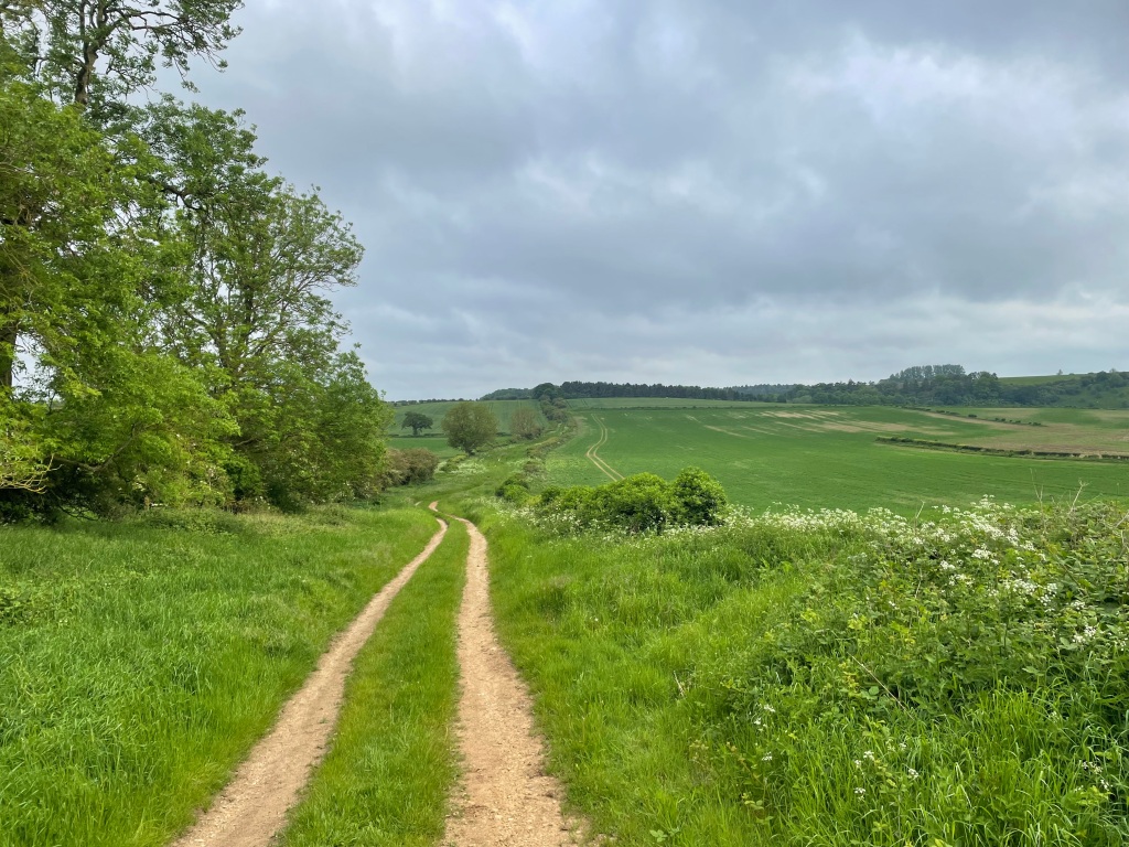
We headed up Gorse Hill towards The Drift (a long distance track). The Drift runs parallel to the East Coast Mainline Railway and so, we watched numerous trains passing us -its a busy line!
Along The DriftA short train passes us
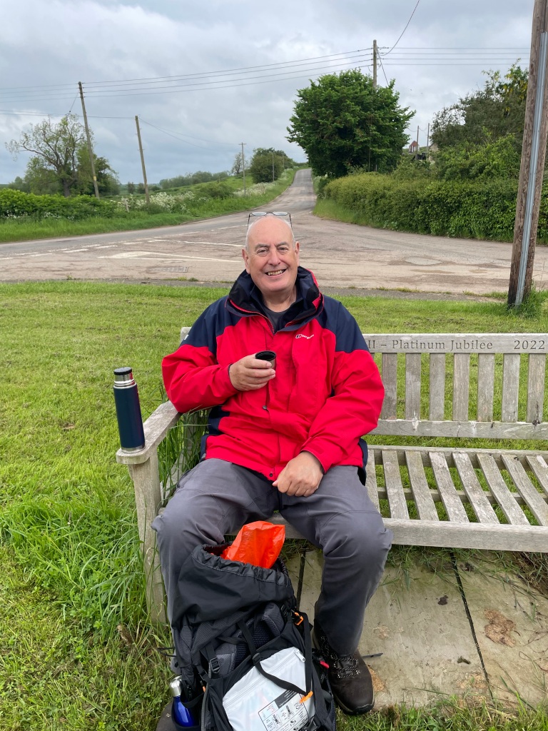
We reached the small hamlet of Creeton where we happened upon a bench and took time to enjoy a cuppa.
Arriving into CreetonCoffee time
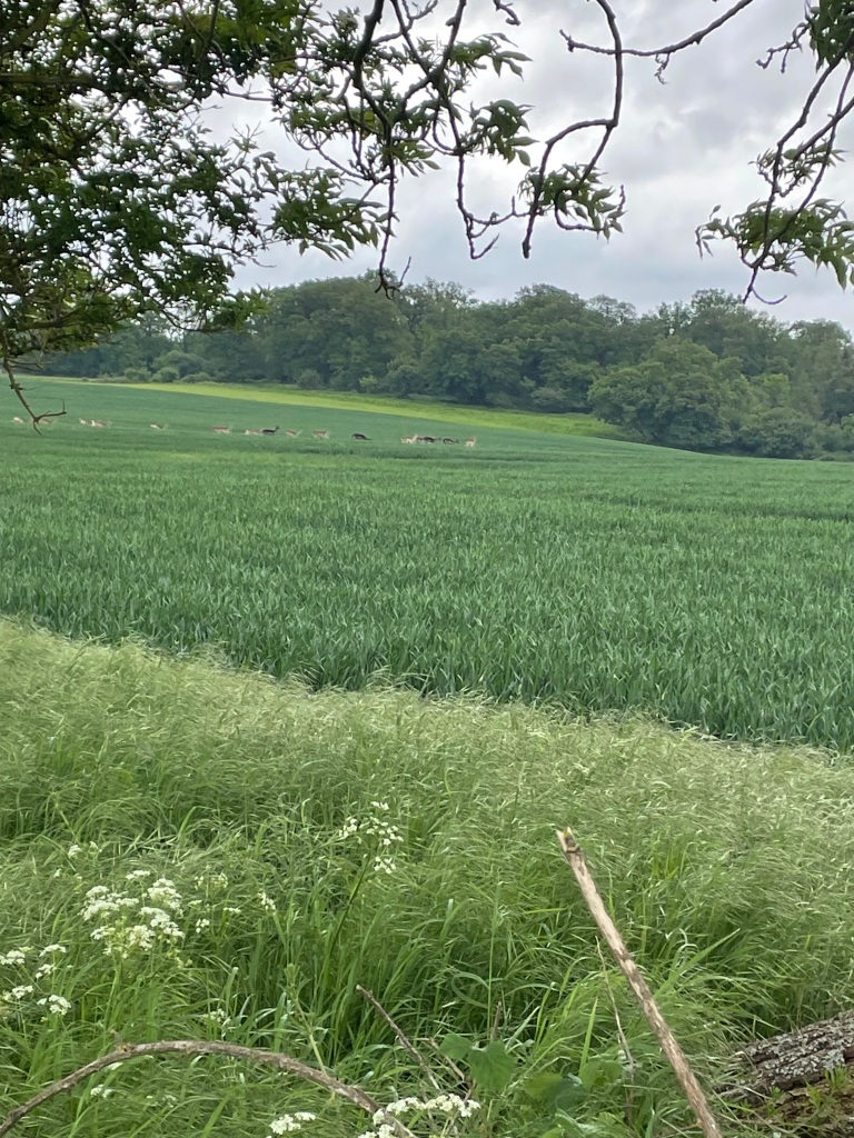
Leaving Creeton Mick spotted a small herd of wild Deer in a field. Finding wild deer is definitely becoming more commonplace in England.
Along the way we would find numerous notices warning that shooting of deer was taking place, although we didn’t hear any munitions today.
A great job of making the footpath clear.
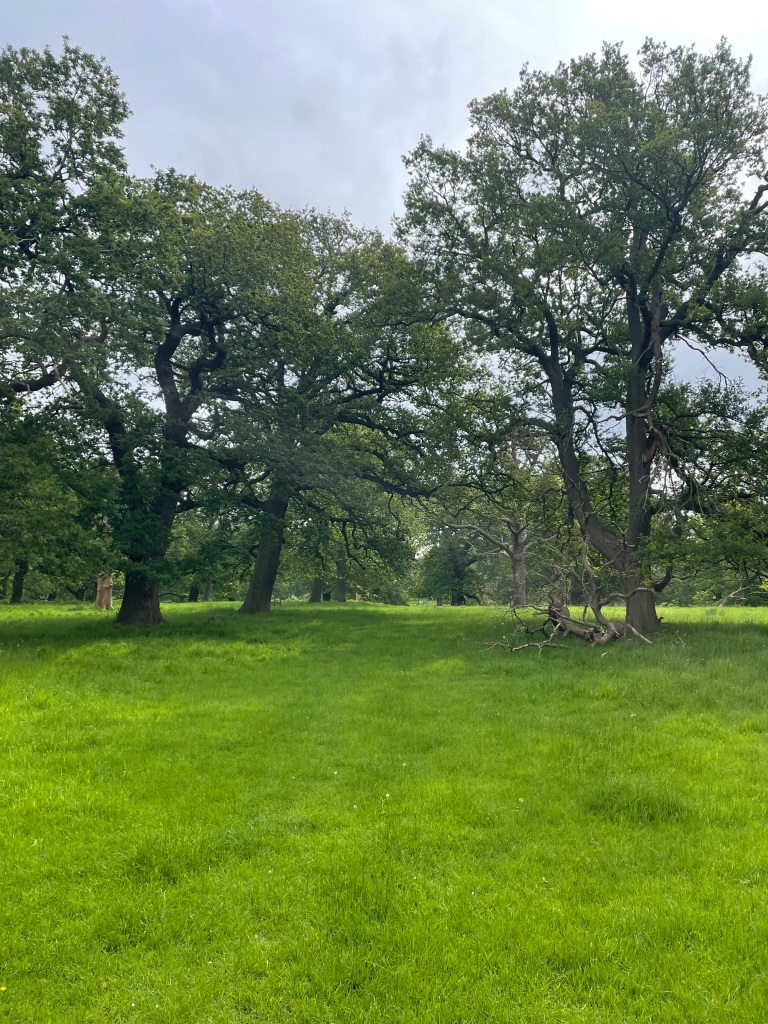
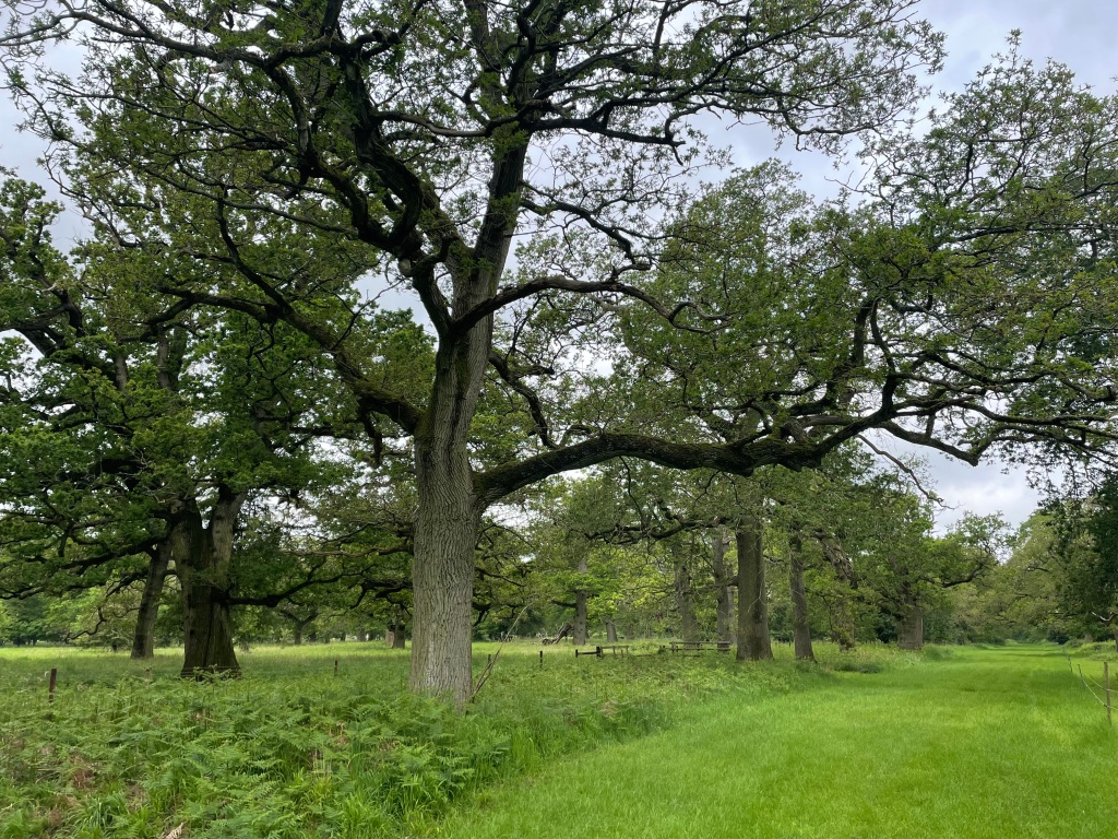
We passed through some nice wooded areas in the Estate and Mick thought he had spotted a wood-pecker.
Grimsthorpe ParkGrimsthorpe Park
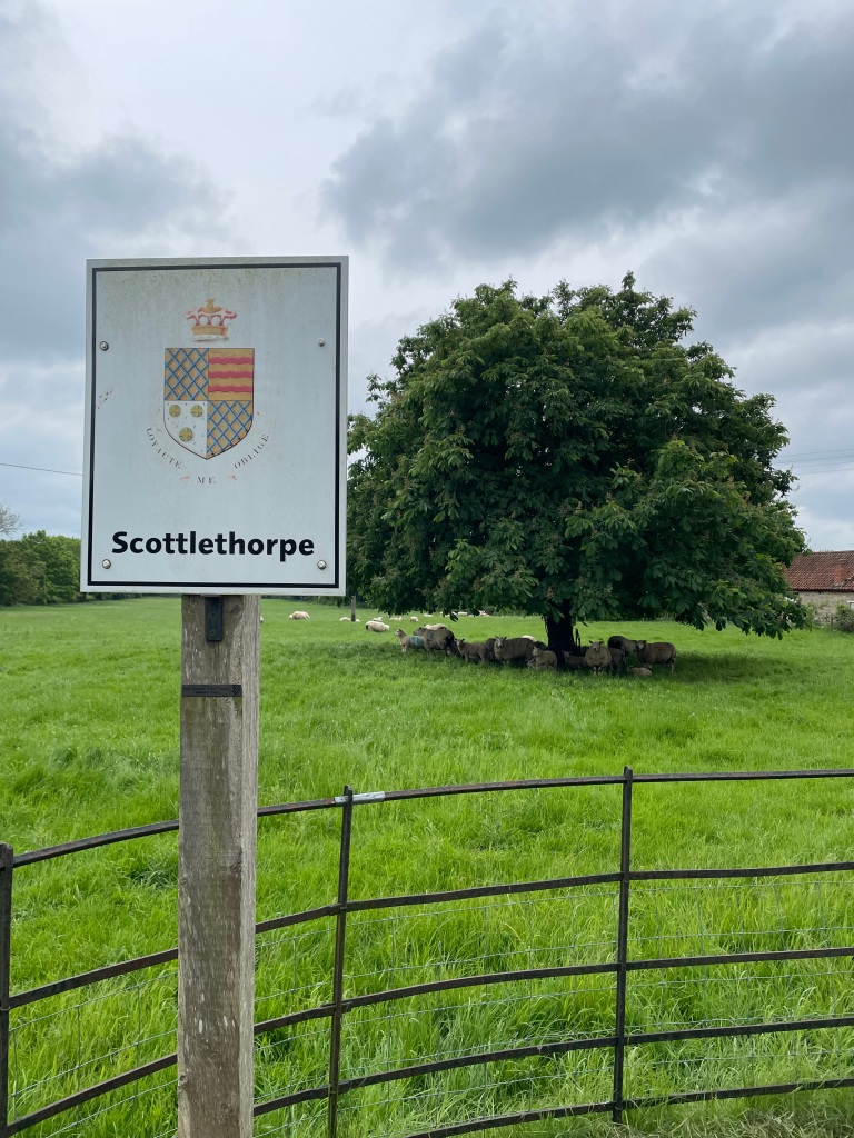
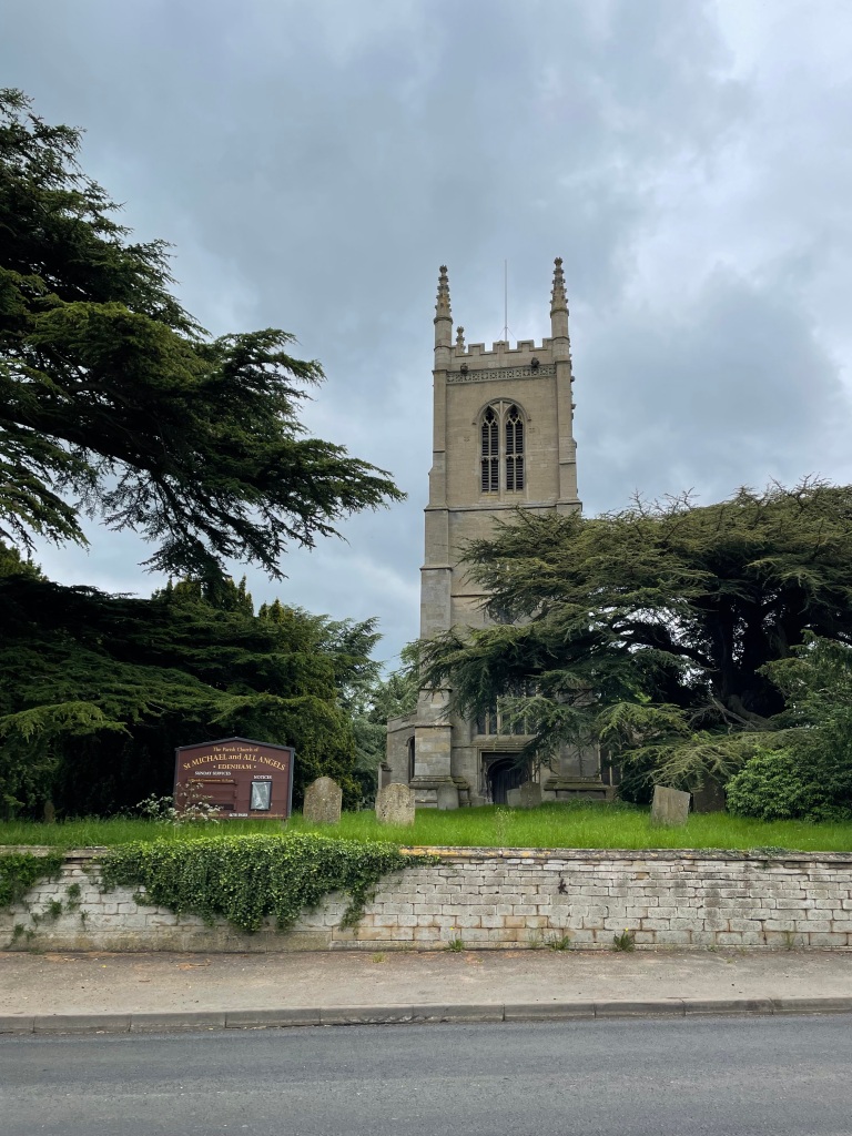
One or two drops of rain started to fall but it didn’t amount to anything 😊. Our route took us through the small hamlet of Scottlethorpe and we were soon walking into the village of Edenham where there were roadworks occurring.
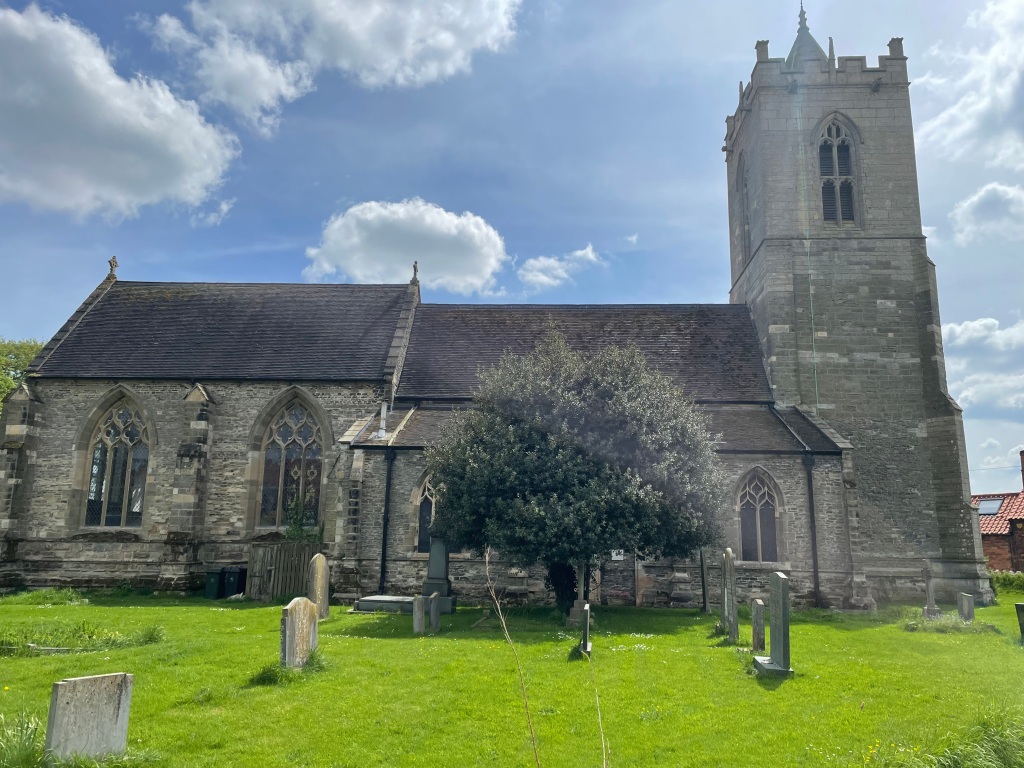
St Michael and All Angels Church- Edenham
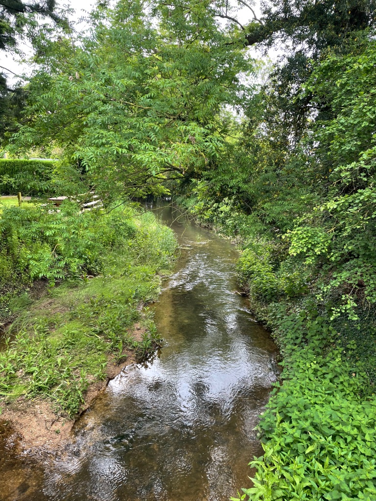
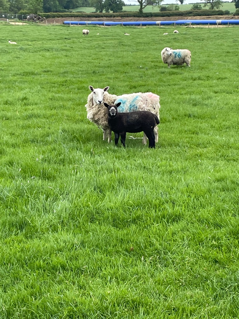
We walked through the village , past the pub (looked nice) over a bridge across the river , through a field containing well behaved cows and another containing sheep.
The East Glen river in EdenhamCurious sheep
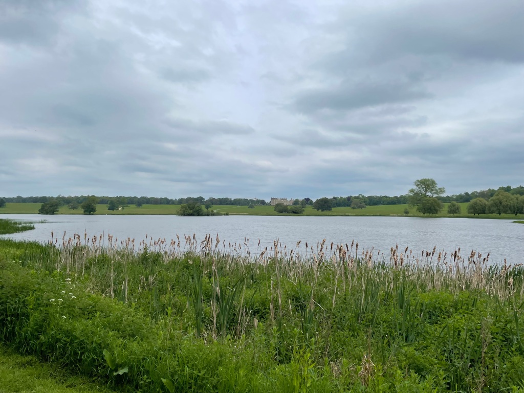
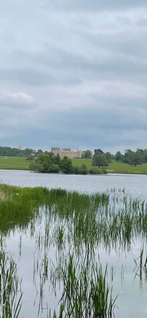
Shortly, we could see the large lake belonging to the Castle and then the castle itself. Our route took us around the outside of the lake.
The castle and lakewalking close to the lake
The castle is the home of Jane Heathcote-Drummond-Willoughby, 28th Baroness Willoughby de Eresby. Grimsthorpe has been the home of the de Eresby family since 1516. The park is 3,000 acres and is 5 miles across at its longest point. Apparently the castle was a filming location for the latest series of Bridgerton.
We were enjoying the views of the castle and lake. At this stage we had walked 9 miles and not met a soul.
It wasn’t long before we were walking back into Swinstead.
Swinstead
Arriving back at the car we both agreed that it had been a cracking walk. It had been quite undulating so we were feeling it in ours legs. I am sure we will be doing this walk again.
As the rain poured down from the heavens all day yesterday, myself and Mick both had the same thought – are we going to be able to walk tomorrow morning?
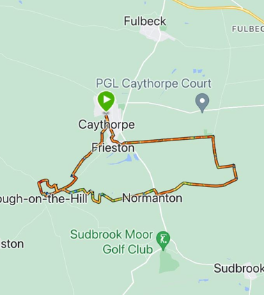
Fortunately, the rain moved away overnight and we had a warm sunny morning for our walk. The walk would take us on a 9-mile circular route from Caythorpe to Hough-on-the-Hill then Normanton-on Cliffe before arriving back into Caythorpe.
Todays route
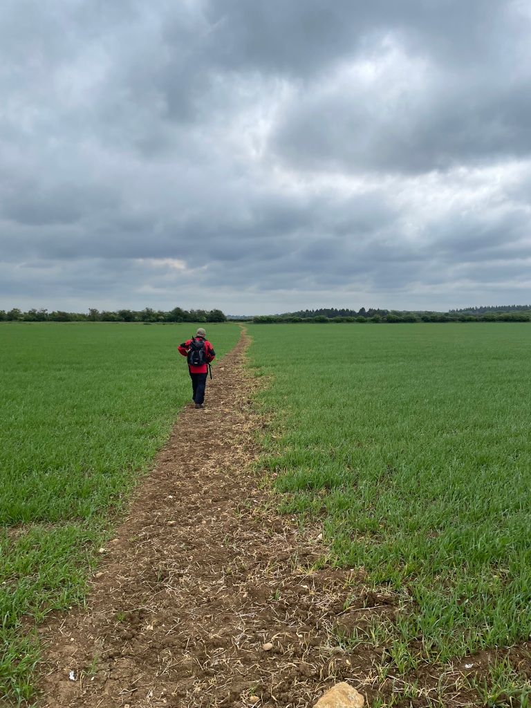
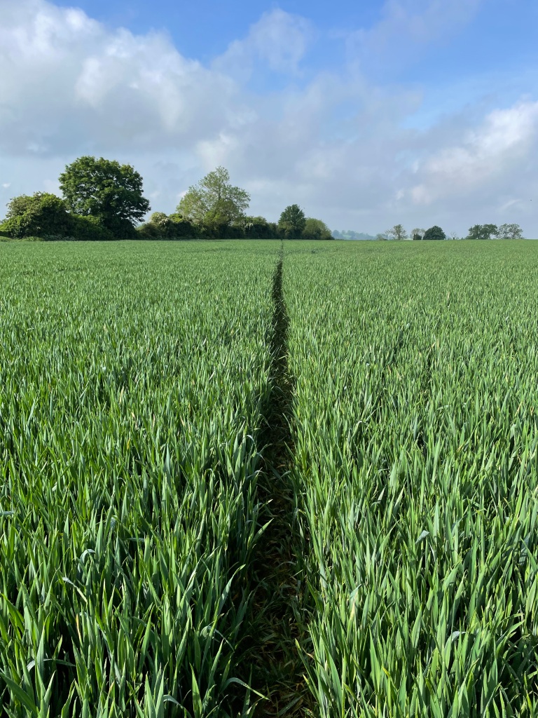
Parking in Back Lane, Caythorpe we set off on our planned route and were soon crossing a field of wheat where previous walkers had carved a path through.
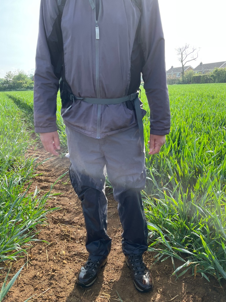
Unfortunately for us the crop was very wet from the rain and by the time we had crossed the field our feet/trousers were soaking wet! Not a good start.
Wet legs /feet
Undaunted, we carried on and found that some of the paths were overgrown and so, also wet. Our feet /trousers were getting a soaking. Soon we came to an open field containing sheep and were relieved to be out of the long grass.
Crossing a field of sheep on the way to Hough-on-the-Hill
We could see Hough-on-the Hill in the distance as we strolled onwards.
Mick heading for Hough-on-the Hill
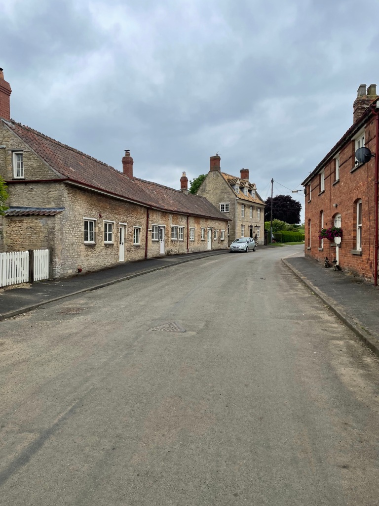
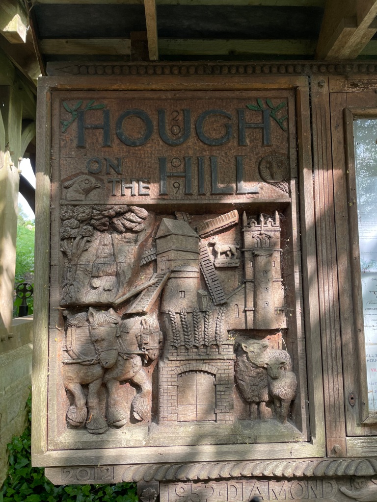
Hough-on-the Hill is a small village – it only had a population of 399 in 2011. The word Hough is Old English for enclosure and yes, the village sits on top of a hill. After arriving in the village we decided to walk around it and view the big houses.
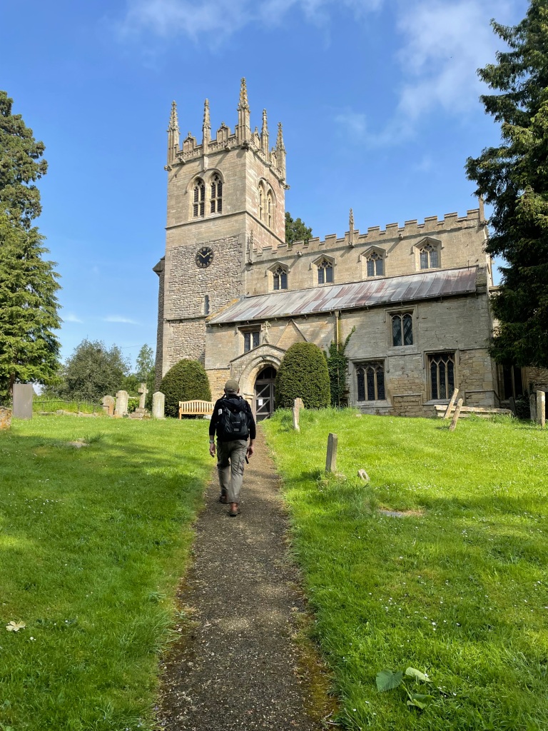
The church in the village is called All Saints and dates back to the 11th century. It is built of ironstone and limestone. Mick spotted a bench in the church yard and we headed up to sit and take a break and allow our trousers to dry in the sunshine. As I munched on my scotch egg Mick had a perusal of the gravestones which although old (c1875) were in very good condition.
All Saints Church Hough-on-the-Hill
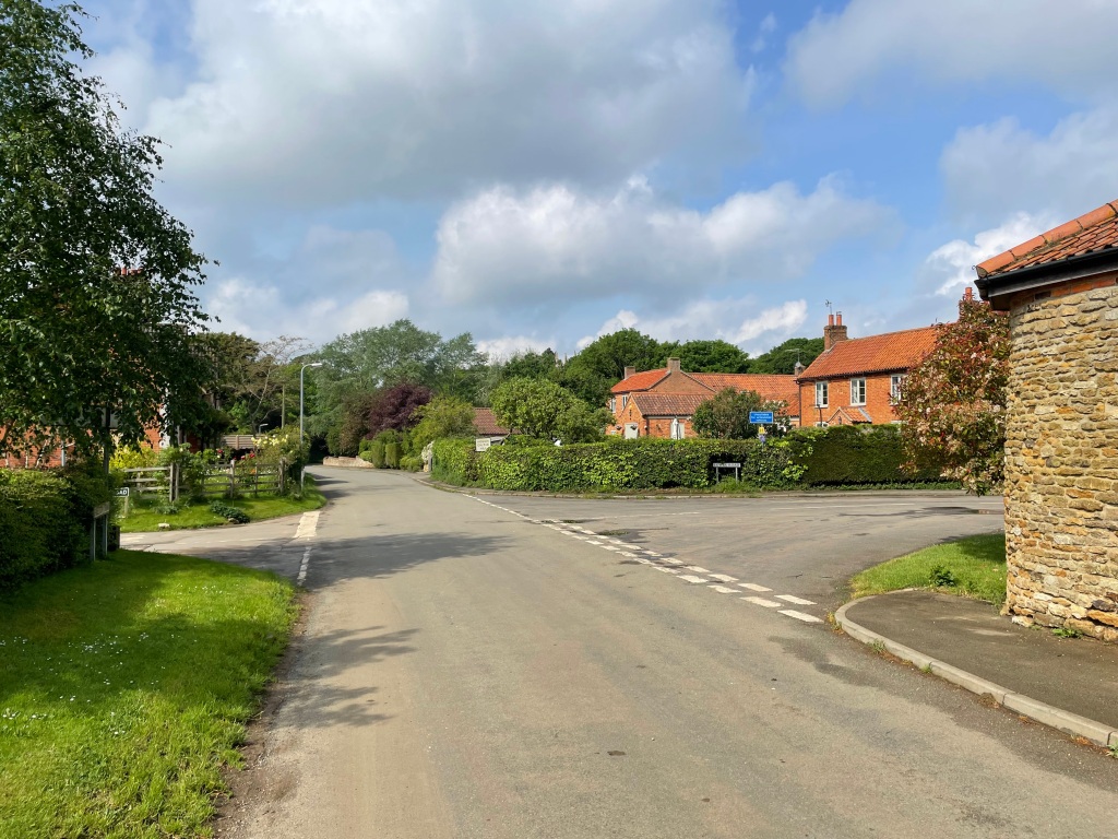
Leaving the church we got talking to a cyclist who was on a 70 mile day trip – it amazes me the distances cyclists cover in a day. In the village we spotted a few small old metal gates and wondered what their purpose was ?
Hough-on-the-hill
Leaving the village we crossed a field containing an old Foden excavator which was unexpected and interesting to see.
After leaving this field the path took us along the edge of the adjacent field which was overgrown with vegetation. Our trousers which had started to dry out soon became even wetter than previously!
Our path was straight through this overgrown section.
Reaching the end of the overgrown section we could not follow the defined pathway because the landowner had fenced in the route. This was not helpful but we did find a way around. We were feeling at this stage that this was proving a troublesome route.😒
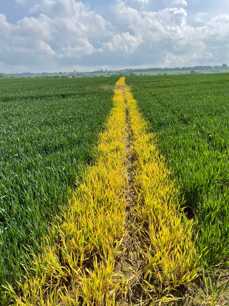
We continued to cross fields and at one point we could see, in the distance, the point of entry into the next field which looked like it contained oil-seed rape. Our hearts sank – we have previous experience of not being able to cross oil seed rape fields because the farmer had not restored the footpath after planting the crop.
However, we were pleasantly surprised to find, when we entered the field, that the oil seed rape we had seen was only remnants from a previous year and the farmer had sprayed a path through the new wheat crop. Maybe our luck was changing.
We followed the yellow stripe path, crossed the route of a former railway line and entered Normanton-on-Cliffe. After a short walk along the main street we turned off and headed along a road that headed uphill giving nice views over the surrounding countryside.
Having reached the top of the incline we crossed a field where the farmer had placed cones at the entry/exit point but we didn’t realise this because they were not on the defined pathway. Oh well.
Having walked up the hill we were soon walking down the hill and looking for the footpath. This was not to be found so we decided to abandon trying to follow the footpaths and follow the lanes instead, back to Caythorpe.
Arriving in Caythorpe we passed a bright yellow flowering tree which I think is Common Laburnum / Golden Rain.
Back at the car we both felt that, for whatever reason, the walk was tougher than the 13-miler we had done last week. Maybe it was the blocked paths, although we had that last week too. Despite this, it had been nice to be out in the sunshine and explore new territory.
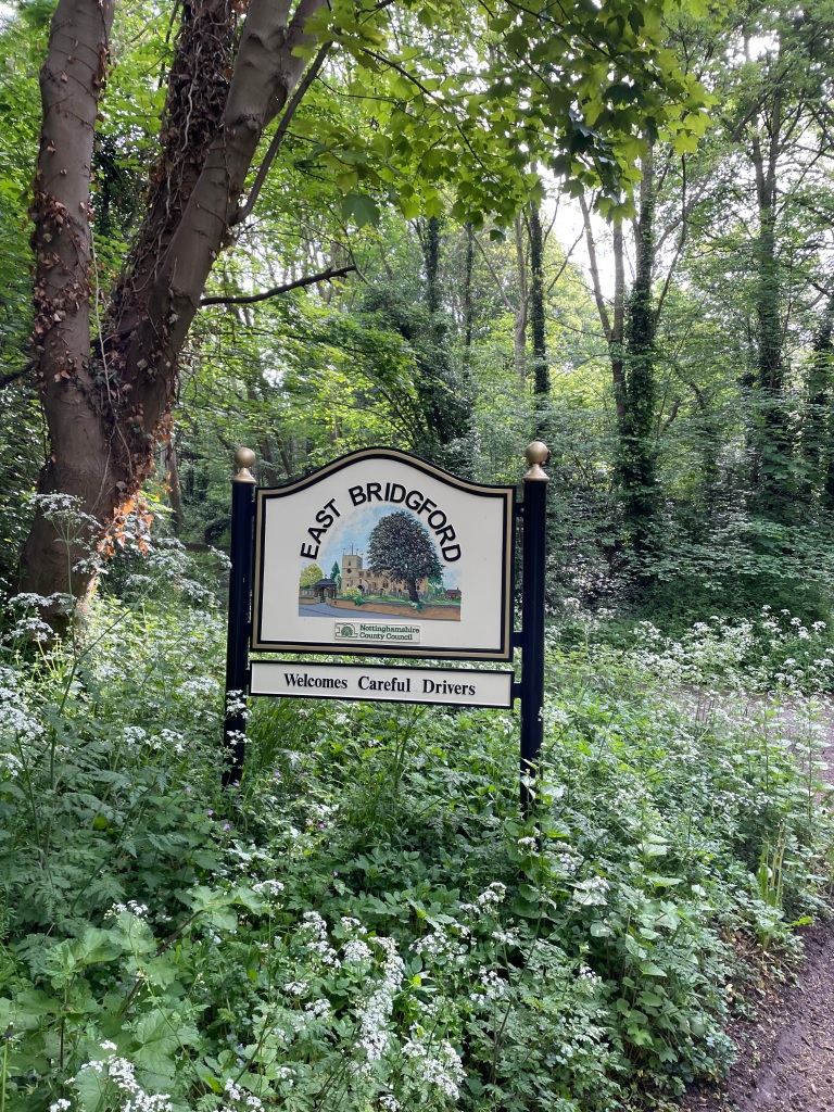
This morning I met up with Mick and we did a walk that we had been trying to do for a few months now. We parked up in the free car park (👍) in East Bridgeford intending to do a 12.5 mile circular walk. It was a hot day and we were looking forward to a good stretch of the legs.
Our actual route
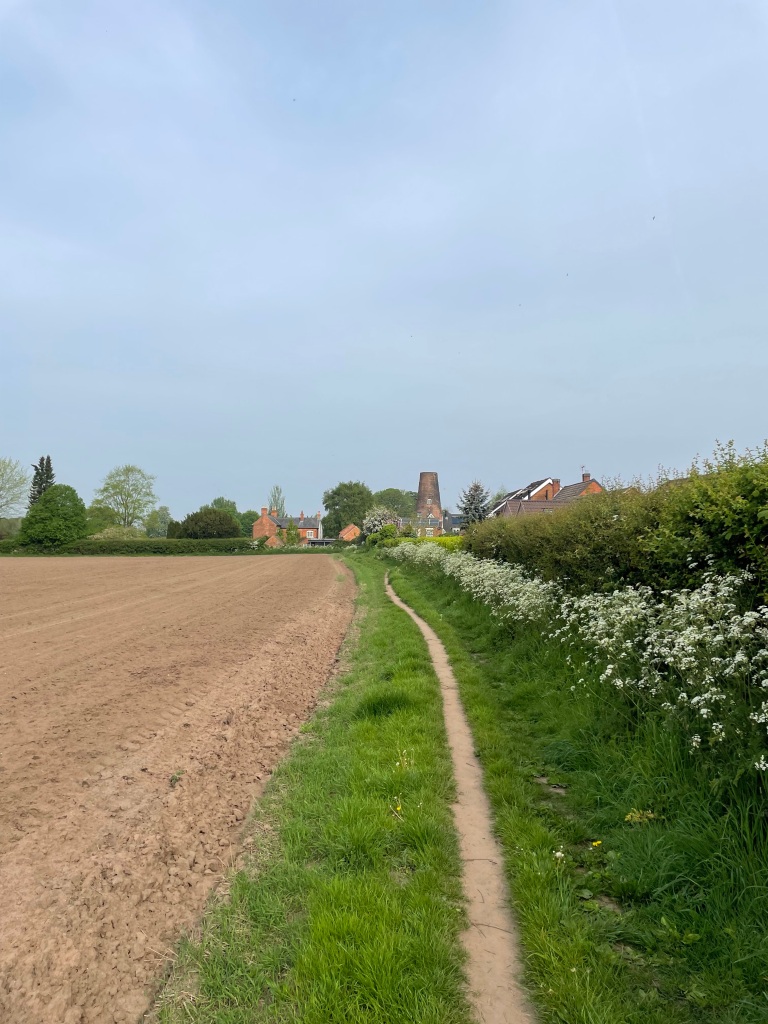
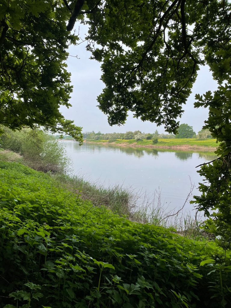
East Bridgeford is a charming little village which I had not been to previously so I was enjoying walking through it. We set off across fields heading towards the river Trent where we would pick up a path that ran adjacent the river.
Heading out of East Bridgeford with Stokes Windmill ahead.
It wasn’t long before we met the river and a Marina.
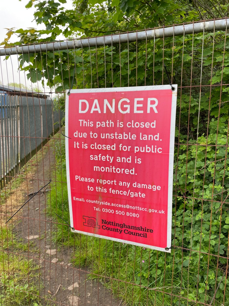
Alas, as we turned a corner to follow the path we came up against a path closure.
The path closure sign
Now, we had heard that the path had been closed last October following Storm Babet but naively assumed that 6 months was plenty of time for the council to address the issue. Wrong!
We now had to check the map to look at alternative routes. The problem was that we didn’t know how far the path closure extended and we did want to walk by the river. We headed along the road to get back into East Bridgeford and then picked up the road to Kneeton, looking for a path that would take us back to the river.
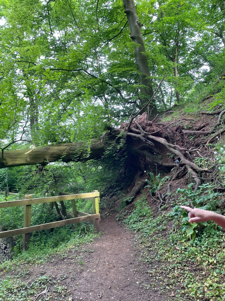
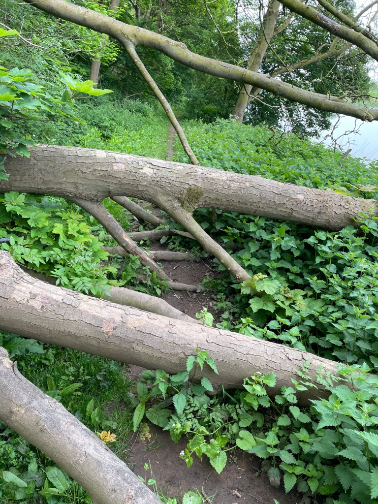
We found a path and walked down it to find the other end of the path closure, so that was good – we knew we were now clear of the path closure. Dropping down to the river we passed a fallen tree – one of many that we would see.
One of the fallen trees.
Pleased that we were now back on track we headed along the river bank path taking in views of the river Trent.
The path by the riverThe river Trent
Continuing along the path we found our way blocked by a fallen tree so we had to climb over / limbo under it to get passed. Not impressed.
Carrying on we found the path getting narrower and narrower with the sides full of stinging nettles. Guess who was wearing shorts? Mick was lucky that he was not in shorts.
We pressed on thinking that we would pass through this area shortly. However, the path petered out into an impassable morass of nettles. Eventually, we could go no further.
My legs were tingling from the stings and we now had to go back through the nettles and climb over the fallen tree once more 😒. Things were not going as planned!
Consulting the map once more we looked for an alternative route to take us away from the river and on to Kneeton. Heading up the steep embankment we found a good path with nice views.
Rolling countrysideThe river down below.
We met a friendly dog walker who asked about our route and warned us about paths that may not be accessible. I thought ‘we have had our fair share of those already!’
We had a steady walk along a grassy path, which was still very muddy in places. We were pleased to roll into Kneeton and find a handy bench by the church. We were most definitely ready for a break.
A welcome break in KneetonKneeton village
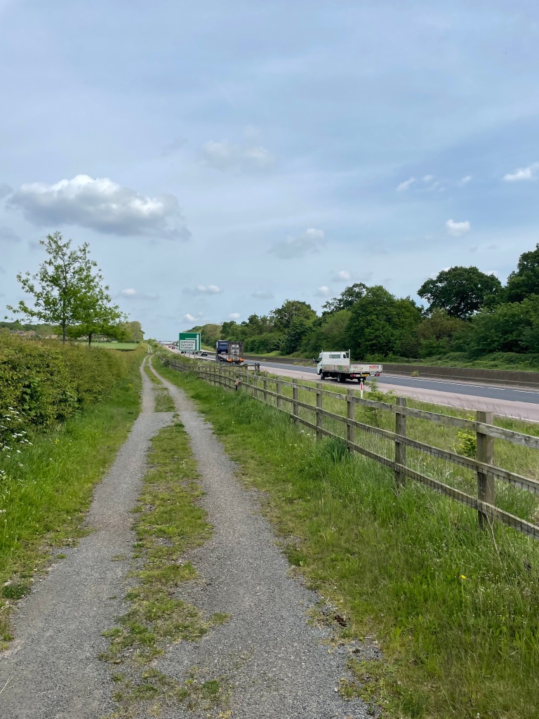
Leaving Kneeton we passed across fields and were heading to the busy A46. The route that we were following took us across the road but this was impossible because access was fenced off. We took a quarter mile walk along a road adjacent to the A46 to cross by a pedestrian bridge.
Our path by the A46The pedestrian bridge across the A46
Crossing the A46 we now had a quarter mile walk in the opposite direction to pick up our planned route!
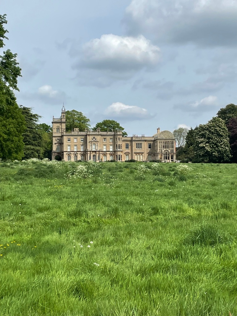
Crossing fields we passed the architecturally very impressive Flintham Hall. The conservatory at the eastern end of the hall resembles the original Crystal Palace. It is a private house although it does open its doors to the public once a year. http://www.flinthamvillage.org.uk
Flintham Hall
At this stage we agreed to modify our planned route because of the delays we had suffered. We took to the roads and headed for Screveton passing an unexpected sculpture in a field, although it was looking slightly ragged in places.
The unexpected sculpture of a woman tilling the soil.
Close by, there was a nice memorial to the crews of two RAF aircraft who lost their lives in a mid-air collision above Screveton on April 14th 1944. It never ceases to amaze us how many memorials we come across on our wanderings.
We passed through the quiet village of Screveton and headed for Car Colston, passing a tangled root system on a house wall.
The road through ScrevetonWhat a tangle!Arriving in Car Colston
We passed the church in Car Colston and passing the cricket club we watched lawn mowers cutting the grass ready for a game of cricket . Car Colston boasts the largest village green in Nottinghamshire. Following a road aptly named Butt lane we headed back to East Bridgeford and the car park.
The walk hadn’t gone as expected – sometimes these things happen. We had seen some unexpected things (Flintham Hall and the sculpture at Screveton) and had a good stretch (13 miles) of the legs – what’s there to complain about?
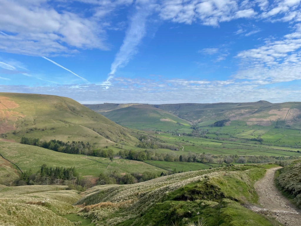
The forecast for today was sunny, so myself and Angela thought it would be nice to visit the Peak District. Knowing that it would be busy we made an early start, arriving at the main carpark in Edale at 07:00 – there were already lots of cars parked up! Alas, the toilets were still closed.
Our planned circular walk was from Edale to Barber Booth and head up to Rushup Edge and Lords Seat. Then, after descending, ascend Mam Tor, walk along the ridge to Hollins Cross and drop back down to Edale.
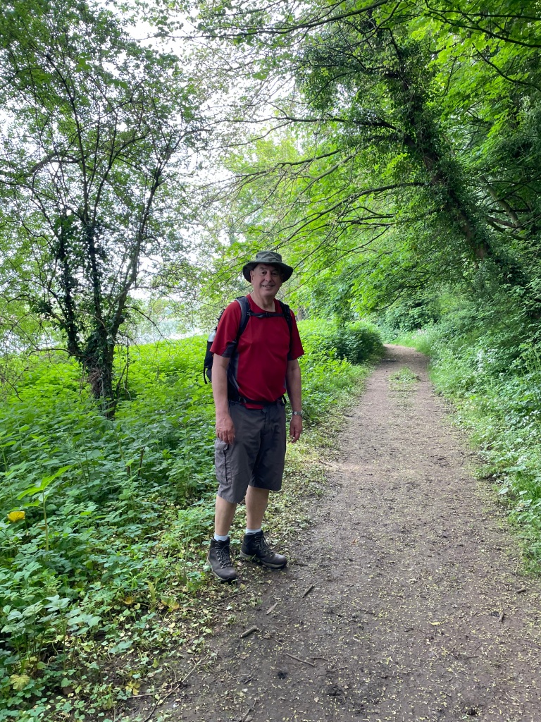
Ready for the walk
The path to Barber Booth was quite boggy but we pressed on taking in the panorama views.
Mam Tor ridge on the right in the distance.
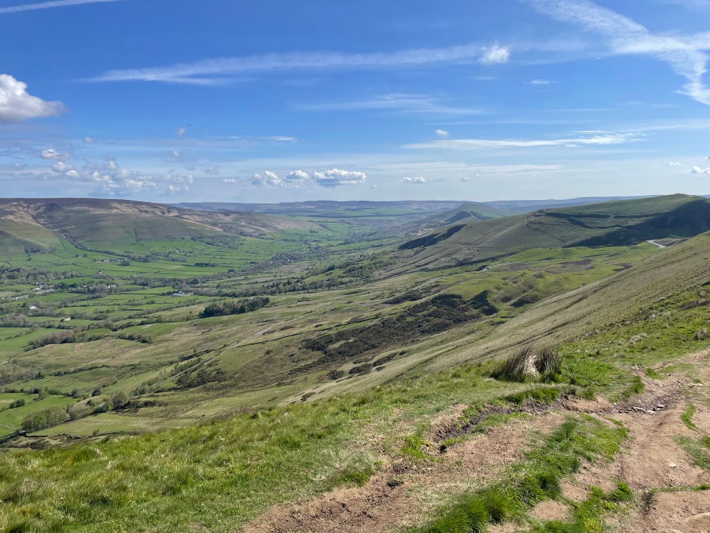
Leaving Barber Booth the path was good as we climbed up to Rushup Edge, shedding layers on the way. The day was hotting up. We had not been to Lords Seat before so were looking forward to the view.
Looking back into Edale valley ascending to Rushup Edge
The climb wasn’t too onerous and as we reached the top we stopped for a cuppa and a sandwich at a spot with a view. Walking along the top we were plagued my midgies – I had heard that they were becoming more prevalent in the Peak District so this was confirmation. There was very little wind so this didn’t help the situation – at least they were not the man-eating variety you get in Scotland!
From Lords Seat we had a wonderful view of Edale valley and the Mam Tor ridge. We were loving our walk.
View of Edale valley from Lords SeatA panorama view of Edale valley
As we were descending from Lords Seat we could see there were many people ascending the path to Mam Tor.
Descending Lords Seat with Mam Tor behind.
We arrived at the point to walk up the steps to Mam Tor and joined the folk heading up.
I found the walk up Mam Tor quite easy – I must be getting fit!
Angela at the trig point on Mam Tor
There are great views from Mam Tor along the ridge and into Hope Valley.
Taking in more of the glorious views we headed down the ridge to reach Hollins Cross. From here we descended rough paths back to Edale. We found a big difference from when we left – many more people milling around and a couple of full trains had just arrived. I much preferred the quiet time we had earlier.
The walk was 7.4 miles with 1648 ft of ascent.
We headed home to carry on decorating in the kitchen.
This morning I did a 5 mile circular walk that had been recommended to me by a fellow walker – thank you Paulette! Along the way I had rolling hills and I could imagine myself in the Yorkshire Dales – I felt a definite sense of remoteness, which was good. This walk was far better than I had anticipated.
It was a cloudy morning as I parked my car in a lay-by in the village of Croxton Kerrial. Looking at the map contours told me that the walk would be undulating and would have fine views – its a pity it was not a sunny morning!
The circular walk would take me to the village of Branston and then back to Croxton Kerrial.
Leaving Croxton along a farm track I had my first hint that I might get some boggy sections along the way.
The path out of Croxton KerrialLooking back towards Croxton Kerrial
The path took me along the sides of fields and was most definitely squelchy in places. My boots were wet but my feet stayed dry thankfully. I passed a field containing sheep corralled by electric fences, two sheep were on my side of the fence. They must have found a way through to escape – are these the clever ones I thought.
The escapees!
I was starting to get some nice views of rolling hills. You have to appreciate that living in Lincolnshire I don’t see many hills!
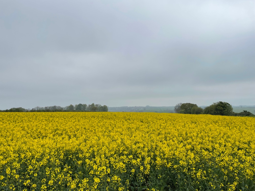
Walking along I started to sense that feeling of remoteness – I soaked it up. I was passing fields growing oilseed rape and I just love the bright yellow flowers – so colourful.
Oilseed rape
Close to Windmill hill I came across some beautiful bluebells in a small wood- a wonderful sign of spring. My senses were definitely being stimulated this morning.
Bluebell woods
In the distance I could see the village of Branston as I followed the path down from the hill.
Heading down to Branston.
Crossing a boggy field I arrived in Branston and then found the track leading back to Croxton Kerrial.
My route out of Branston towards Croxton Kerrial.
The undulating track brought me into Croxton Kerrial -I had enjoyed the up!
Arriving into Croxton KerrialColourful flowers in a wall.
I decided to stop at the village shop and get a coffee. I had a nice chat with the friendly staff and then sat outside on a bench enjoying my coffee and millionaires shortbread 😊. The sun was starting to come out now!
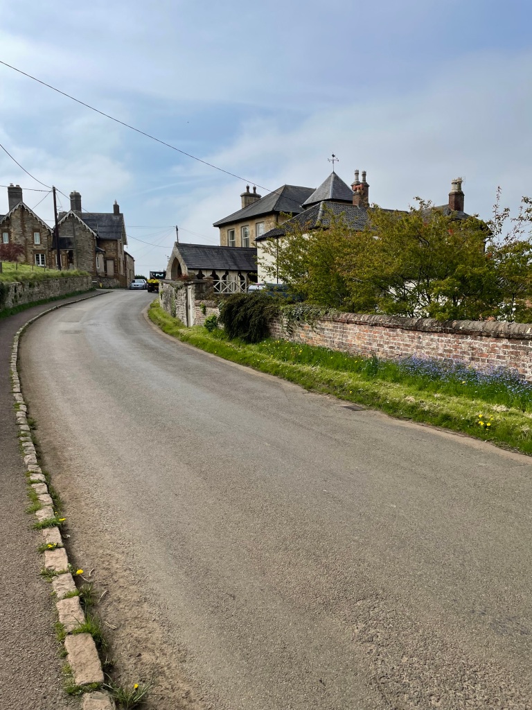
It was a beautiful, sunny, blue -sky day this morning as myself and Mick met up in the Lincolnshire village of Skillington. Our original plan was to park in the village hall car park but we arrived to find the gates locked. – not a good start! Undeterred, we drove on and easily found parking in the village.
The quiet village of Skillington
Chris, the third member of the Three Amigos, was not around for this walk but he was in spirit!
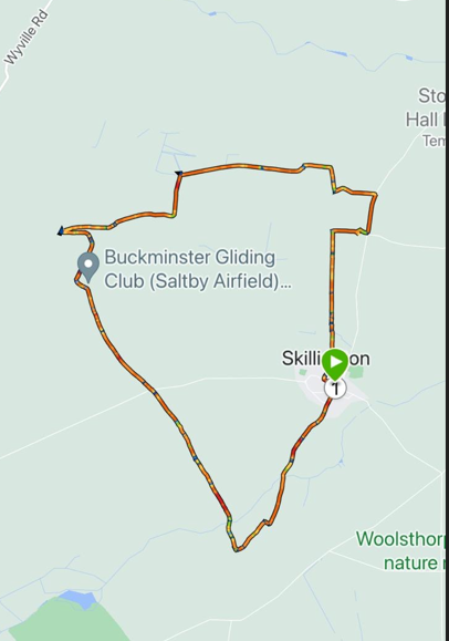
The walk today was new to us and billed as a 6.5 mile circular walk. It was great to be exploring new territory.
Easily finding the path out of the village we crossed a number of fields and then reached a wider track which we followed.
Good track out of Skillington
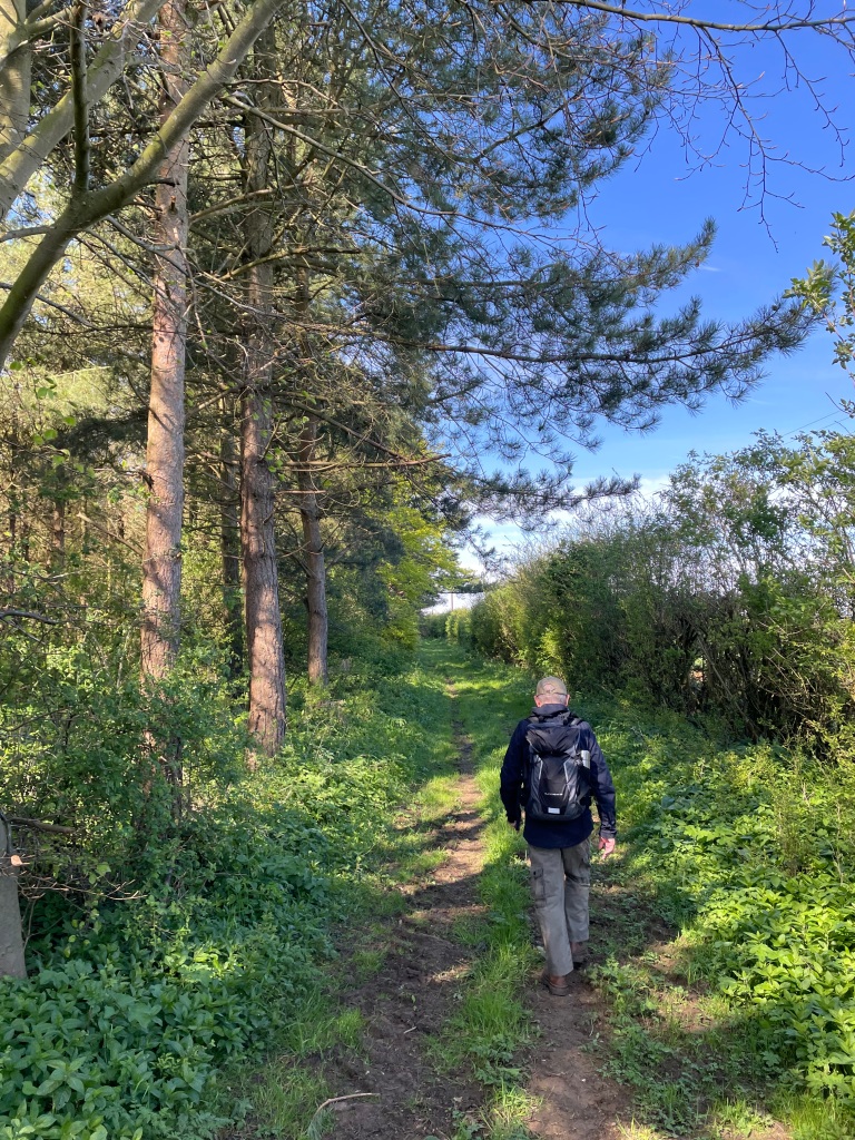
A red kite was circling quite low above our heads – lovely to see😊 . Our path skirted some woods and then brought us to a track called The Drift. The Viking Way route runs along this track.
Skirting a woodJoining The Drift
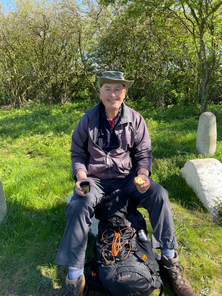
This was a good spot to enjoy a cuppa and a scotch egg (my favourite snack!). I commented on how dry the route had been so far, given that we had had torrential rain a couple of days earlier. Later on the walk I would wish that I had kept my thoughts to myself!
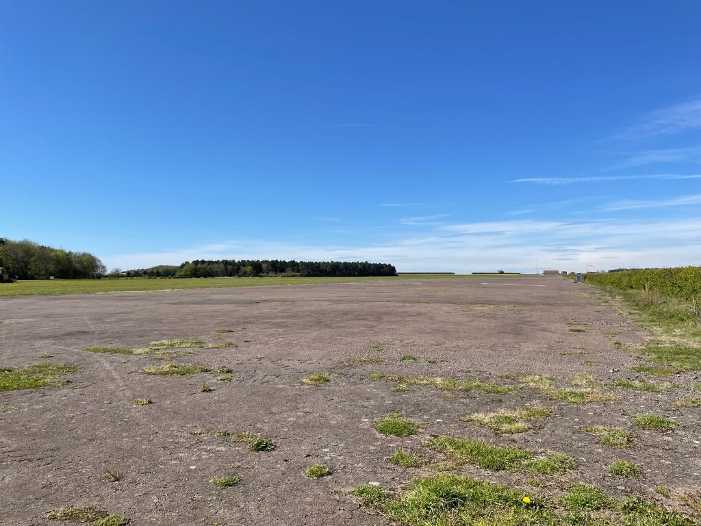
Walking along The Drift we came unexpectedly to an airfield – we discovered it is Buckminster Gliding Club. Previously it was Saltby RAF base.
The runway
Our route took us past the end of the concrete runway. We passed 4 gliders that were on the ground – I think it was probably too windy to fly a glider.
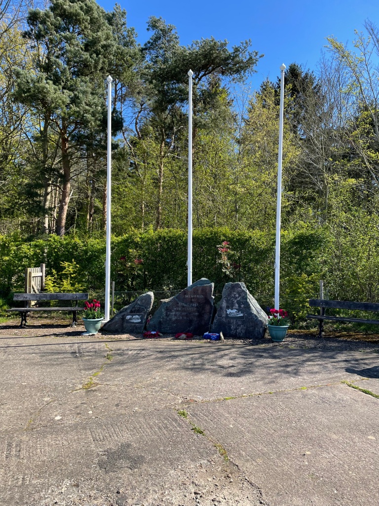
We passed a memorial to those who had worked at the former base.
MemorialOne of the plaques on the memorial
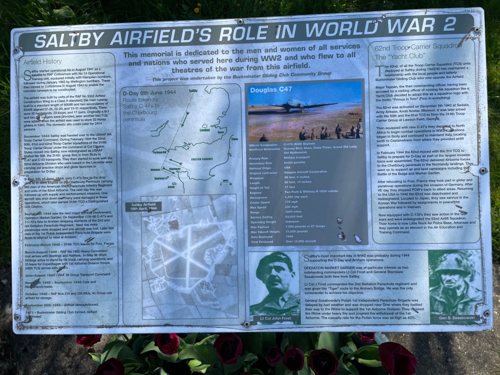
The airfield started operational life in 1942 as a training unit initially with Hampden bombers and later Wellington bombers. In 1943 the base was handed over to the USAAF who, with the 82nd Airborne division, were preparing for D-Day.
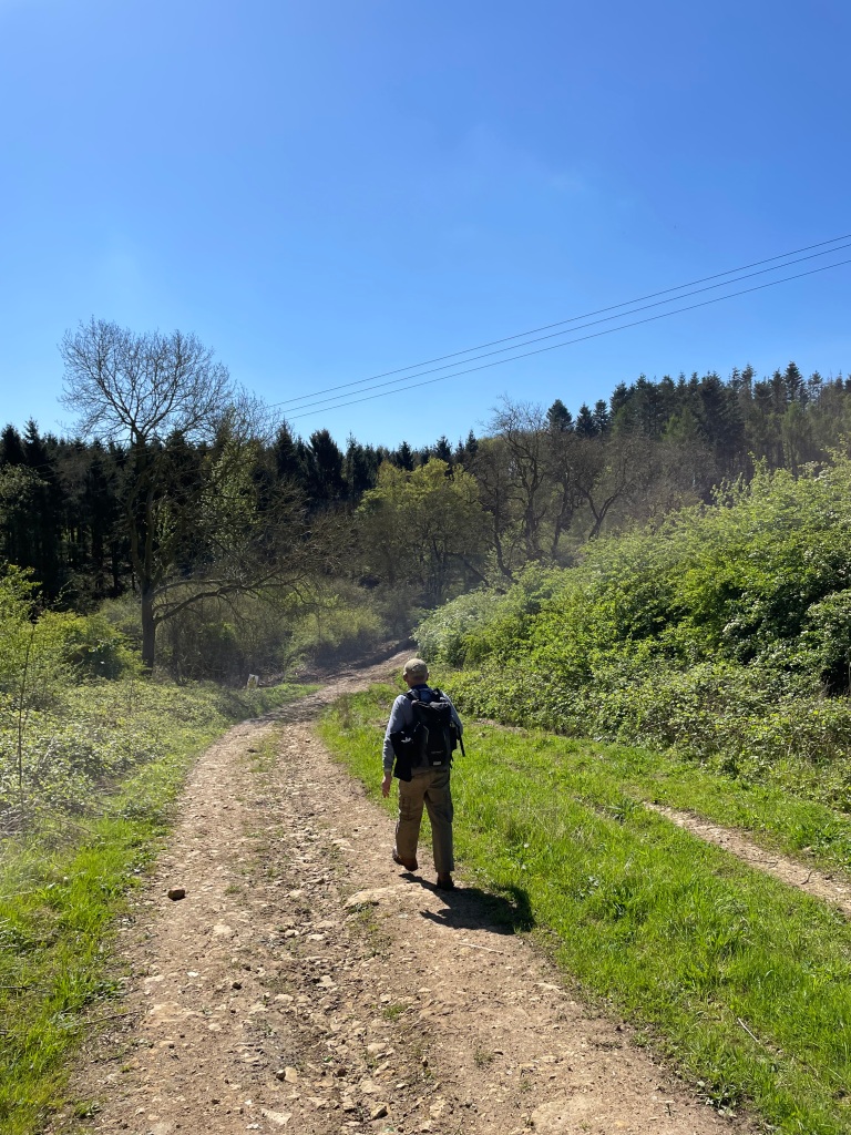
Moving on we passed the storage area for the gliders and the main office block.
Leaving the glider club The Drift started to show signs of the heavy rain. We had to negotiate around several very large puddles. I wished that I had kept quiet earlier.
signs of worse to come.
As we walked on the path was getting badly chewed up by vehicles involved in timber logging. We ended up climbing on the side embankments to avoid the deep pools of water. Hope I don’t slip off this, I thought. The day was warming up so off came the jackets – maybe a sign of better weather to come? I hope so.
A good section of track.Mick striding out.
There was some undulation through this section. Eventually, we left The Drift and headed across a field full of sheep and cute lambs. All were enjoying the sunshine.
Spring Lamb
We picked up a path called Buckminster Lane which, with a little bit of up, brought us back into the lovely village of Skillington and the finish of our walk.
We had enjoyed a 6.5 mile meander through the countryside enjoying the spring sunshine. The highlight of was stumbling across the Gliding Club.
With heavy rain forecast for tomorrow I decided that today was the time to get out for a walk. I need to start doing some longer walks because I am taking part in a 26-mile sponsored walk along The Grantham Canal for The Grantham Canal Society at the end of June and I want to enjoy it! https://www.justgiving.com/crowdfunding/granthamcanalsociety
It was still a chilly day as I set off on my walk. My plan was to follow The Viking Way from Allington to Foston, passing through the villages of Long Bennington, Westborough, Foston and then return to Allington. Rain was forecast for midday so I got a shift on.
Allington Village Green
There was the odd glimmer of sun on the way to Long Bennington but there was cloud for most of my walk. I had my fingers crossed 🤞that there would be no cows in a field where they were last week – they had moved, so I was pleased about that. I crossed green fields from Long Bennington to Westborough and there, I crossed the river Witham.
I noticed that the fields were now quite dry on top so that was good for walking.
Bridge over the river Witham in Westborough
I headed across open fields towards Foston.
On the way to Foston across green fields.
Along the way I met an elderly couple out walking their one-eyed black Labrador and we had a chat. The dog said hello too 😊.
Heading towards Foston.
In the fields it was evident that the endless rain had taken its toll on the crops with large sections that had been under water now barren.
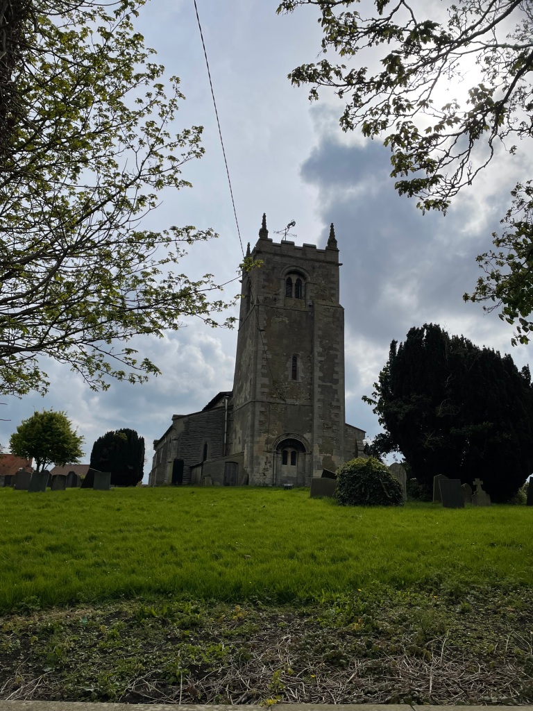
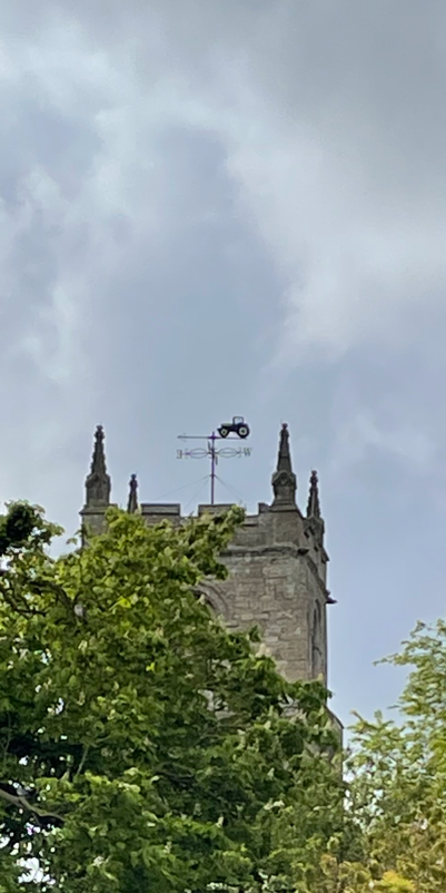
Entering Foston, I passed the village hall and noticed that there were quite a few cars in the car park. In rural communities village halls tend to be very busy all week hosting all manner of activities. I think they are a great asset to their communities. The church in Foston has an unusual weather vane – a tractor, reflecting the rural location.
St Peters church FostonUnusual church weather vane.
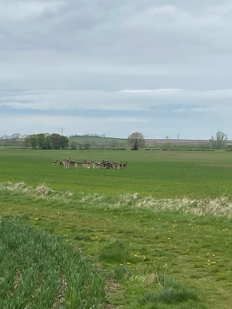
Leaving Foston I made my way across fields and a couple of bridges to Long Bennington. I was looking out for the Roe Deer that I had seen the other week but they were hidden.
Wild Row Deer near Long Bennington
I picked up The Viking Way and headed back towards Allington. The clouds were starting to look ominous.
Some fields have been spayed with weedkiller and have an orange/brown hue to them. Leaving the Viking Way I followed quiet country roads back into Allington.
I had walked 11.4 miles and enjoyed my walk. I just wish that it had been a warmer day.
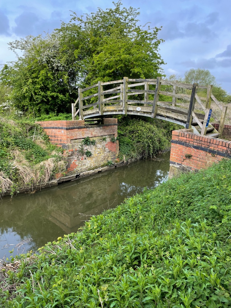
This morning the ‘Three Amigos’ met up and did a 10.6 mile walk from Woolsthorpe -by-Belvoir to Grantham along the Grantham Canal and back again. The Grantham canal is being restored by The Grantham Canal Society https://www.granthamcanal.org/
Parking the cars near the Dirty Duck pub, Belvoir Castle loomed large on the hillside dominating the area. Chris was 15 mins ‘late’ to meet up – ‘How come I am 15 mins early and I am still last ?’ he asked.
We had chosen to do a canal walk because of the recent rain and we wanted to avoid boggy fields. Water levels in the canal were low we noted as we peered over the bridge by the pub.
We set off along the towpath heading East towards Grantham. Light rain was forecast but nothing drastic.
Passing the ‘Three Shires’ hire boat.Casthorpe bridge – a nice wooden pedestrian bridge
It was odd seeing the low level of water in the canal as it is not usually that low. So, we were on the lookout for any evidence of leaks from the canal as we walked along.
The path lies ahead
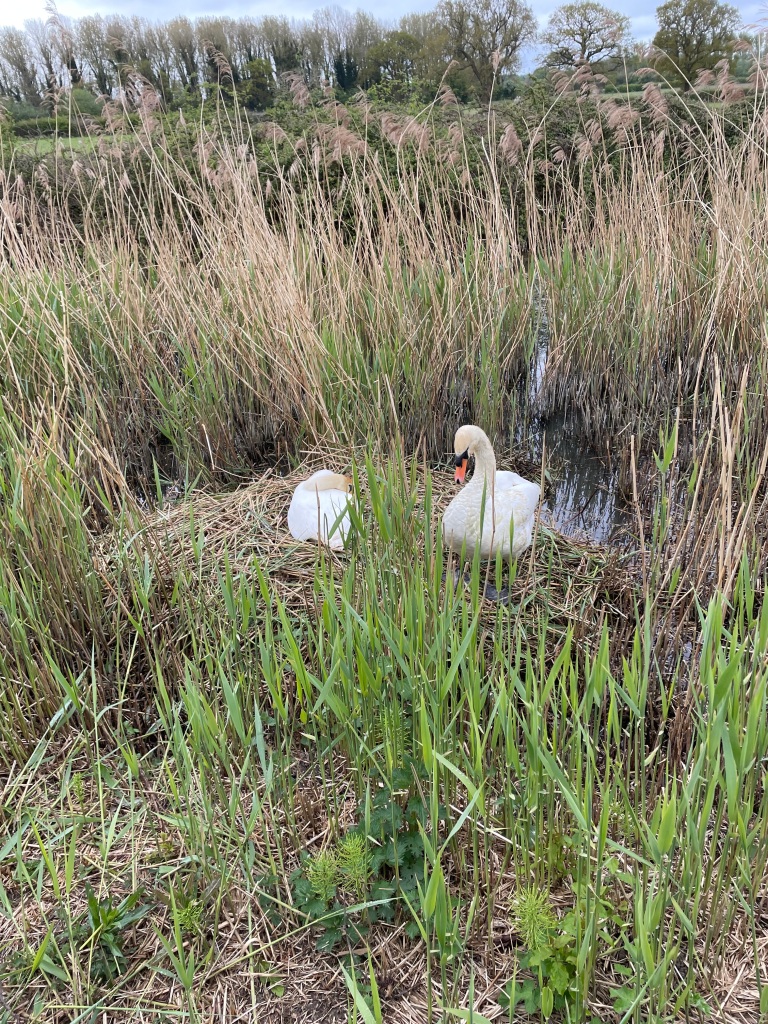
We passed a nesting swan – majestic birds- and a couple of Mallard ducklings. New life along the cut.
Chris was coughing and spluttering alot and clearly only firing on two cylinders. It was quiet along the canal with just the odd few cyclists, runners and dog’s walking their humans. If only the cyclists would ring a bell before frightening you half to death!
Denton Winding Hole
The green foliage was particularly striking this morning – spring was in full swing.
A cluster of Bluebells and a cycle trail sign
We passed under a number of brick humpback bridges along the way. I always enjoy looking at the brickwork.
Vincents Bridge
We reached the point where the A1 cuts across the canal and walked along Barrowby road to rejoin the canal in Grantham at Swingbridge Lane. We had left a rural area and were most definitely in urban territory.
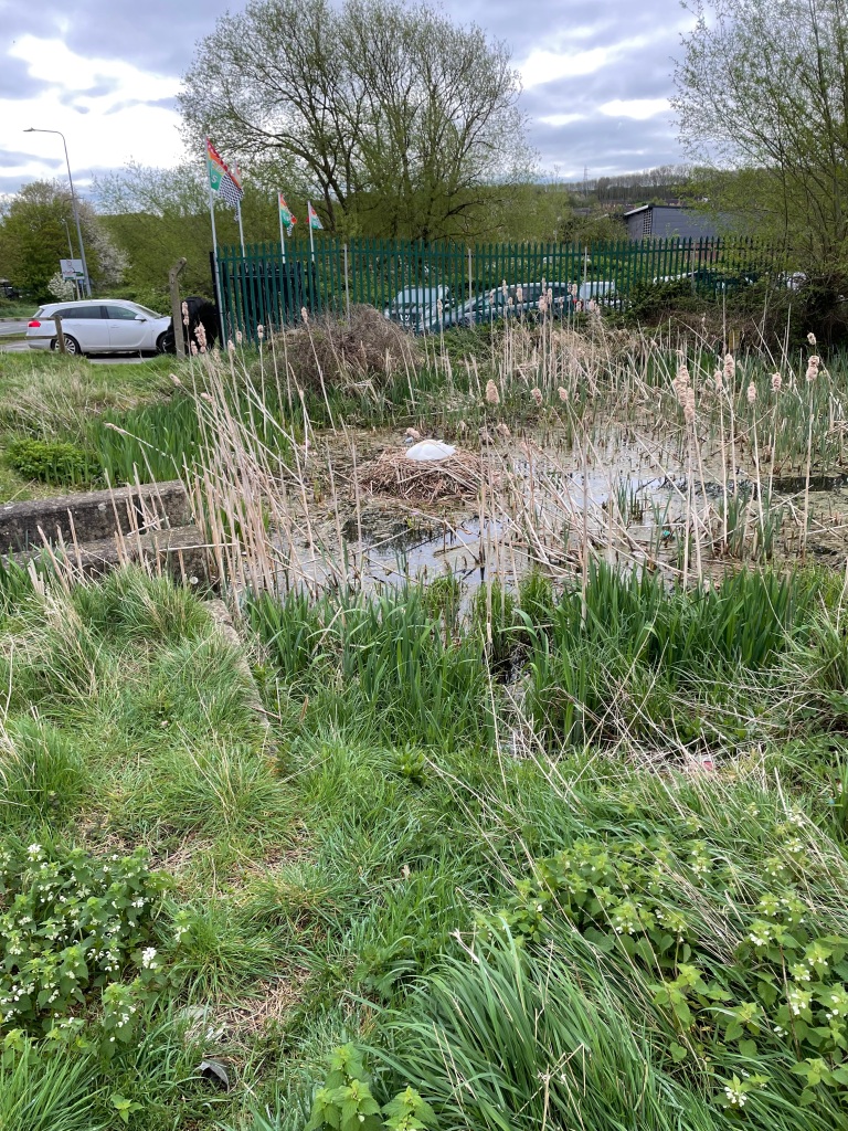
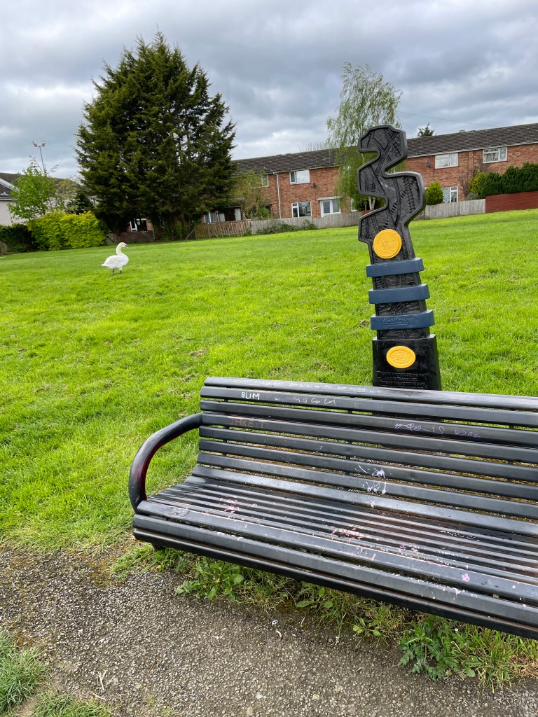
Walking to the end of the canal at Earlesfield Lane we passed another nesting swan and found a handy bench for a cuppa.
A handy bench for a cuppa
After a refreshing Bovril we headed back. Light drizzly rain accompanied us along our way. The main topics of Three Amigo talk this morning were canal water levels, Jury service and Guitar playing!
We had thoroughly enjoyed the walk. We never found a leak, but I later found out that over the weekend there had been some boat movements and locks opened/closed. Water from Denton reservoir, which supplies the canal, has now been turned on so it won’t be long before the water level returns to normal 😊.
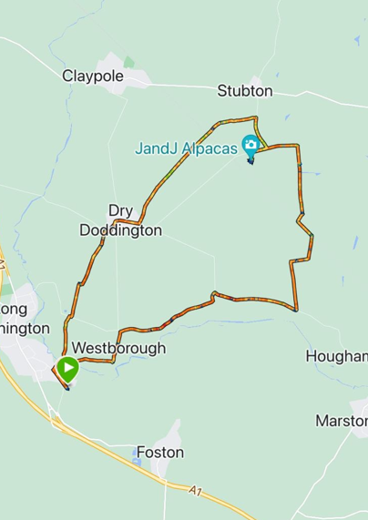
This morning the Three Amigo’s met up and did a 10.8 mile circular walk starting in Long Bennington and taking in the Lincolnshire villages of Westborough and Dry Doddington.
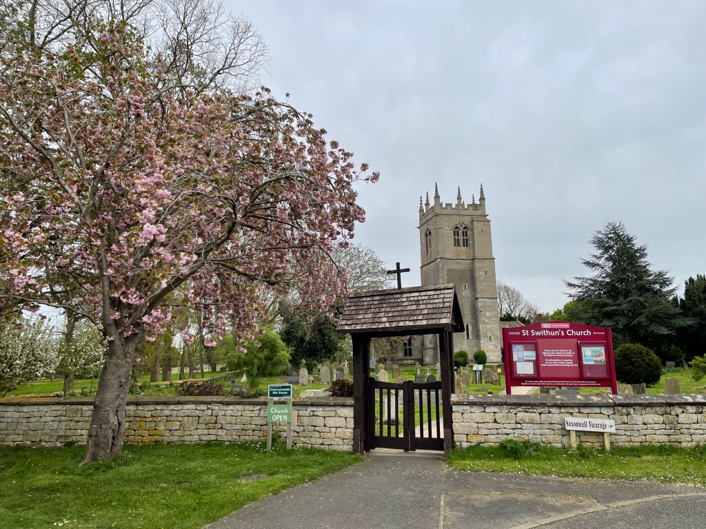
It was a sunny but chilly morning when we met up outside St Swithun’s church in Long Bennington. We were most grateful that it was a sunny and dry day for once.
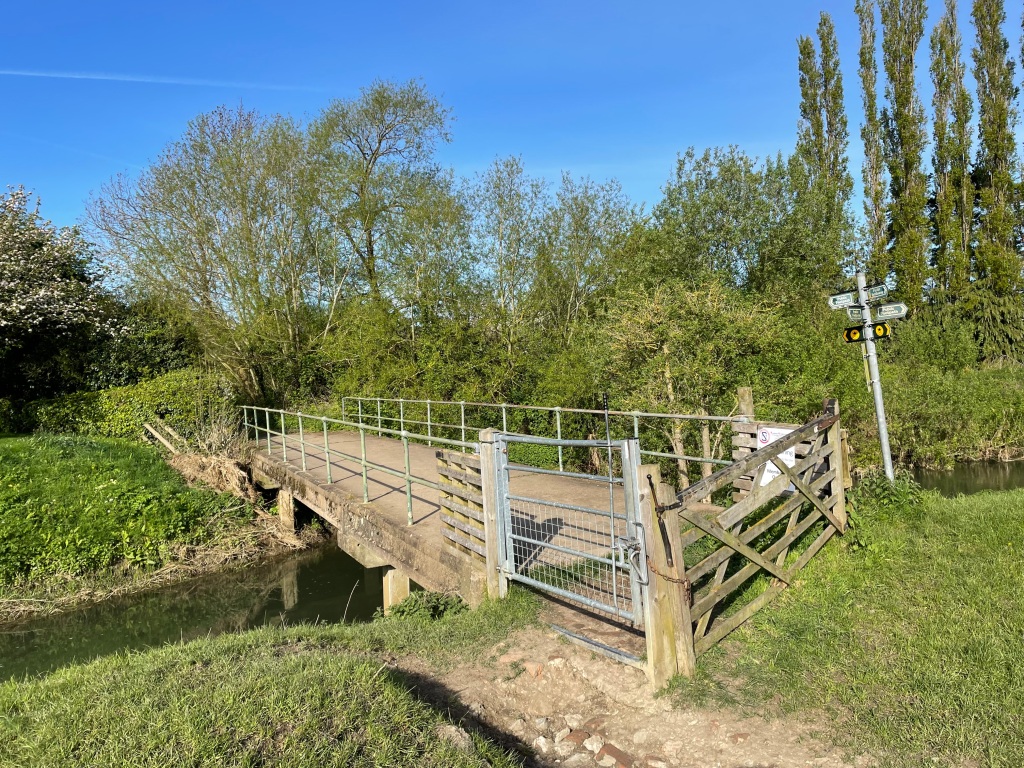
We set off following the Viking Way towards the picturesque village of Westborough, crossing a bridge over the river Witham followed by a few green fields.
Bridge across the river Witham
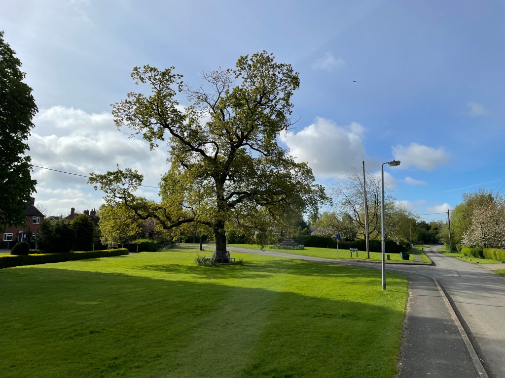
We walked through the peaceful village. There is a church in the village which has an interesting interior apparently so we will have to pay a visit when it is open.
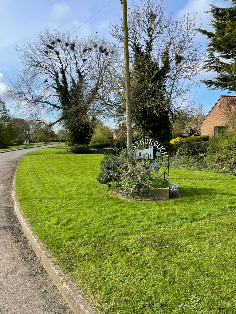
Westborough village greenSign at start of the village. This area was noisy with crows in the nests in the tree.
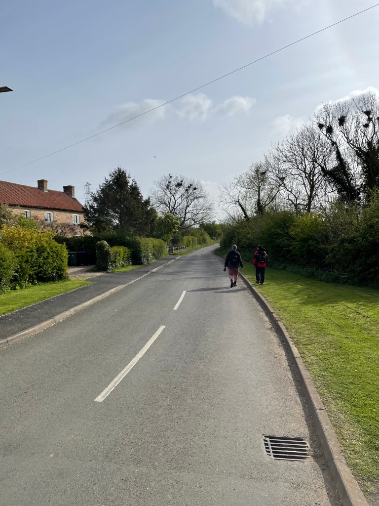
Leaving Westborough we joined the road towards Hougham. ( pronounced Huffham Chris told us – I do like the vagaries of the English language) It was quiet with very few vehicles.
Heading out of Westborough
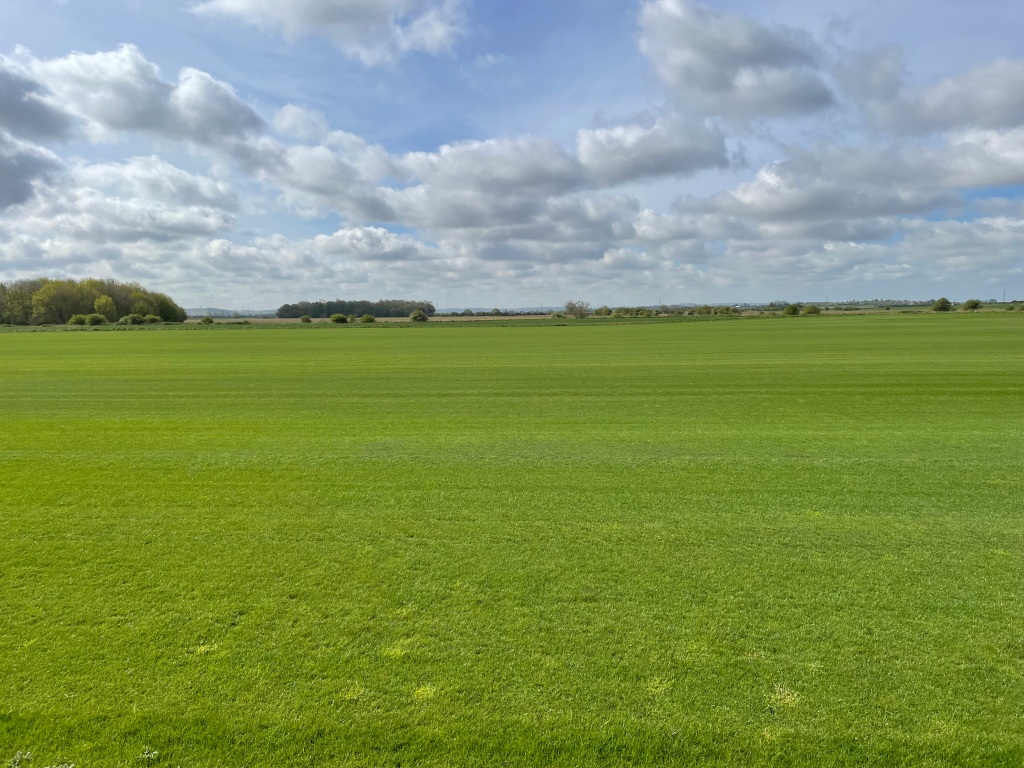
Along the road we trod, spotting Hares bounding across the fields. One of the fields was being used to grow turf and looked like quality grass. England’s green and pleasant land!
Grass for turf being grown
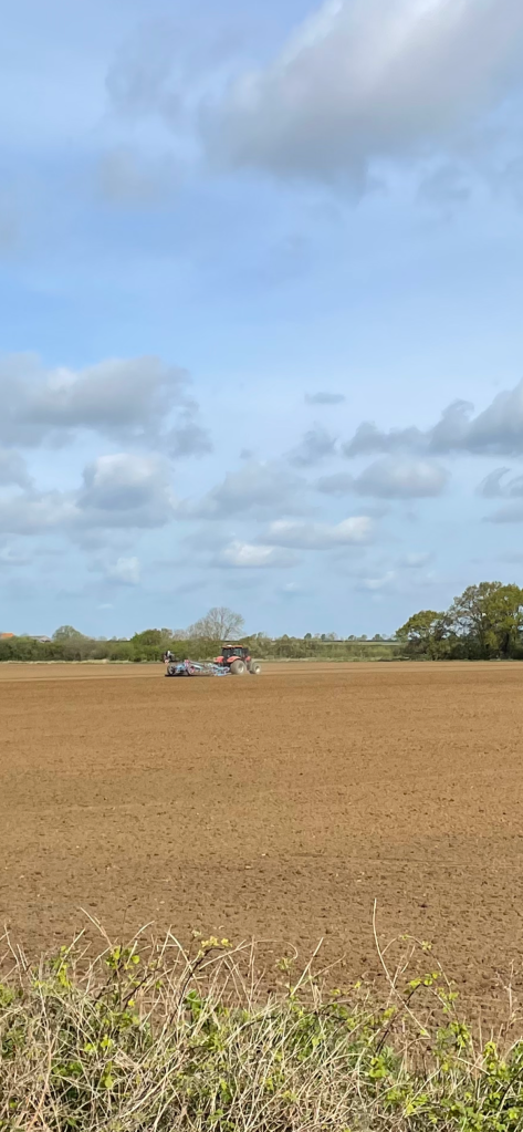
A tractor was in another field doing some ploughing- good to see this as previously the land had been too wet.
The Three Amigos were discussing gentle tv comedy of bygone years – such as ‘The Detectorists’, ‘Dad’s Army’ and ‘Last of the Summer Wine’. All fantastic series but alas nothing like it is made any more. We chuckled when ‘Last of the Summer Wine’ was mentioned as it is about three old blokes who go walking together! Chris said being the tall one I must be Foggy but who is Compo? 😊 We burst into laughter!
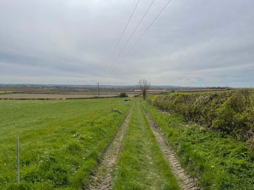
Leaving the tarmac road we followed a farm track north.
The farm track heading North
We passed a strip of grass that was a runway for microlight planes.
The Microlight runway
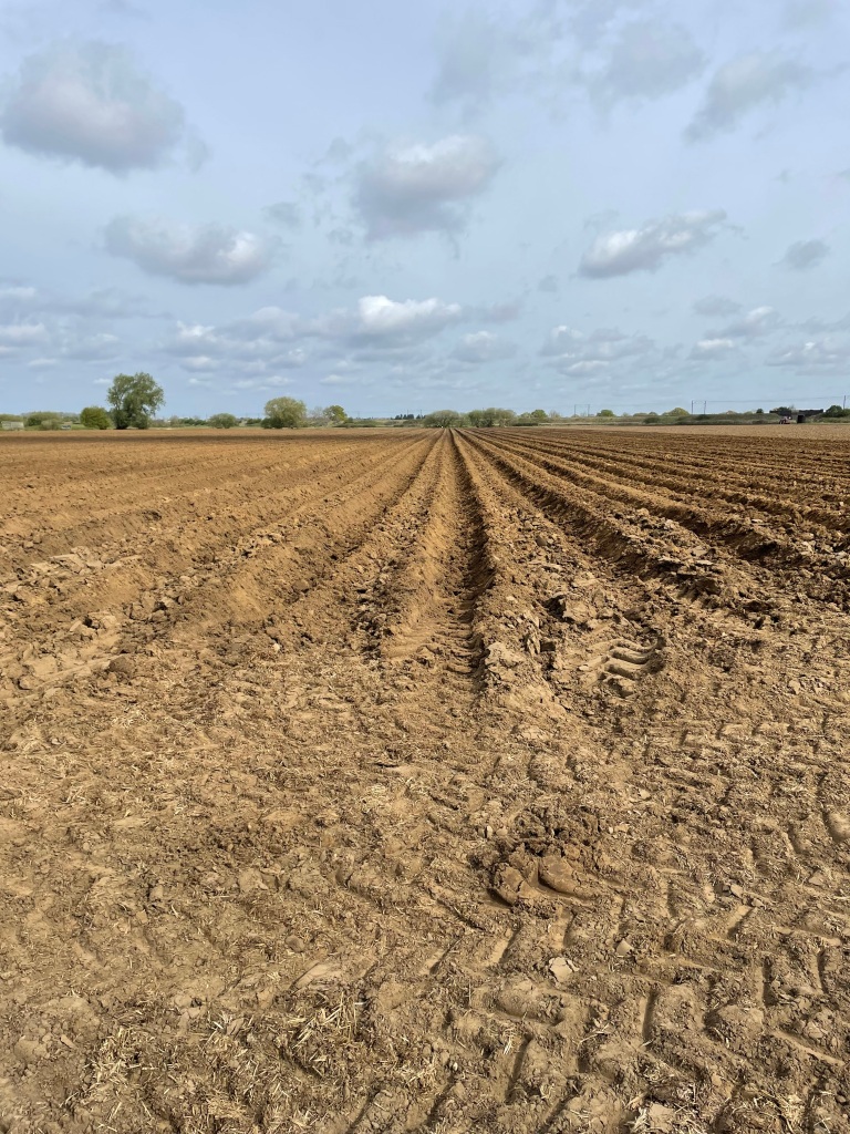
A field was being ploughed for potato planting – it had deep furrows.
Field being prepared for potatoes
We were headed to a crossing under the East Coast main line railway.
Crossing another field
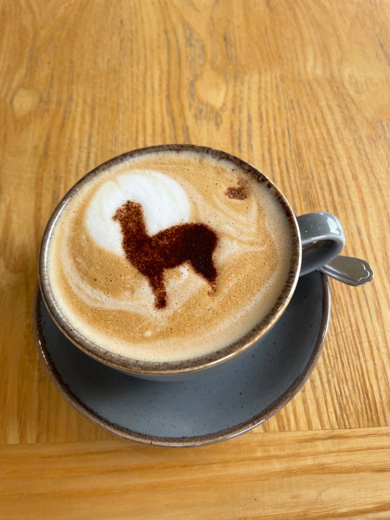
We were about 6 mile in on our walk and we were looking forward to arriving at the cafe.
Arriving at the Alpaca café
The site is home to over 90 Alpacas and is a very popular spot. I hope to visit again soon.
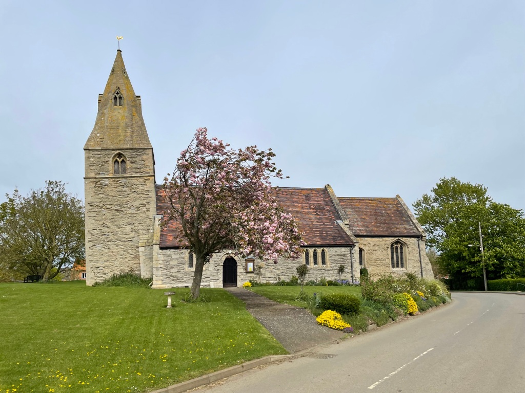
Leaving the café somewhat reluctantly we were now heading towards the village of Dry Doddington. The church of St James dates back to the 12th century. The tower was built in the early 14th century and is famous for leaning towards the west. The angle of the lean has been authenticated as 4.8 degrees – this is greater than the Leaning Tower of Pisa!
The leaning tower.
Our walk continued, passing a trig point, we had extensive views over the countryside. I had a great sense of openness and space. It was wonderful.
Plenty of distant views.
There were a few good hearted murmurings in the ranks about the length of the walk – we had exceeded the billed distance. Mileage can be a flexible measure on my walks I have been told 😊.
We soon arrived back into Long Bennington after a great walk.