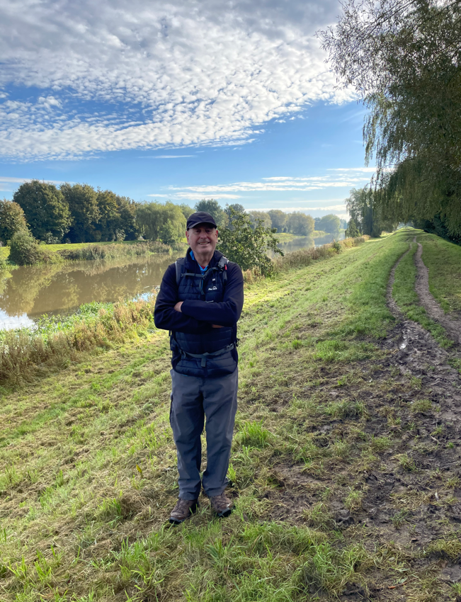
Today’s walk was a 9-mile circular walk starting in the Lincolnshire town of Louth. The walk would be mainly through agricultural fields ending in a walk through Hubbards Hills.
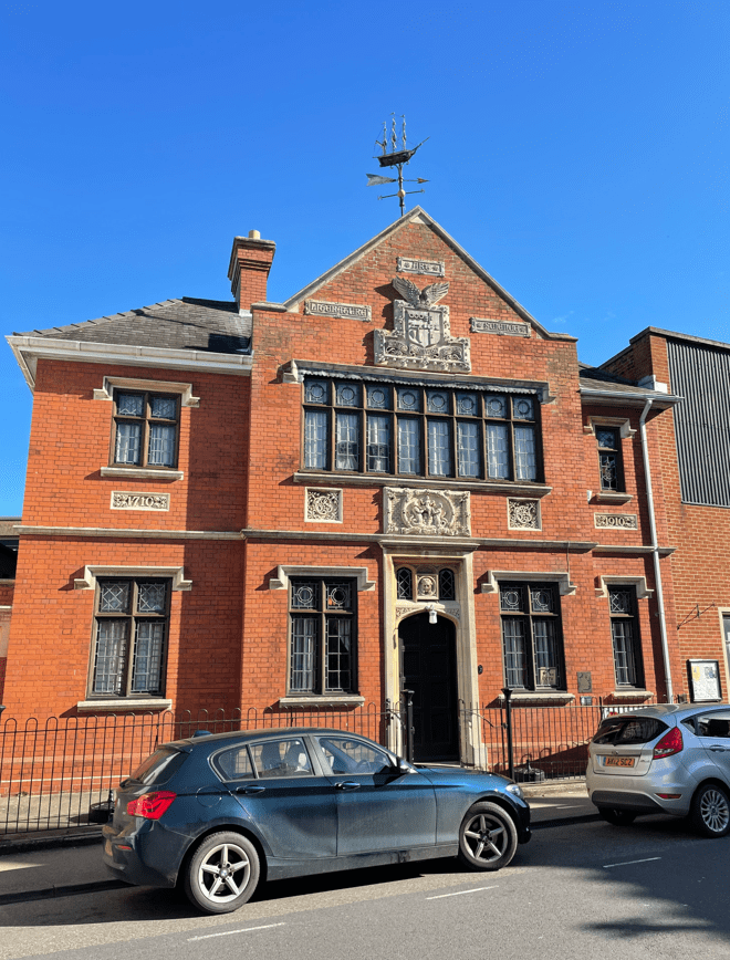
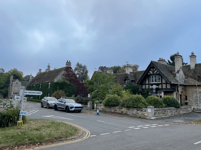
Myself and Angela parked in a suitable car park in Louth and headed off through the town, passing an interesting plaque to a famous daughter of Louth and a building that once was the railway station, but is now a shop. It was early and there were few people about.
The old railway station facade
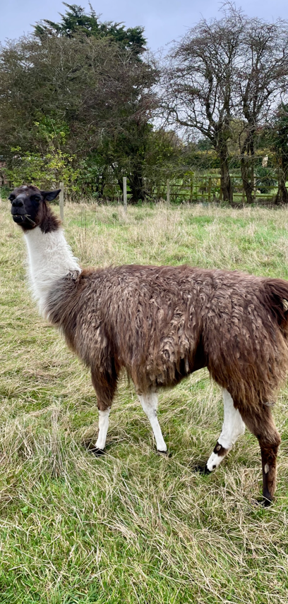
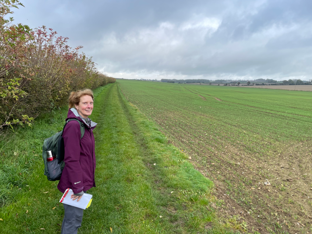
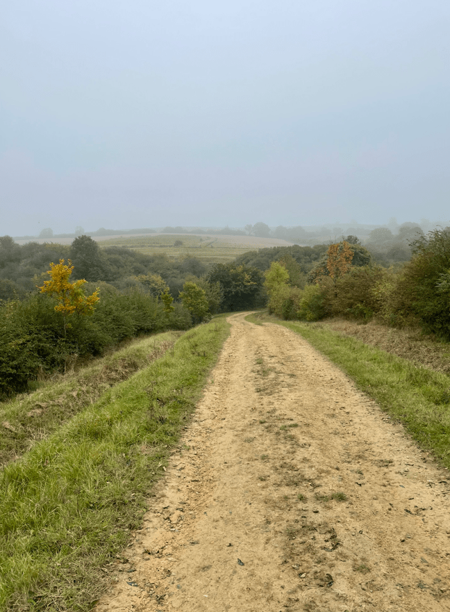
It was another grey day but mild and dry as we headed across fields. We passed through a field containing Alpaccas – they ignored us. It made a change from cows and sheep 😊. I wondered if they would become a more common sight in the future.
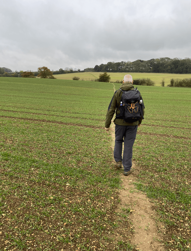
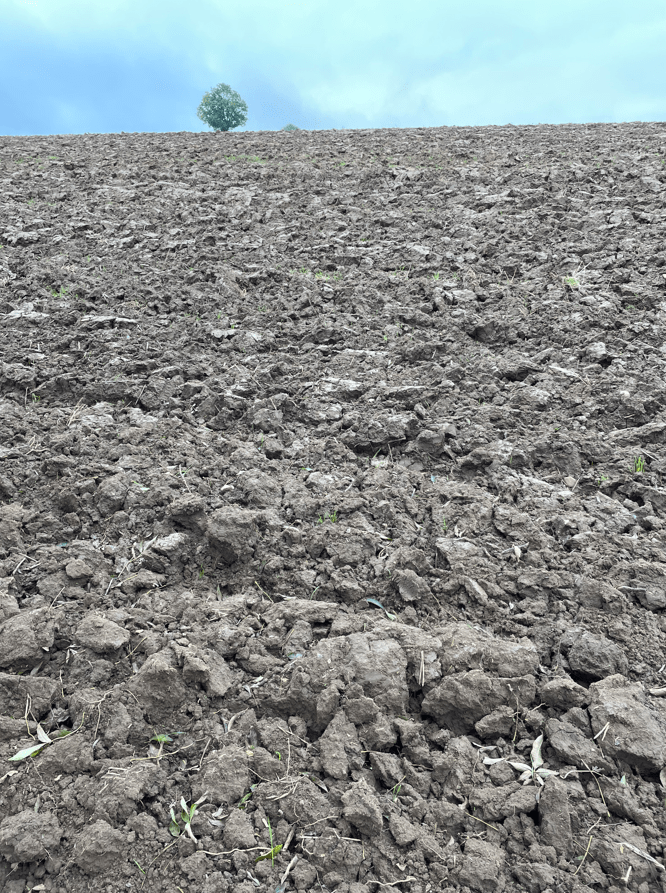
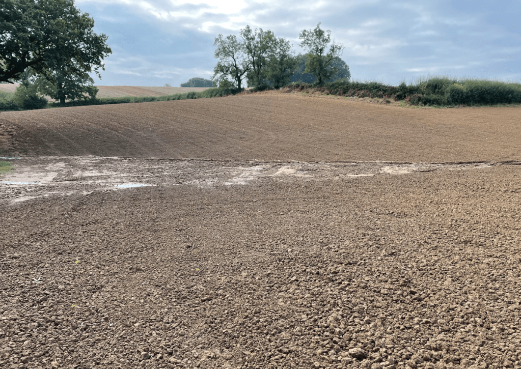
We soon found ourselves unable to follow the path as a number of fields had recently been ploughed up- it would be very easy to turn an ankle. We walked around the outside of the fields instead. It was a little frustrating but to be expected at this time of year.
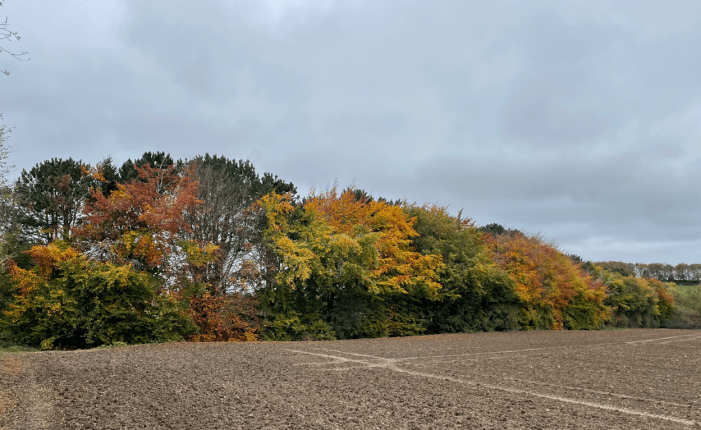
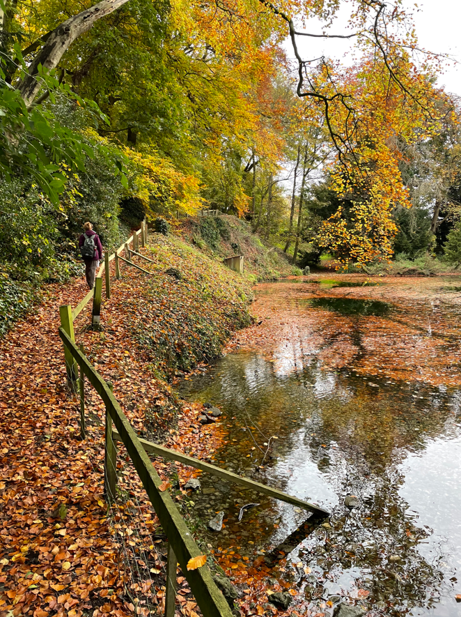
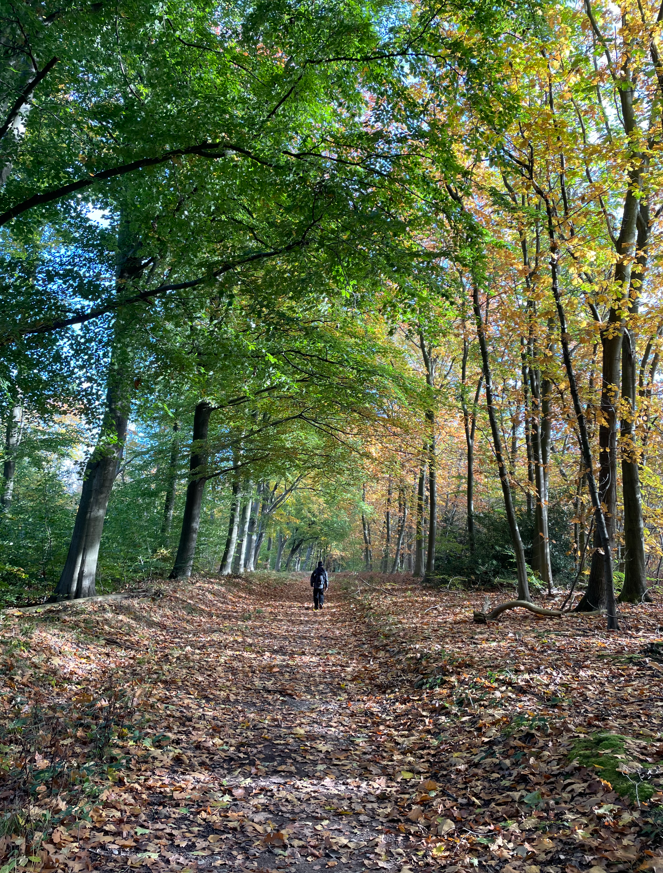
It was nice to admire the autumnal colours in the trees as we passed by.
Pausing for a break in the hamlet of Tathwell we had a walk around the pond. The surface was covered in fallen leaves – very autumnal.
Walking on to the hamlet of Raithby I noticed that the church (St Peters) had been built in a unusual style.
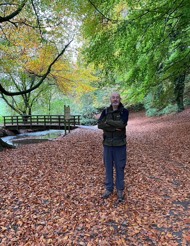
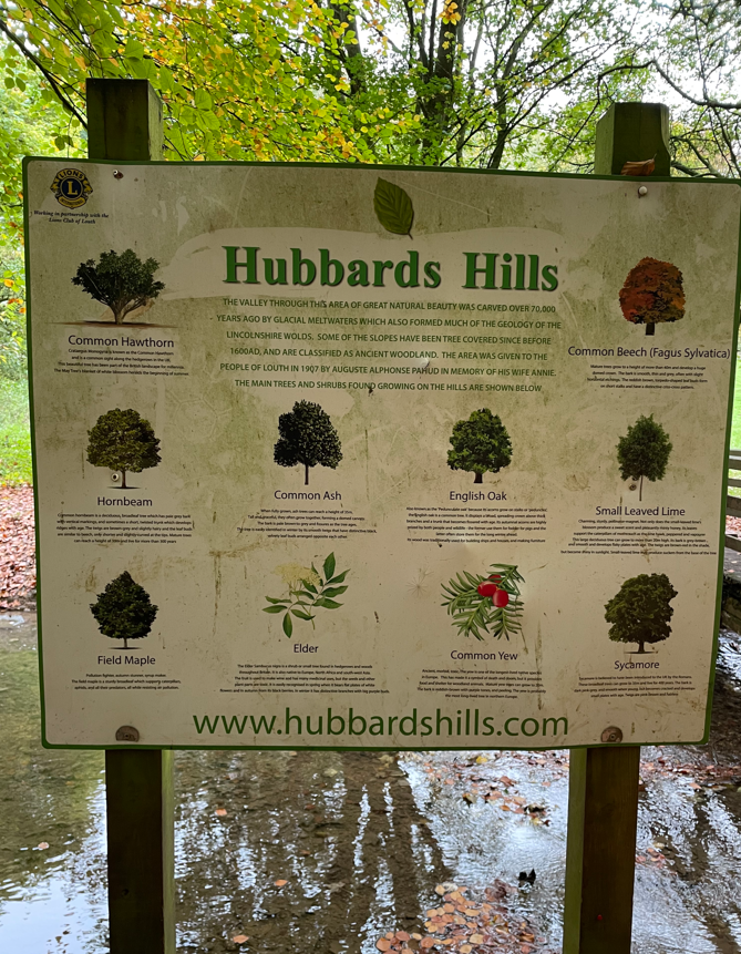
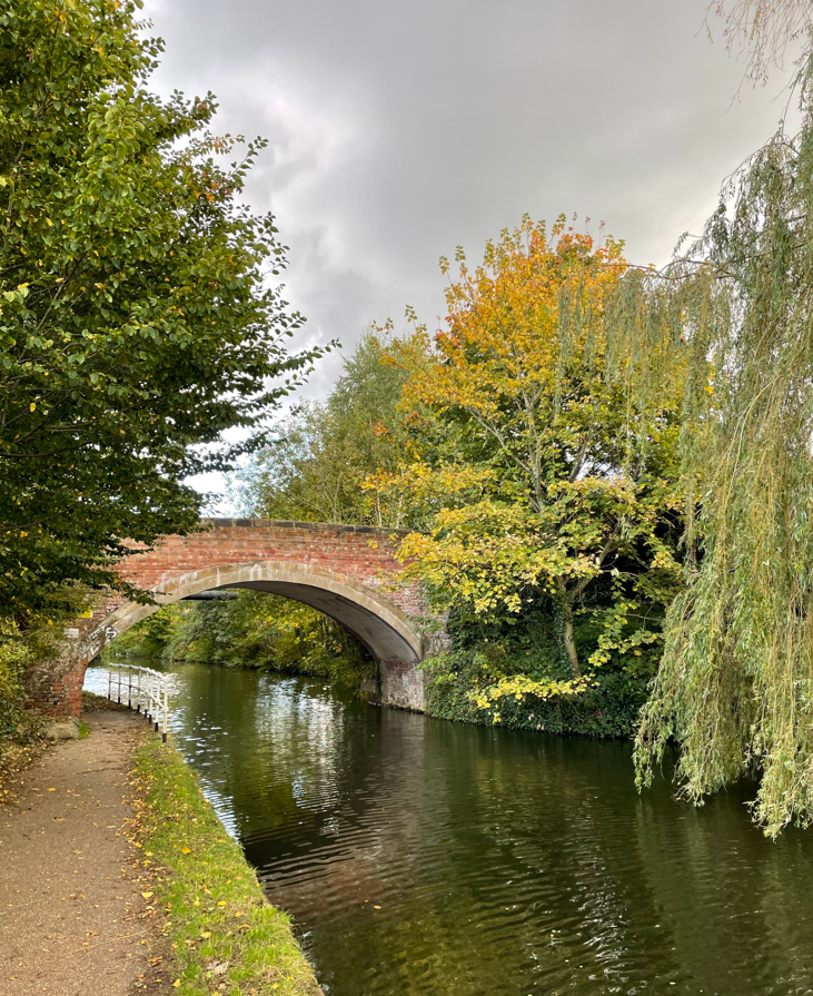
After crossing the A16 we entered Hubbards Hills, a 40m deep valley that was formed by glacial meltwater cutting through chalk hills at the end of the last Ice Age.
At Hubbards Hills
This beautiful site was saved for the people of Louth in 1907 by Trustees investing money left in the will of schoolmaster Auguste Pahud as a permanent reminder of his wife Annie. It was a lovely walk through the deep sided valley. It was a fitting end to a nice walk.
Entering Louth we walked past St James church which has the third tallest spire in the UK. I do like a flying buttress.
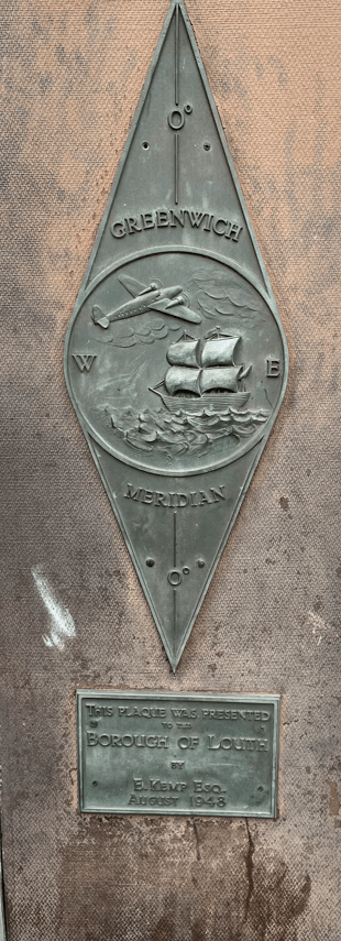
In the town centre there is a sign on a wall marking the zero degree Greenwich meridian line.
This explains the signs that we saw when walking for the Greenwich Meridian trail http://greenwichmeridiantrail.co.uk. The route is a 273 mile trail that follows the line of the Prime Meridian. I might have a look at this!
It had been an interesting walk today and I enjoyed the autumnal feel to it.
Today’s walk was a 10-mile circular walk starting in the market town of Horncastle. Myself and Angela parked the car in the Tescos supermarket long stay carpark and planned to follow a walk from the OS book ‘Lincolnshire and the Wolds – outstanding circular walks’.
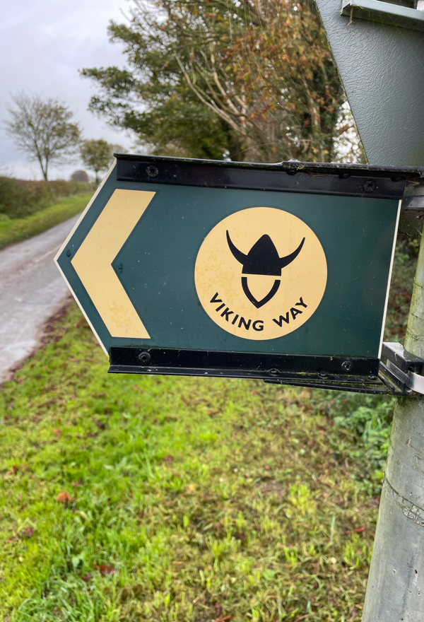
The walk was a wide circuit of the Bain valley to the north, west and south of Horncastle. We followed the Viking Way at the beginning and end of the walk.
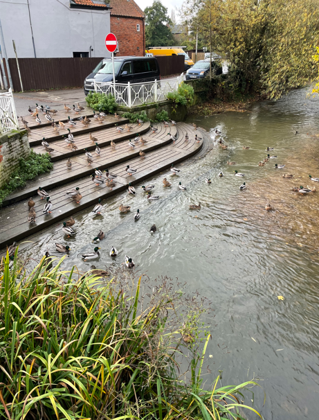
Leaving the carpark nice and early in the morning the local ducks were making a lot of noise as we made our way to the market square – we wondered whether it was feeding time.
In the market square there was a grand monument, built by the people of Horncastle, to Edward Stanhope – a respected benefactor to the town.
Stanhope Memorial
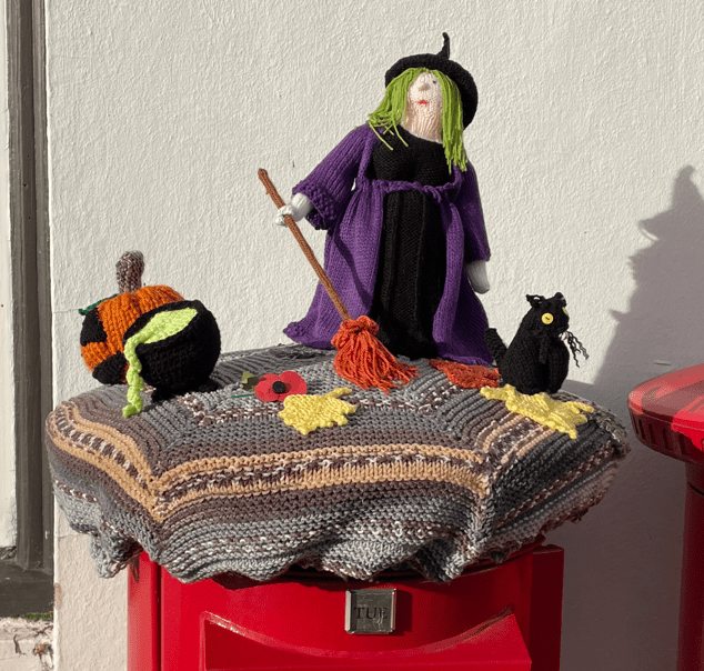
Outside the Post Office in the market square there was a nice knitted cover on top of a post box – Halloween themed.
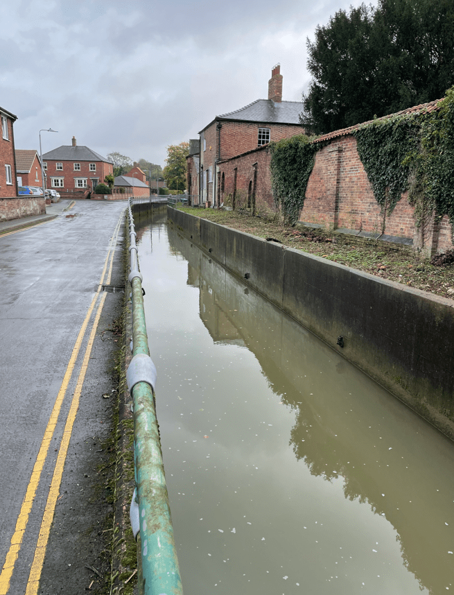
Navigating our way through Horncastle we walked beside the little River Waring.
River Waring
After walking along a track beside housing estates we emerged on to a road and then, after a short road walk, started across fields.
The grass was wetter than anticipated. The day had turned cloudy. After a stretch across field paths we came to a road section. This was not enjoyable because there was just too many cars/lorries passing along it. We wondered whether the walk had been designed years ago before road traffic was as heavy as it is today and hedges were not so big.
A very brief quiet spell on the busy road
The road passed over the River Bain.
River Bain
We were glad to leave the road and head across fields again.
The walk was pretty uninspiring from a scenic perspective, however, we were enjoying being out walking and getting some miles in.
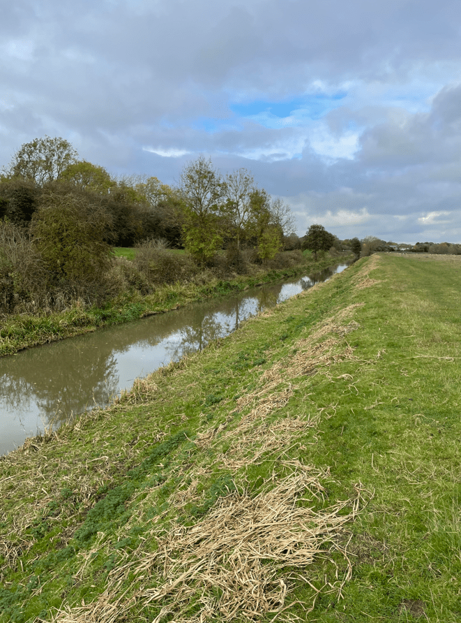
Eventually we came to the disused Horncastle Navigation canal. In 1802 the canal linked Horncastle and Tattershall, running parallel to the Old River Bain. As I am interested in canals this was the highlight of the walk today.
A disused lockHorncastle navigation canal
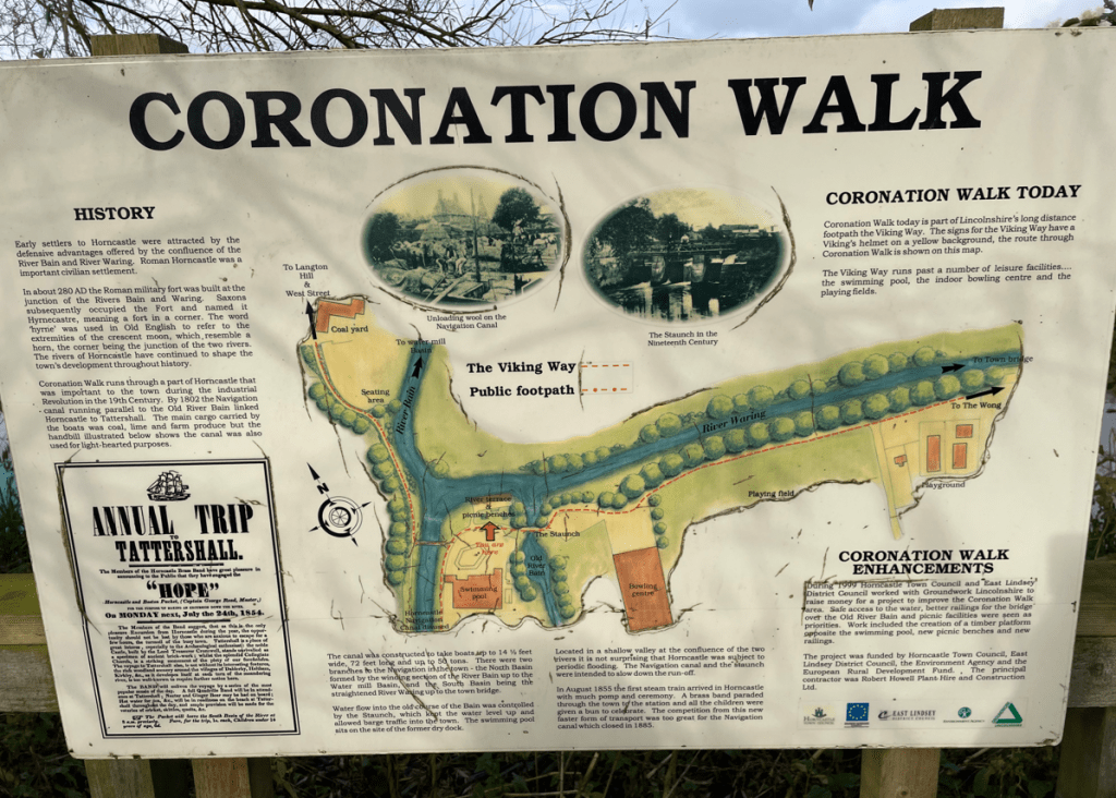
We followed the canal, walking on the embankment to Coronation Walk in Horncastle, and on through town to the car.
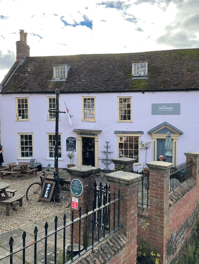
Angela had done some research and found a nice café to have lunch at – The Bridge. We enjoyed a super lunch there and can definitely recommend it.
Horncastle is a very civilised town. Why ? 1. It has public toilets and 2. They are free!! 😊.
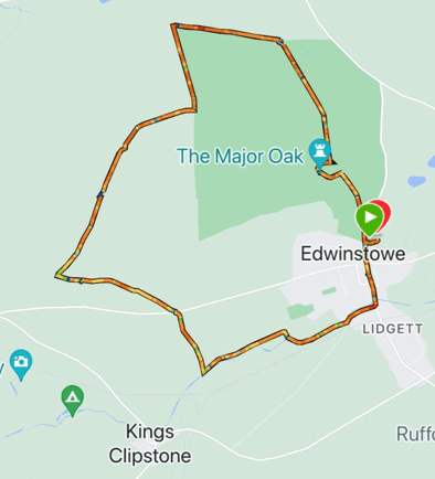
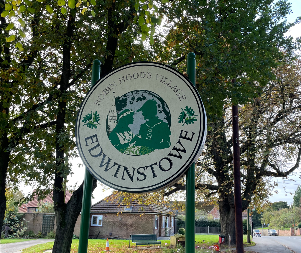
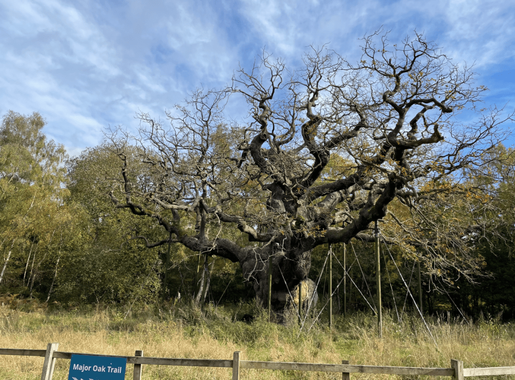
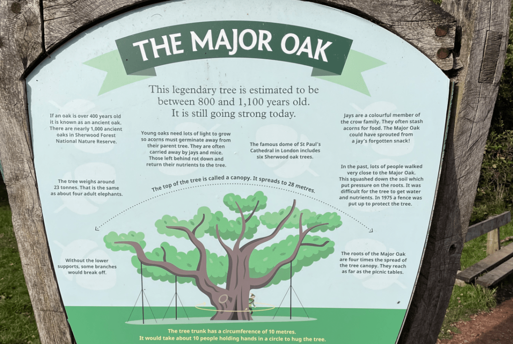
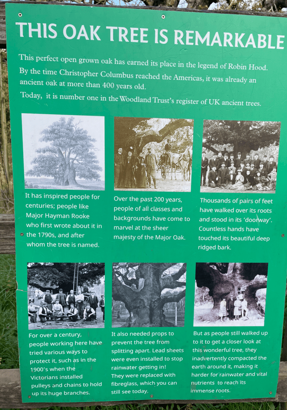
This morning myself and Mick enjoyed a 9-mile walk autumnal walk in Sherwood Forest . The highlight of the walk was visiting the Major Oak, reputed to be 800-1100 years old!
Arriving in Edwinstowe we parked in the RSPB car park. We were in Robin Hood country.
It was quite cloudy and a chilly wind was blowing – not what we were expecting. Our day began by walking through the village where we saw a nice sculpture of Robin Hood and Maid Marian.
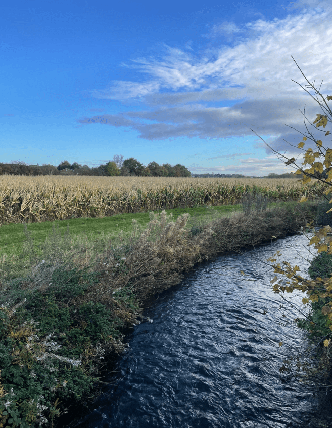
We picked up a track that took us beside the river Maun. The path was slightly muddy but could have been worse. The sun was starting to put in a welcome appearance.
The river Maun
Shortly, we found the path to take us into the forest, passing a nice building.
The trees in the forest were full of Autumnal colours and sweet chestnuts were covering the floor. I’d never seen so many! Mick picked some up to feed the squirrels at home. We saw signs to say that part of the forest is a Naturist area – needless to say, this resulted in a bit of banter.
There were many paths in the forest and we took the wrong path a couple of times but soon got back on track. Roughly half way through the walk we stopped for a cuppa. We joked about keeping an eye out for Robin Hood.
We pressed on, starting to meet a few people now. It had been very quiet – we didn’t hear any birds singing. We met a couple who couldn’t remember where they had parked their car – in a lay-by somewhere apparently. They are probably still wandering around now!
Mick pressing on through the forest
We started to see signs directing people to the major oak and we arrived in an area where there were people milling around. It must be close. Then, I turned around and there it was!
The Major Oak
Mick was delighted to have seen the tree – ‘that’s one off the bucket list’ he said. Its incredible to think the tree is so old and is still alive today. Amazing!
Leaving the Major Oak we continued to follow the woodland trail that was carpeted in leaves. It brought us back to the car park.
It was a good walk and made a pleasant change from bog-trotting across fields.
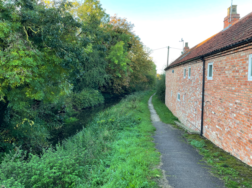
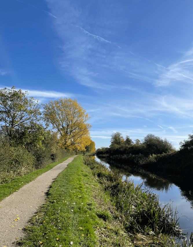
This morning was forecast to be a sunny one, so I decided to make the most of it, and get out for a nice easy walk along the Grantham Canal Towpath. I did a 6.5- mile walk from Harby to Kinoulton and back again.
After an initial cloudy start the sun came out and it was an incredibly mild day. Wonderful!
The Grantham canal is a restoration canal and I volunteer for The Grantham Canal Society, whose ambition it is, to restore the canal from Nottingham to Grantham. I feel a close affinity to the canal.
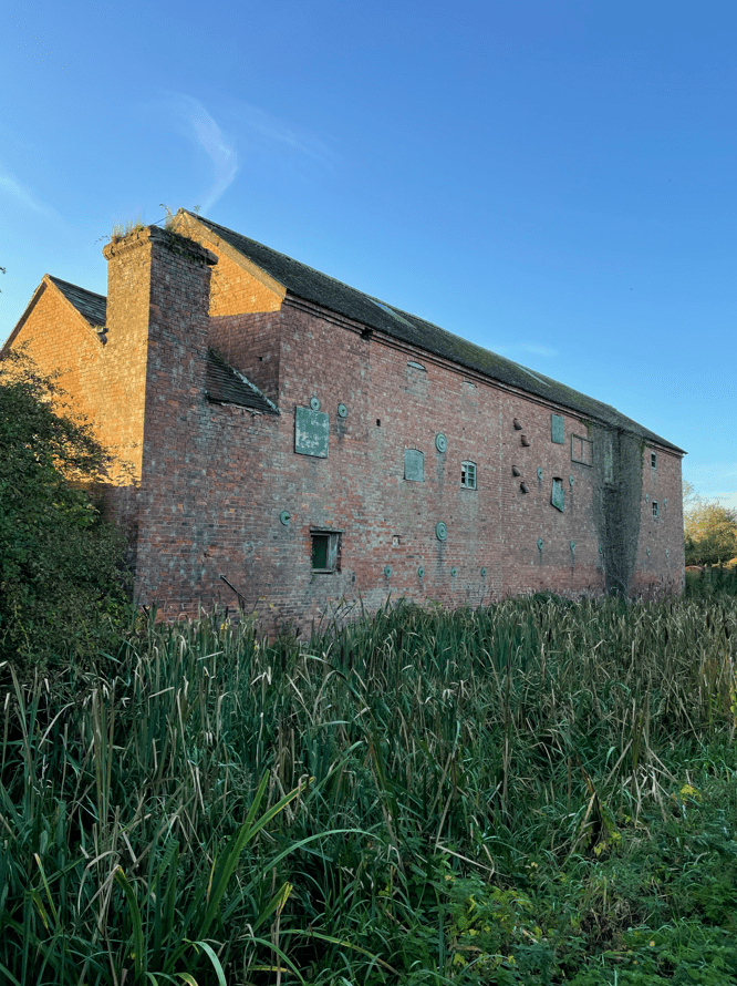
I joined the towpath at Harby and soon passed the old Warehouse that is still standing as a silent monument to the past.
Starting at HarbyThe old Harby warehouse
The observant amongst you will have noticed that the canal at this point has a lot of weeds in it. This section is not navigable yet – nature has a habit of reclaiming what was once its.
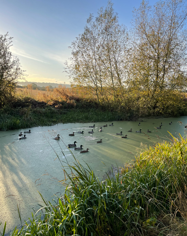
Further on I spotted a flotilla of Ducks heading along the canal. It was lovely to see. I wondered where they were going?
Duck Flotilla
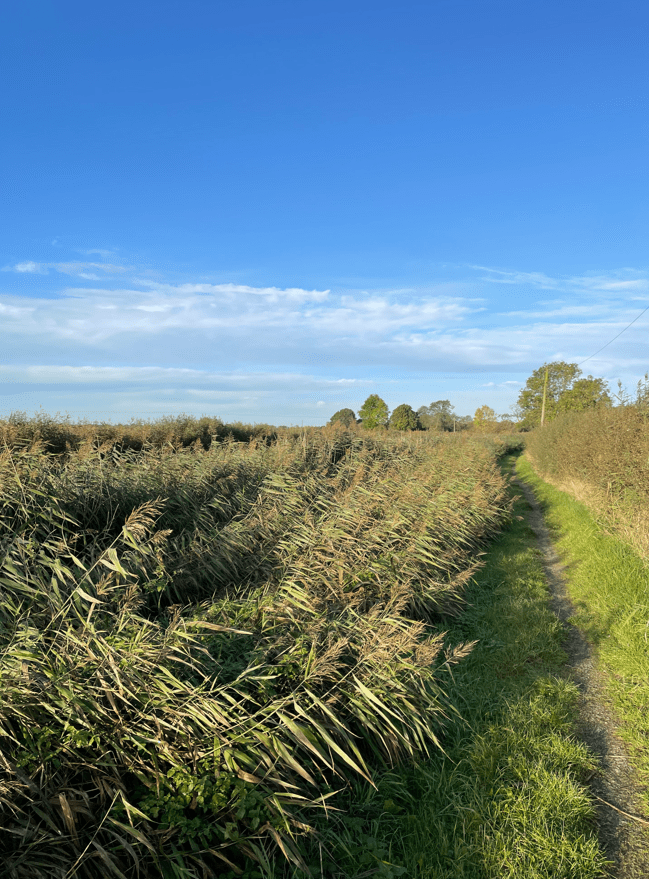
I met a few people being walked by their dogs and a couple of runners, but on the whole it was quiet. The towpath in places was sandwiched between reeds from the canal and hedges. I enjoyed watching the reeds sway with the wind.
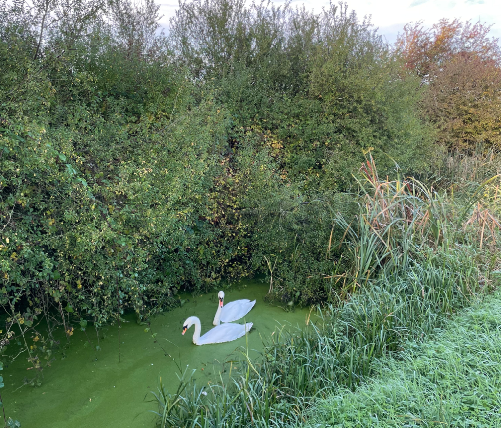
I was so taken in with looking at the canal that I walked past a ‘Towpath Closed’ sign without seeing it. So, further along I had to crawl under a very low bridge. I should have followed the diversion – I did on the return leg!
A very low bridge
Emerging from under the bridge a couple of Swans were looking at me as if to say ‘can’t you read!’
Can’t you read!
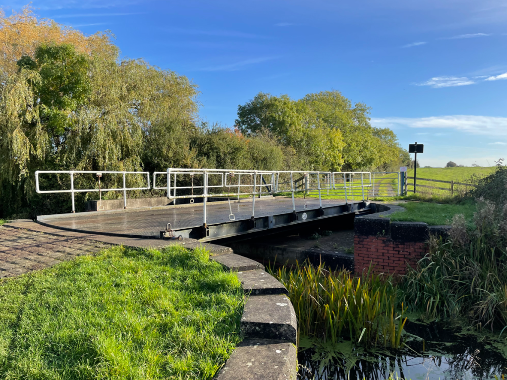
I was enjoying the warm weather, the sun and the scenery. I also loved looking at the swing bridges. Dragon Flies were skittering around on the breeze.
A swing bridge
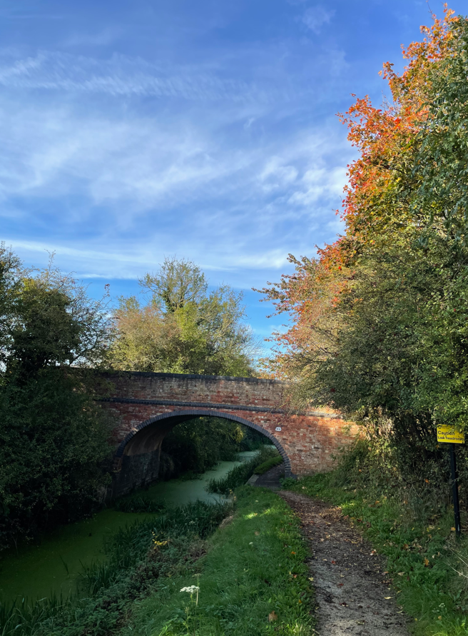
The miles were slipping away as I headed to Hickling passing under Clarkes Bridge where, sadly, I spotted a dead swan in the water. I reported this to DEFRA when I got home.
Clarkes Bridge
I would soon be arriving into Hickling, passing the restored Lengthmans Hut. The hut used to provide shelter for the canal worker who looked after this section of the canal.
Restored Lengthmans Hut
This section feels quite open with a nice wide path.
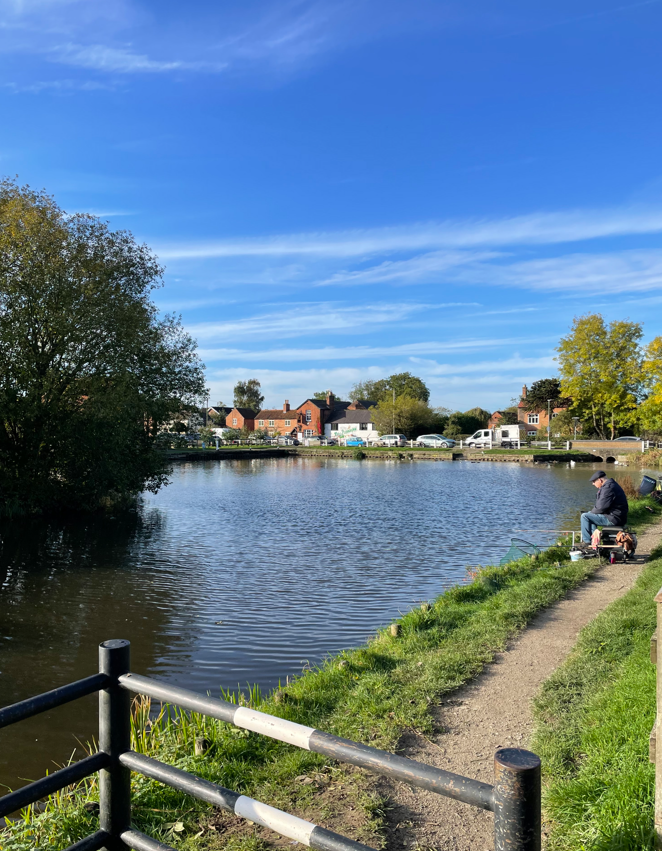
Hickling basin was in full sunshine with a few Anglers dotted around the outside. I found a bench and enjoyed a cuppa and a sandwich. I could see the ‘Old Wharf’ café on the other side of the basin and it was, as it usually is, very busy. I had a chat with a chap who was emptying the bins – he said that the sun always makes people happy, how true!
Leaving Hickling I headed for Kinoulton. This section of the canal was very busy with people – its obviously a popular walking spot. At Kinoulton I turned around and headed back. This time, the wind was in my face which was cooling as the sun was quite hot.
It was a great walk, I got a good few miles in and it was nice, easy walking- no boggy fields!!!
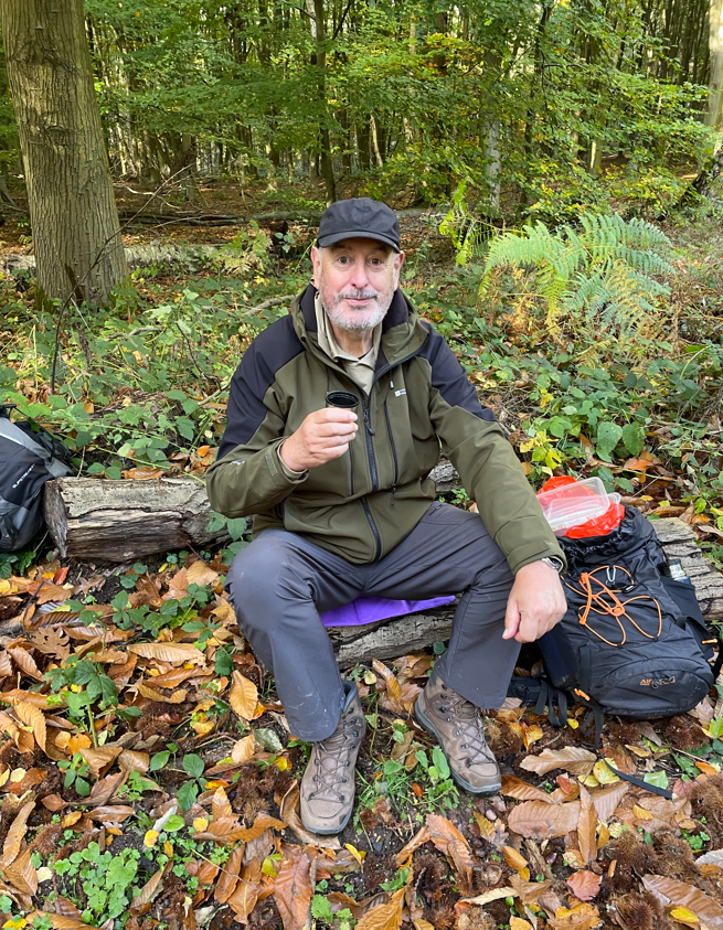
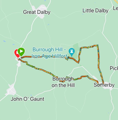
This morning myself and Mick walked leg 5 of our Leicestershire Round Expedition. We parked the cars in Somerby and Belton-in-Rutland and completed the 9-mile leg.
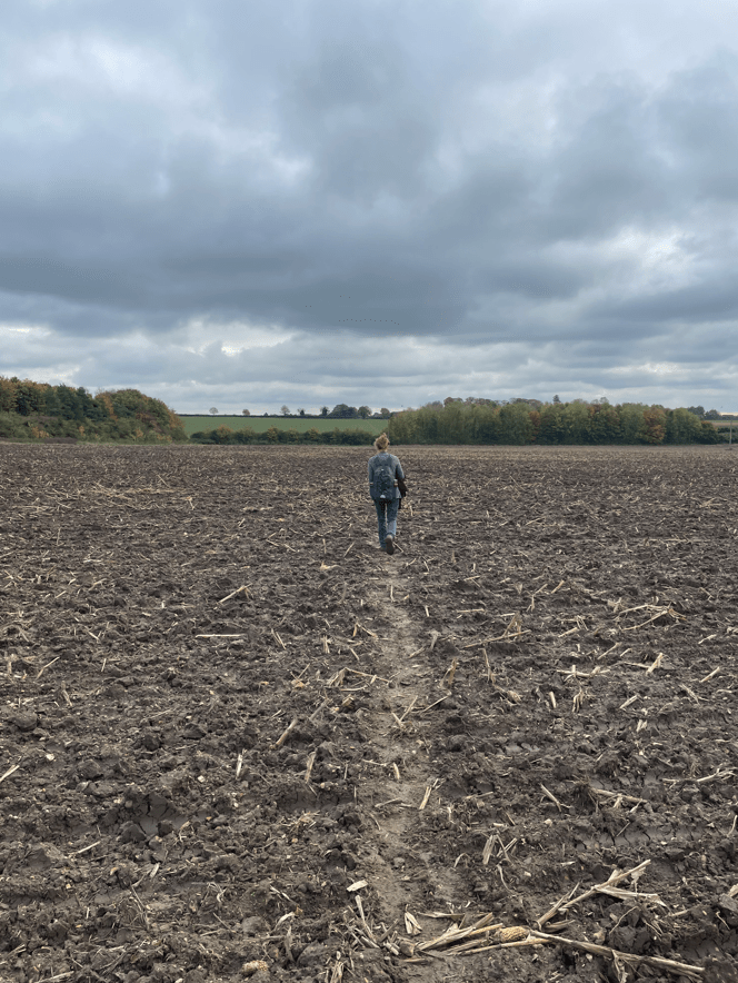
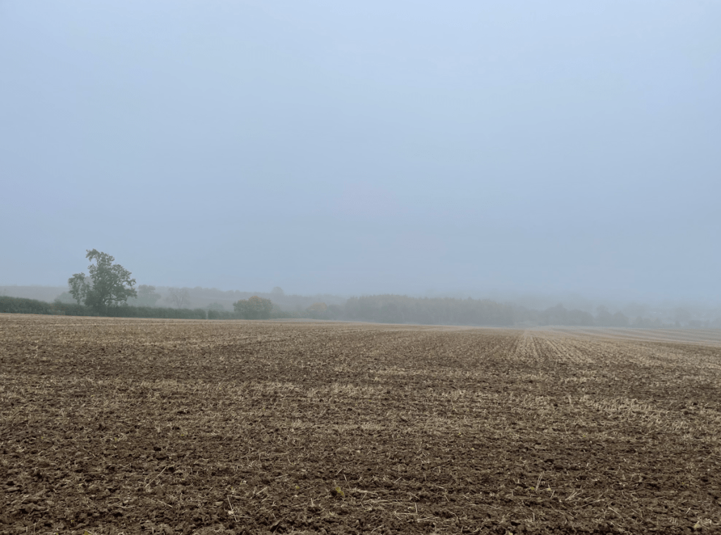
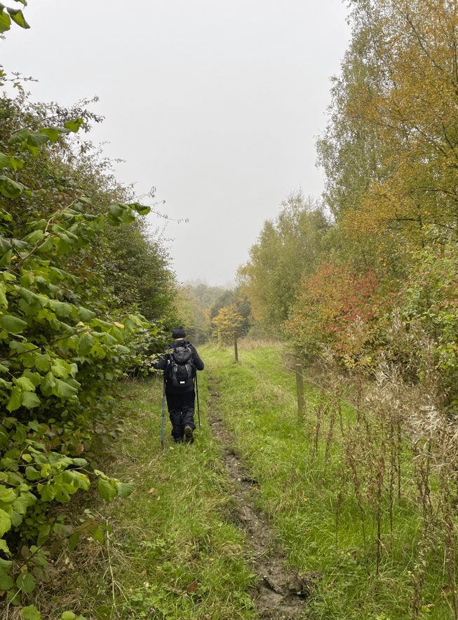
It was a very misty day as we began our walk in Somerby. We walked towards the hamlet of Owston. This walk would be mainly across fields so we had prepared by wearing waterproof socks and gaiters.
On our way to Owston
It was a shame about the weather because the mist did not allow us to appreciate the countryside we were walking through. It also meant that photos for my blog are limited! We found the paths slippery, boggy and we made good use of the walking poles.
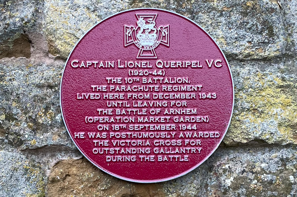
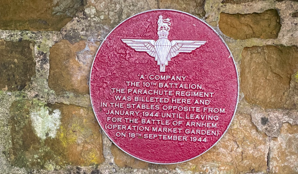
Walking through Owston we spotted a maroon heritage wall plaque similar to one we had seen last week in Somerby.
Sign on Corner Cottage in Owston
Mick had seen some walking signs saying ‘Battalion Way’ as we were walking. The 15- mile trail takes you to various places relating to the 10th Battalion, the Parachute Regiment, during the nine months the Battalion spent in high Leicestershire from Dec 1943 to Sept 1944 . https://friendsofthetenth.co.uk/the-tenth-battalion-trail/
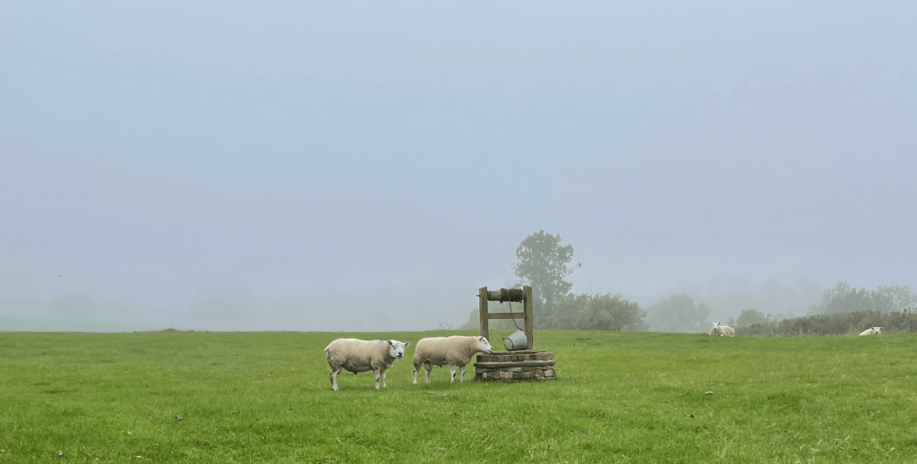
Owston was home to an Augustinian Abbey at one time. Leaving Owston we headed up a road and Mick spotted a water well with a couple of sheep looking like they might use it.
Owston Woods was next – what a nightmare! The path through was extremely boggy- made worse by the fact that horse riders also use the path. We were so glad to get through this section. Our guide book did pre-warn us that it can be muddy, however, reality was grim. Reaching the end of the woods – it was all uphill – the path emerged onto a avenue of Chestnut trees. We stopped for a cuppa and a bite to eat. Our guidebook describes the path through the woods as ‘very wearisome’ – we both agreed!
Owston Woods is the largest area of ancient woodland in Leicestershire and has been a Site of Special Scientific Interest since 1956.
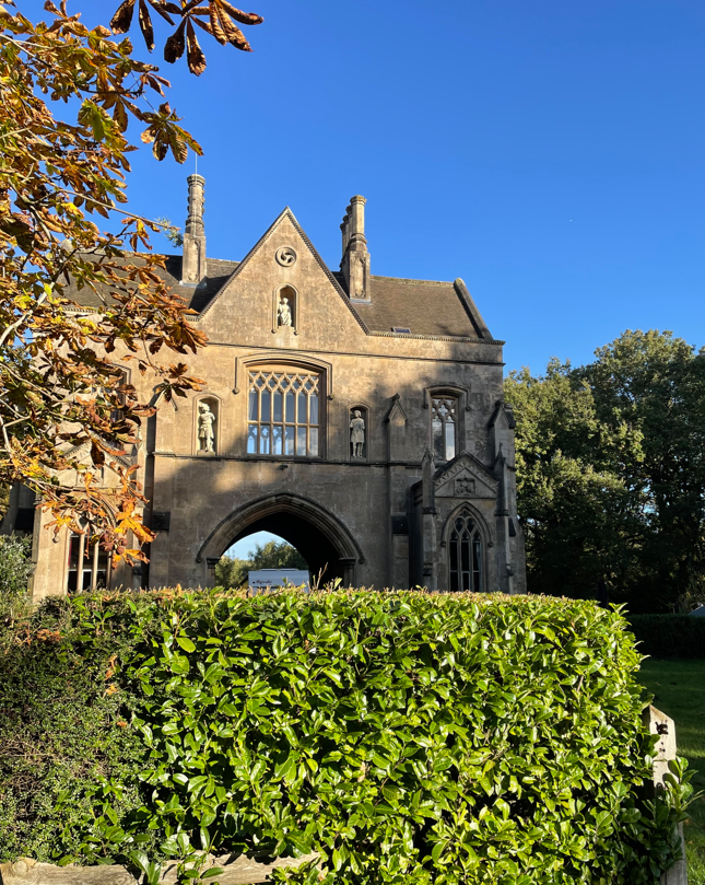
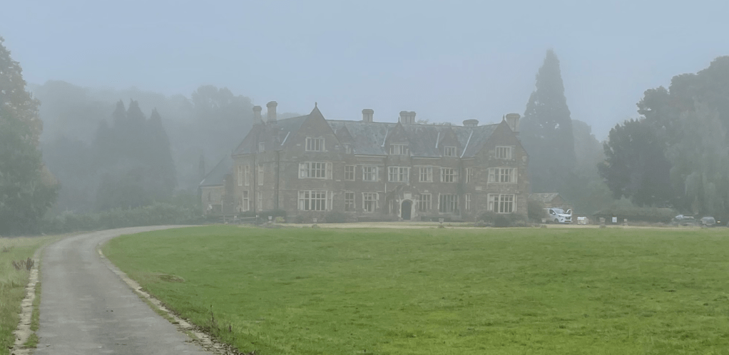
It wasn’t too long after leaving the woods that we arrived at Launde Abbey in the mist.
Launde Abbey
This Tudor house was built for Thomas Cromwell who owned it for three years before his execution in 1540. It is now a retreat for the Leicester and Peterborough dioceses of the Church of England.
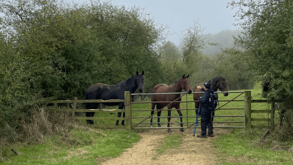
Our paths took us across fields of cows – they were well behaved. Mick said ‘Hello’ to some friendly horses.
Friendly horses
The footpaths turned into wider tracks and we were glad to find drier conditions under foot.
Better tracks
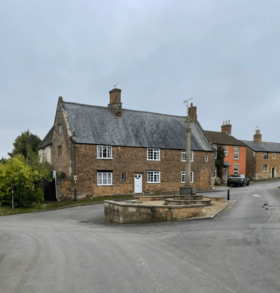
Soon we were arriving into Belton-in Rutland- its almost like the village that time forgot.
This was the end of todays walk. We have now completed 37-miles (Bradgate Park to Belton- in-Rutland) out of the100 mile Leicestershire Round total. Our journey continues ……………….
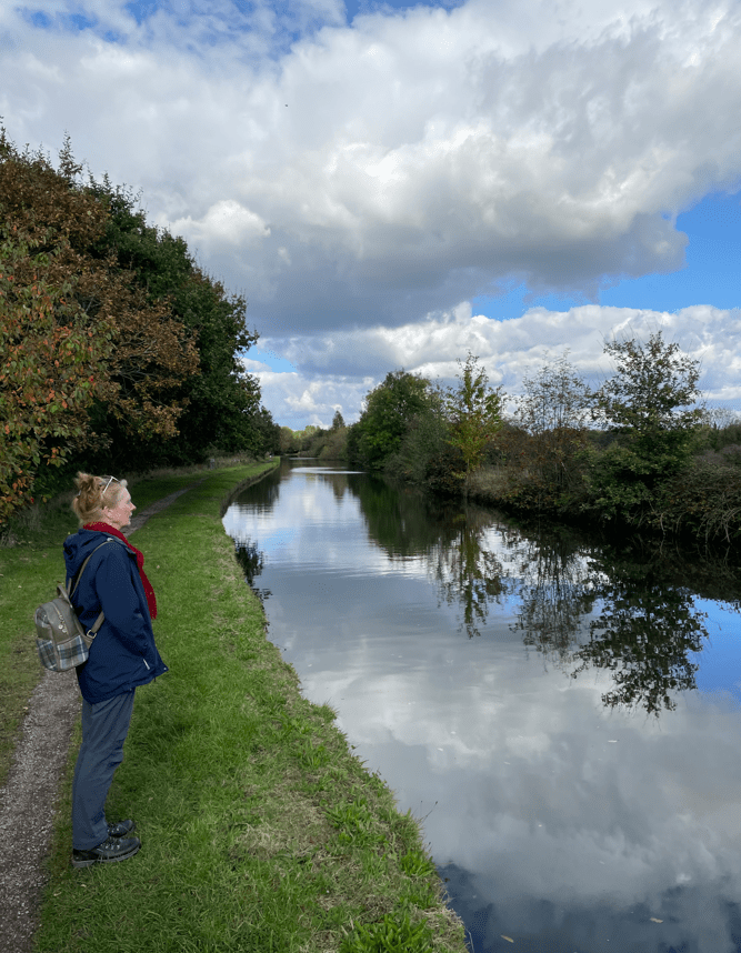
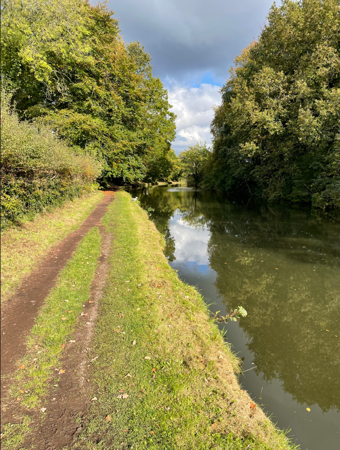
Today myself and Angela enjoyed a 7-mile walk along the Bridgewater Canal. It was a lovely sunny day and chillier than recent days. We parked in Dunham Park car park and headed out on our sunny walk. We had a spring in our step.
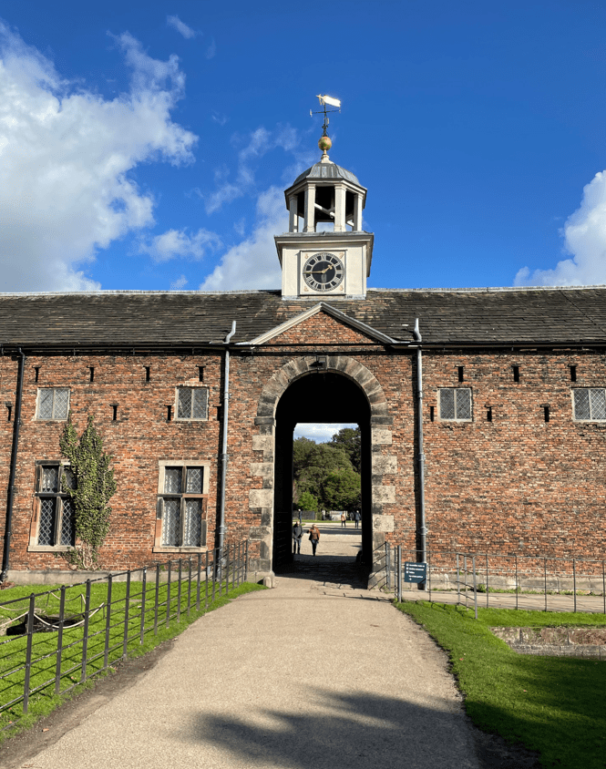
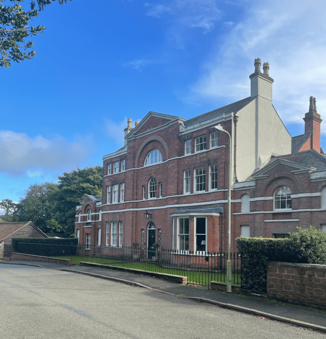
There were quite a few people about in the park taking advantage of a nice day. Passing the stable block and old mill building we headed towards the Bridgewater canal.
Stable block
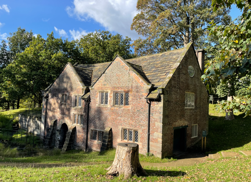
We noted that the water wheel for the mill was turning and that there were tours around the mill in the afternoon – we will do that sometime.
Old Mill
Arriving on to the towpath the sun went in – I wondered whether it was anything to do with Angela putting her sunglasses on 😊.
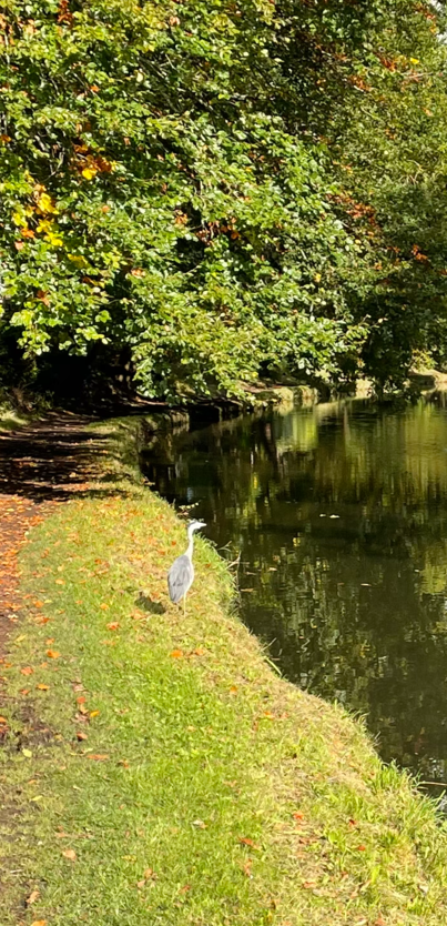
The towpath was quiet and as we walked along we spotted a heron sat there.
Surprisingly, it let us get quite close before flying off. It was great to see it.
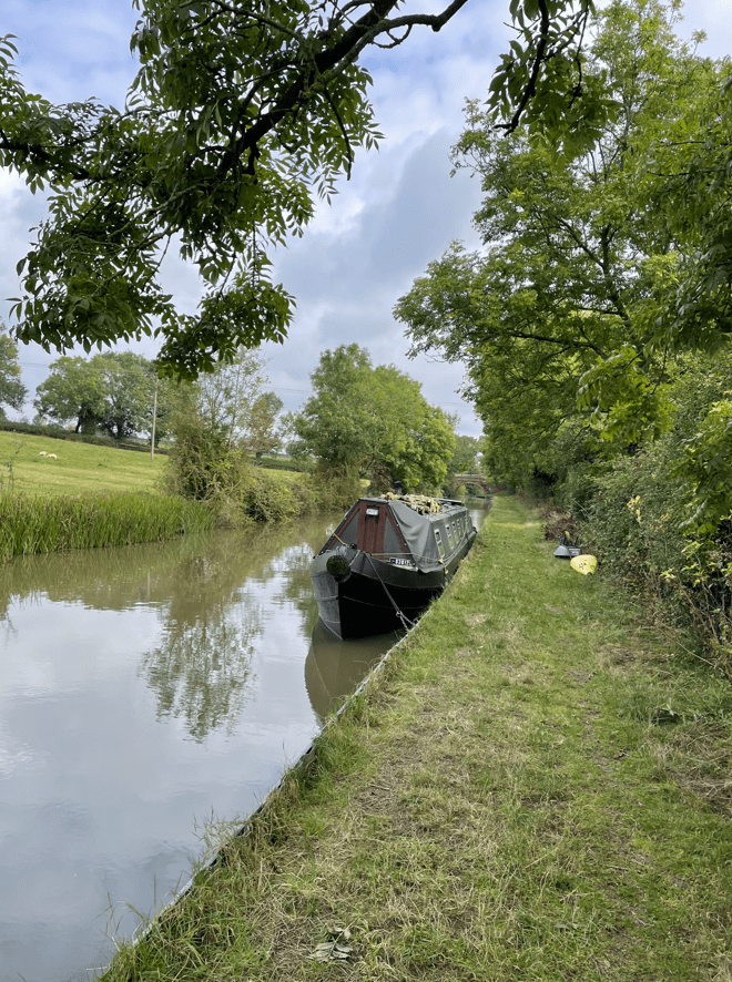
Continuing along we passed a few narrowboats that were moored up and a tent where someone was living (and has been for a while). I can think of worse places to pitch a tent.
We passed over and under a number of bridges some of which I admired.
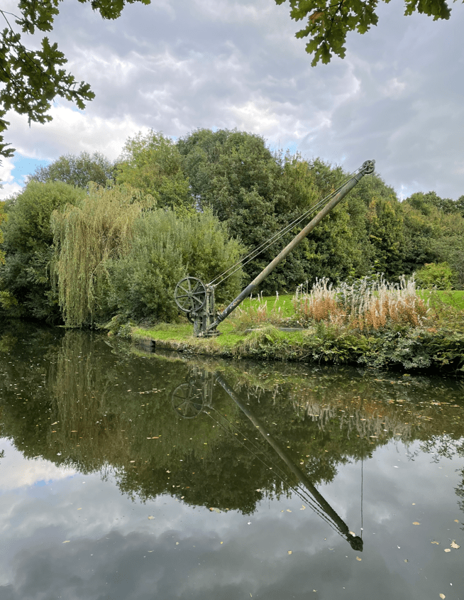
As we neared Oldfield Brow we passed a small Marina and then, further on, a nice piece of old engineering – a crane for lifting stop planks into the canal.
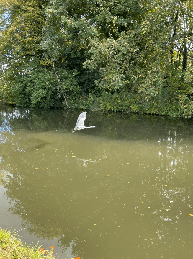
At this point we turned around and walked back the way we had come. We met Mr Heron again who continued to delight us with his flights along the canal. The sky was getting blacker as we walked along the canal – thankfully it didn’t rain. We left the towpath and entered Dunham Park along a tree lined avenue.
Today myself and Mick enjoyed a 8.7-mile circular walk from Thorpe Satchville following the Leicestershire Round path across Burrough Hill to Somerby. There, we left the Leicestershire Round path and walked across fields to Burrough-on-the-Hill and onwards back to Thorpe Satchville.
Leaving Thorpe Satchville the heavens opened up and the rain poured down. We’re not off to an auspicious start! Mick said that he had checked the rain radar and it should be fairly short – indeed it was. The next showers were due just after midday but we would be finished the walk by then.
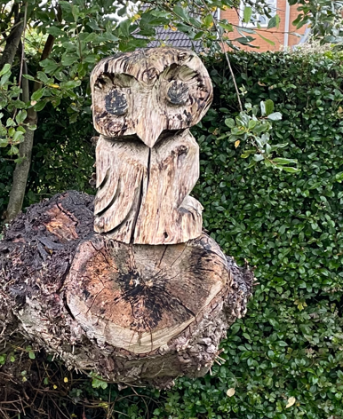
We passed a nice Owl carving in a tree stump.
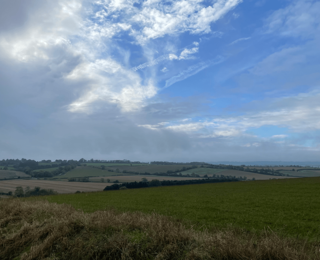
Blue sky as the rain clouds pass overhead
The ground was muddy and wet so I had glad I had put on my gaiters. As it turned out, I should have brought my walking poles because the ground was treacherous in hilly places.
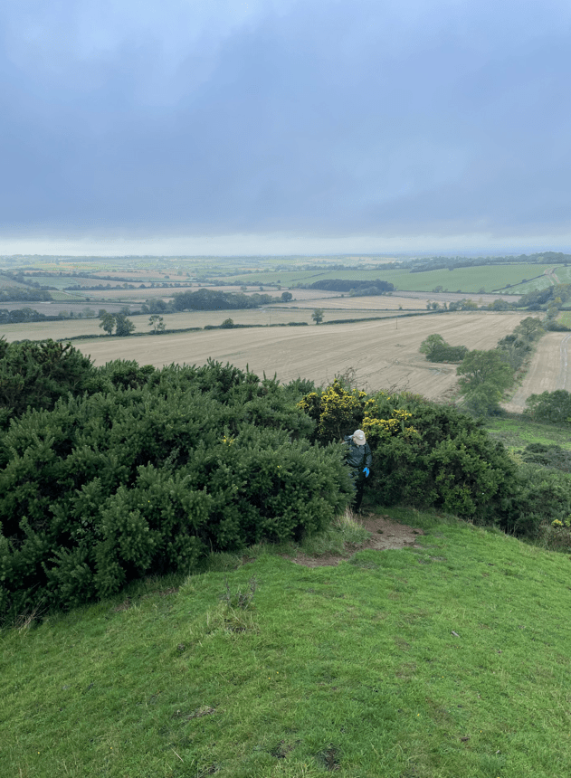
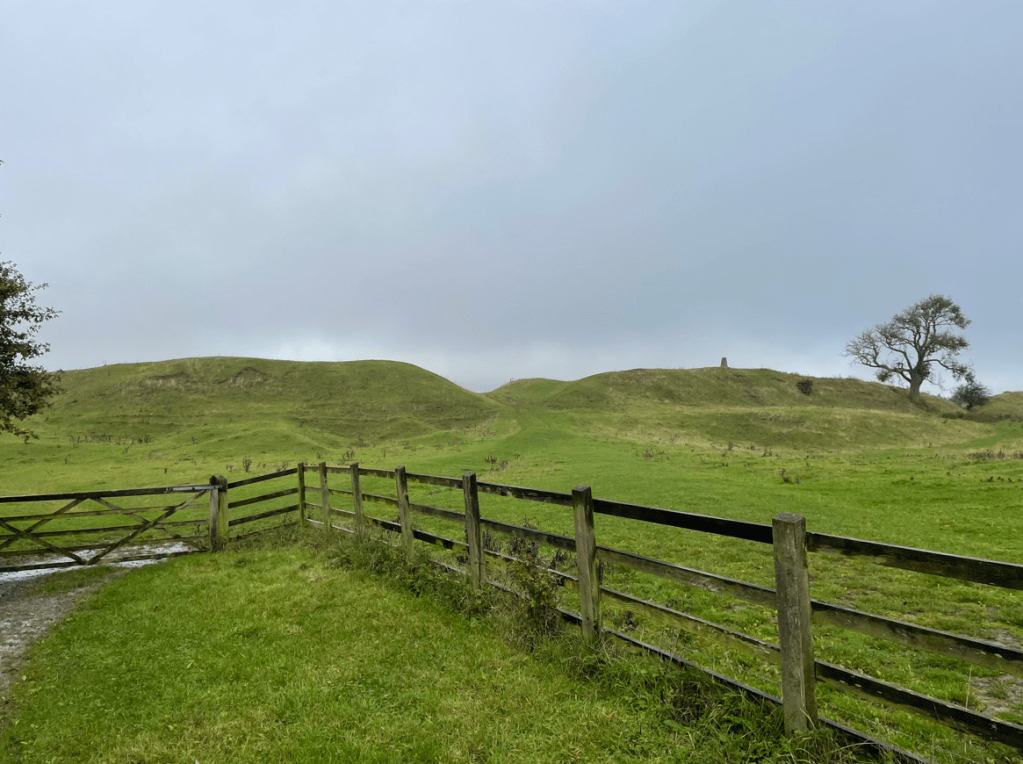
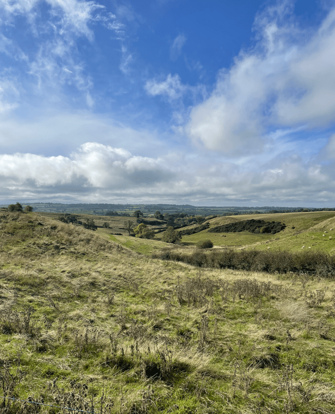
We were on our way to Burrough Hill, at 690 ft, one of the highest hills in East Leicestershire. As we climbed upwards we had nice views across the countryside.
Mick emerging from the gorse after a steep and slippery climb.
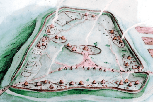
On top of Burrough Hill is an iron age hill fort – the ramparts are clearly visible. It was a pity that the day was cloudy because there would be great views from here on a clear day.
Ramparts of Burrough Hill fortWhat the fort might have looked like.Toposcope near summit of Burrough Hill
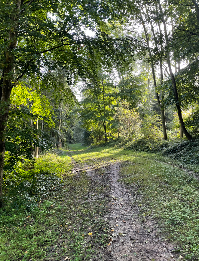
Leaving the hill fort we headed downhill towards the Dalby Hills path which took us through some woods.
Mick leaving Burrough Hill
After squelching along the path we spotted a bench and halted for a cuppa and a bite to eat. We had seen a Roe Deer, lots of rabbits and red kites overhead.
Refreshed we left the woods and headed slightly uphill again. There was 1,200 ft of ascent on todays undulating walk.
Heading towards Somerby
Soon we arrived in Somerby and walked through the village. We spotted a parking spot where we could leave a car when we do our next leg of the Leicestershire Round – Somerby to Belton-in Rutland.
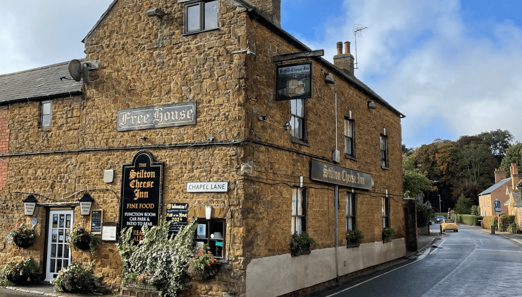
We passed a pub called ‘The Stilton Cheese Inn’ that had nice old brickwork.
Continuing on we saw a sign on a gate pillar leading to a large house called The Grove.
We continued onwards and had an encounter with a feisty Ram who may have been getting territorial or maybe he was just curious. Either way, we hopped across a stile fairly pronto. There were nice views into a valley.
Shortly, we arrived in Burrough-on -the -Hill where we saw a couple of nice houses.
Grand house in Burrough-on-the-HillAutumn leaves
Leaving Burrough-on-the-Hill we took fields towards Thorpe Satchville. Crossing some fields was a slog as they had been recently ploughed. We had nice views across the fields of England’s green and pleasant land.
Soon we were back at our car and we were dry! It had been a strenuous walk because of the wet conditions underfoot and the undulations, but great for the soul. My waterproof socks had worked a treat. We had not met anyone on our route today.
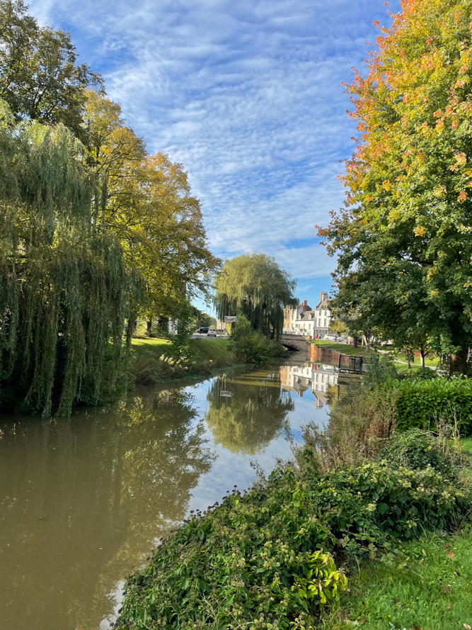
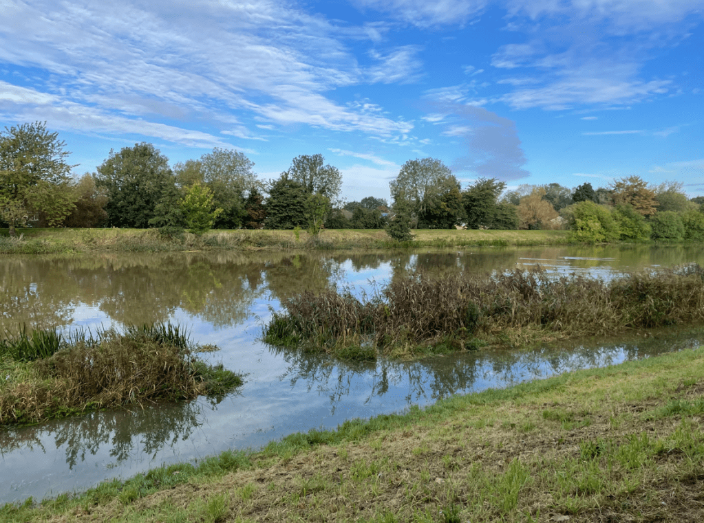
Today, myself and Angela drove to Spalding – a market town on the river Welland in the South Holland district of Lincolnshire. We did a 7- mile circular walk which followed the river Welland, the Coronation channel and Vernatts Drain.
It was a sunny but chilly morning as we left the car park and headed to the river Welland. The river is lined with trees which is nice to see, especially in Autumn.
River Welland in Spalding
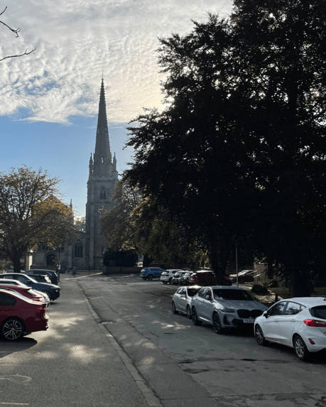
We passed the church with its fine steeple.
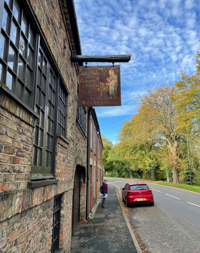
I spotted an old shop sign outside a building – it used to be a cabinet makers workshop.
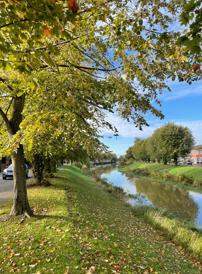
We followed the Welland for about half a mile and then turned left where we met the Coronation channel.
Tree lined river Welland
The Coronation Channel flows north from Crowland, through Spalding and out to the Wash. Land in Spalding had been reclaimed from the wetlands in medieval times. Consequently, Spalding was subject to frequent flooding. The Coronation Channel diverts the excess waters around Spalding and ended the flooding.
The Coronation channel
We walked along a high embankment which was built from the spoil taken out of the channel. The channel is quite wide – I wondered how deep it was? It was very pleasant walking in the sunshine.
The channel banks had been breached in places from the recent heavy rain.
High water in the channel
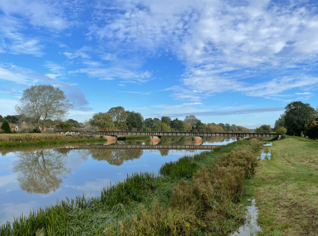
There were quite a few bridges over the channel including a disused railway line. We stopped on one of the bridges for a cuppa – there was a distinct lack of benches on this walk.
Old railway bridge
‘What’s that smell?’ said Angela as a particularly obnoxious odour enveloped us. It was coming from a factory adjacent to the bank and was foul! Angela moved into top gear and scooted along the embankment to get away from the smell. I think the factory was an Abattoir.
Continuing along the embankment we could hear church bells ringing and we soon found the church where it was emanating . The ringing was very pleasant on the ear.
We passed some large sluice gates. We had seen a couple of Herons and cormorants along the way.
Further on we passed Spalding Power station. The new £425m, 860 MWcombined cyclegas turbineSpalding Power Station, owned by InterGen, was built on the former site of British Sugar in October 2004. A second 300 MW expansion to the existing Power station opened in 2019.
Spalding Power Station
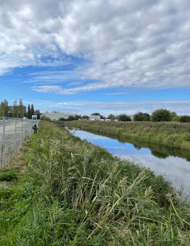
The route we were following was from a guide and clearly it needed updating. The route took us to the very busy A16 where roadworks were occurring and there was little in the way of a path for walkers. We did not enjoy this section which led us to Vernatts Drain (named after one of the engineers who drained the fens).
Walking on the footpath adjacent to Vernatts Drain proved troublesome with overgrown shubbery restricting access. Angela was not happy when she got stung by nettles. Funny smells, no benches and now poor paths, Angela was not enamoured with our walk today.
A poor fothpath along Vernatts Drain
Eventually the path improved.
Vernatts Drain
We passed a nice house by a bridge and then proceeded along our route to where we needed to cross the railway line.
We found that the old railway crossing had been fenced off so, had to find a different route back through Spalding. Most frustrating.
Access to railway crossing fenced off
On our way back to the car we passed a fine looking building with an unusual weathervane- the building is used by Spalding Gentlemen’s Society as a museum! https://www.sgsoc.org/.
So, a mixed bag of a walk and one that we probably would not do again. Still we enjoyed the sunshine and a stretch of the legs.
Yesterday was a very wet day with heavy rain throughout. As I set off in my car this morning I wondered what will the roads would be like, and also, what will my planned walk route would be like?
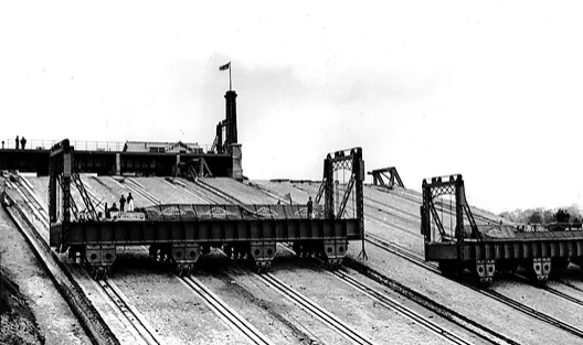
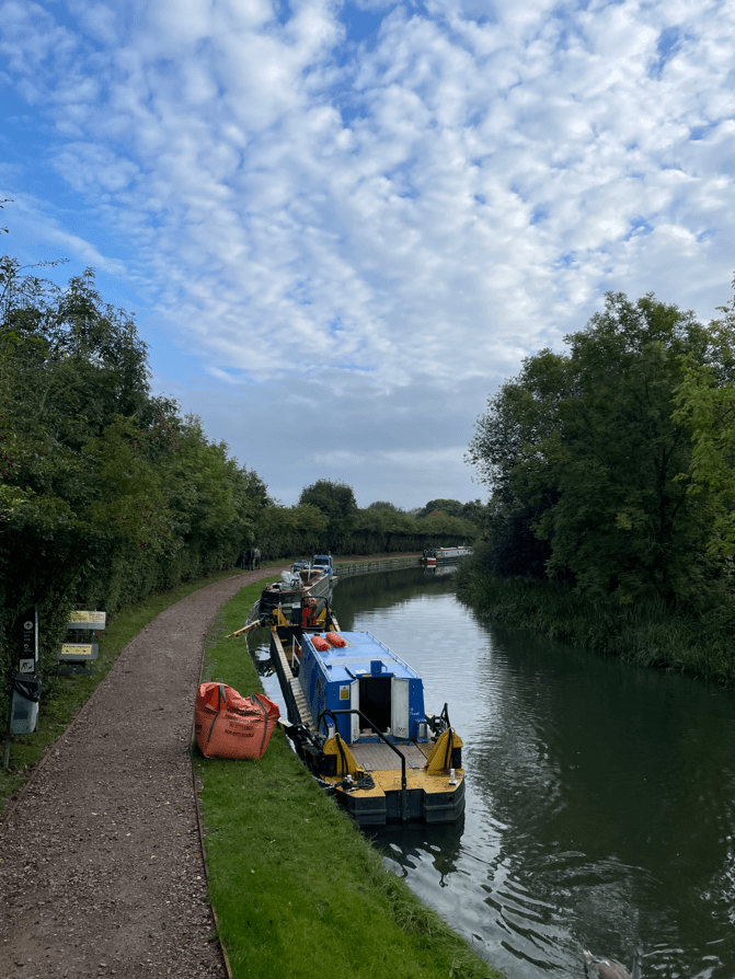
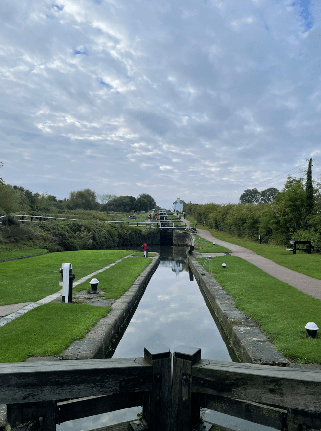
As a canal enthusiast I have been wanting to visit Foxton Locks ever since I had read about them. They are one of THE iconic sights of the canal network. Over 4,000 boats pass through Foxton Locks each year making it one of the busiest spots on the 2,000 mile canal network. Found on the Grand Union Canal the ten locks allow boats to ascend / descend 75 feet. It takes 45 mins for a boat to pass through the locks and uses 25,000 galls of water in the process. Built in 1810 they were superseded between 1900 and 1910, when an inclined plane, powered by steam engines and winches, was used to lift /lower large tanks (caissons) that contained the boats. However, the inclined plane lift proved uneconomic and was removed.
The inclined plane at Foxton
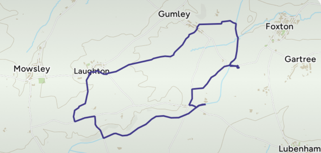
Today’s 7 mile circular walk would begin at Foxton Locks and take me across fields to the hilltop village of Gumley. After, it continued across the top of low Laughton Hills then descended to rejoin the canal. The last 2.5 miles would be along the canal towpath with fine views over the Welland valley.
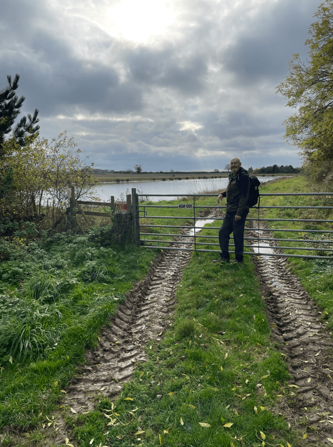
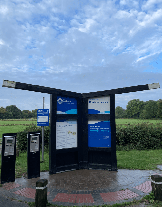
As it turned out, I had to pass through two sections of flooded road to get to the start of the walk – I took it slowly driving through the water. I parked in the long stay car park at Foxton Locks, noting the lock gates by the parking machines.
Leaving the car park (£3 all day) I followed a path which brought me to the canal towpath which I followed towards the locks.
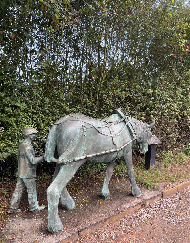
My first view of the Grand Union canalA nice sculpture
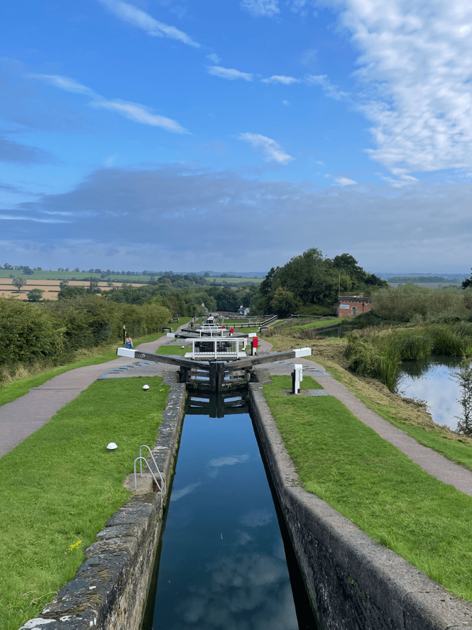
I passed a lovely sculpture of a horse and young lad – a nod to the days when the boats were horse drawn. Further on I reached the brow of a hill where the old locksmiths cottage (now a café but closed when I was there) stood and I gazed out at the wonderful sight of the locks. Awesome! – particularly when there were so few people about.
Foxton Locks Flight
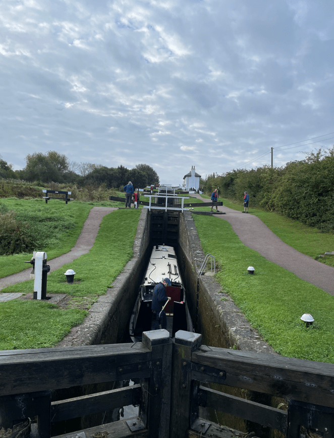
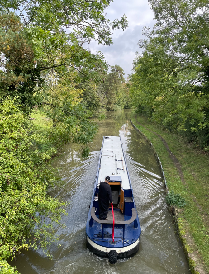
I walked down the flight of locks watching a boat make its way upwards.
Boat travelling up the flight of locks
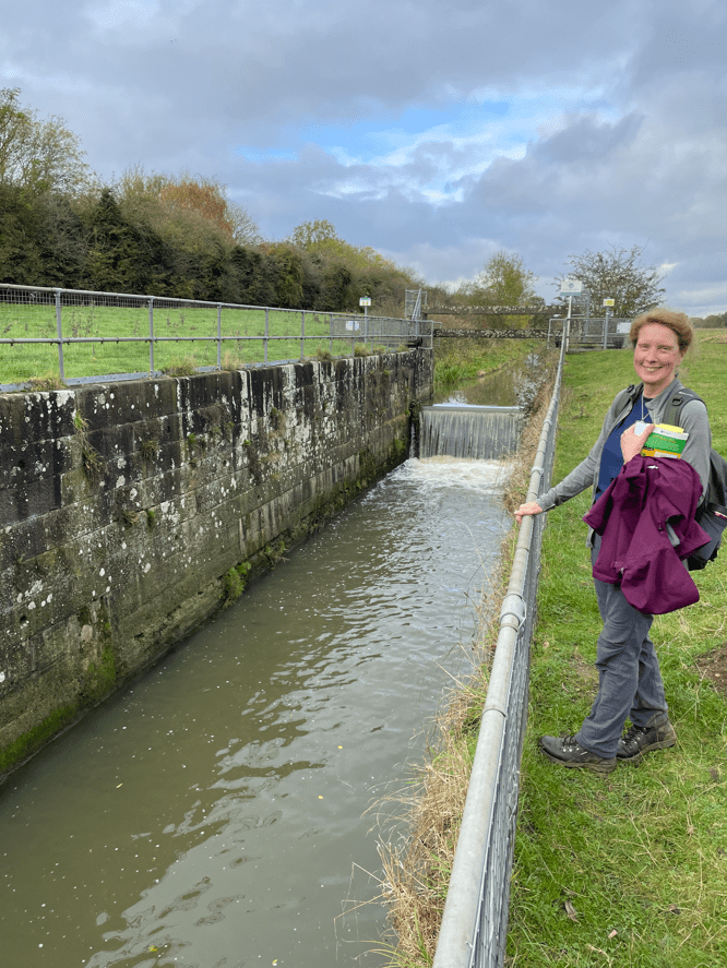
I was interested to see the ponds adjacent to the locks which supply water for the locks. Water is fed through two paddles- one red for filling the locks and one white for emptying the locks. You can see them on the photo above on the left hand side of the lock.
A previous lockkeeper painted the paddles red or white and had this famous rhyme “Red afore white and you’ll be alright, white afore red and you’ll wish you were dead!
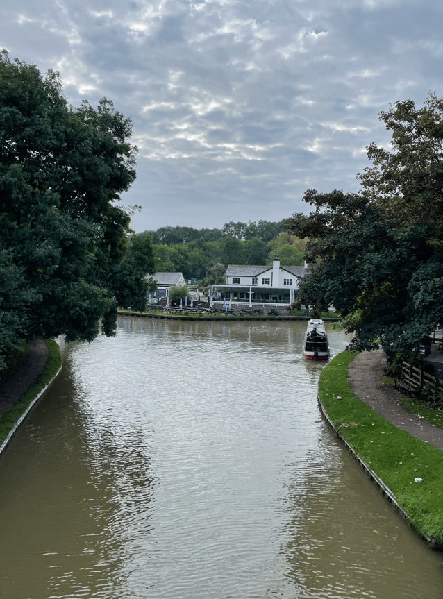
At the bottom of the locks lies a canal basin and a pub! There is also another café but alas, it was closed.
I continued along the towpath for a short while then crossed a bridge over the canal to reach a soggy field.
Over the bridge I go
I followed my route across fields, quite steep at times, to reach Gumley. Interestingly, this section from Foxton Locks to Gumley is part of the Leicestershire Round so I will be passing this way again. I was crossing through fields containing cows, horses and sheep (not all in the same field!)
There was only one field that I crossed which was particularly muddy. It was very wet and I was glad to get through it.
The muddy field
I was particularly careful crossing the many stiles which I found were slippery – especially with muddy boots.
Arriving into Laughton I liked the nice houses and found my path across another field of, thankfully, friendly cows 😊
Laughton
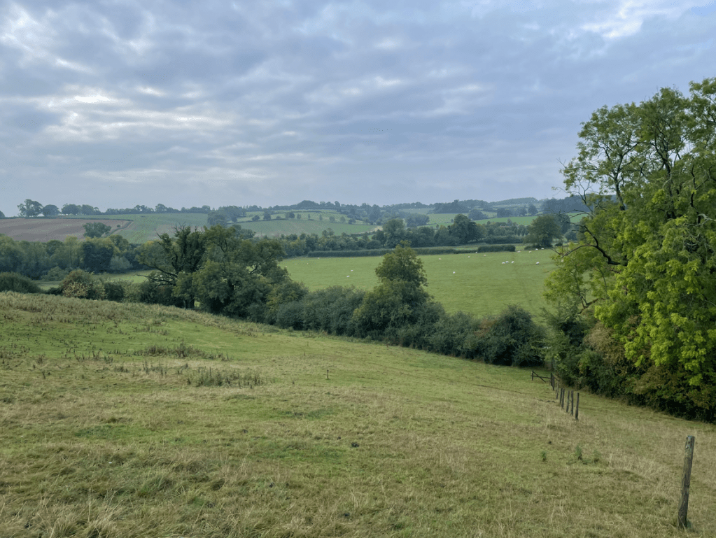
The next section took me along some narrow lanes and I descended steeply to reach the canal – There were nice views across the Welland valley on this descent.
Views across the Welland Valley
This is the Leicester branch of the Grand Union Canal which joins the main waterway near Daventry. Completed in 1814 it was built to provide a direct link from Leicester to London.
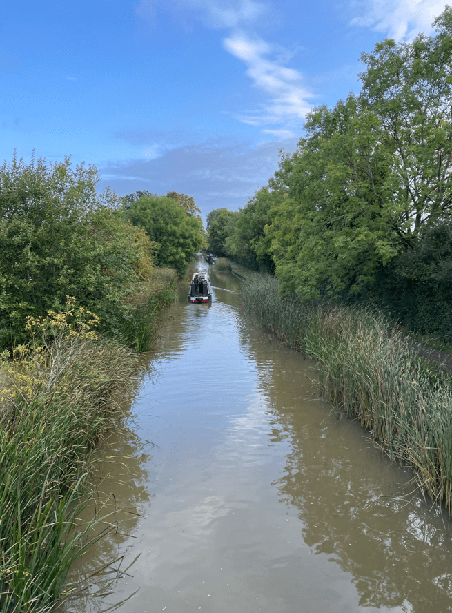
I didn’t meet a soul along the towpath although a few boats chugged by with the skippers giving a friendly wave.
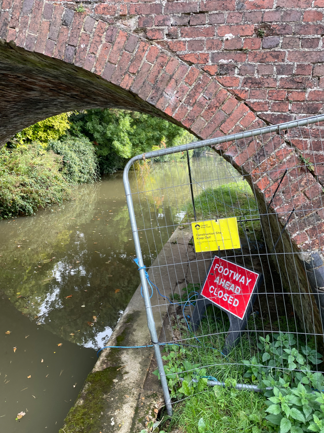
As I walked along, ducking to avoid low hanging folliage and lost in my thoughts I was enjoying the day. Passing by a bridge it had a sign on it saying towpath closure ahead – I wondered whether it would affect me. At the next bridge I found that it did – the path was barricaded off with no information about a diversion and, in fact, no way off the towpath! I had to turn around and go back to the previous bridge – how annoying!
I consulted my map and ended up doing a mile extra along lanes to get back to the canal. Not a happy chappy, but worst things happen at sea, as they say.
I arrived back at the car park to find that it was much busier than when I had left it. I am so chuffed to have seen Foxton Locks – a good day out.
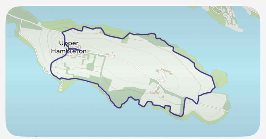
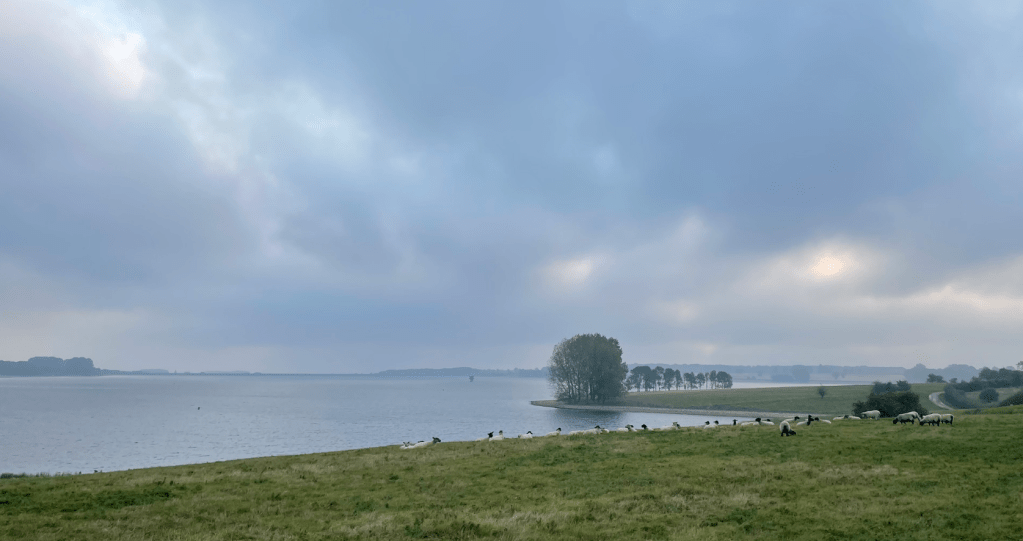
This morning I was up early doors and headed down the A1 to Upper Hambleton at Rutland Water, a large man-made reservoir. When the reservoir was created the high ground around Upper Hambleton was left above the water and so now forms a peninsula. My aim was to walk around the peninsula – a modest distance of 5 miles. I was hoping for some nice views.
My route
I parked my car on the road close to Hambleton Hall hotel https://www.hambletonhall.com/ and walked through the village.
Hambelton Hall HotelUpper Hambleton
After a short walk along the road I joined the cycle/walking trail that runs around the peninsular. It was gently undulating with fine views across the water.
The weather was dry but murky – thunderstorms were forecast for later. Runners were out enjoying an early morning blast seemingly oblivious to the world with their wireless earplugs in. I wondered what their choice of music was or maybe it was radio 4?
Sheep were dotted about munching on the grass.
It was lovely to see the sun trying to break through the clouds and I captured some nice photos.
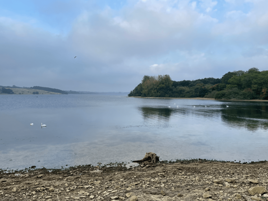
Swans on the water
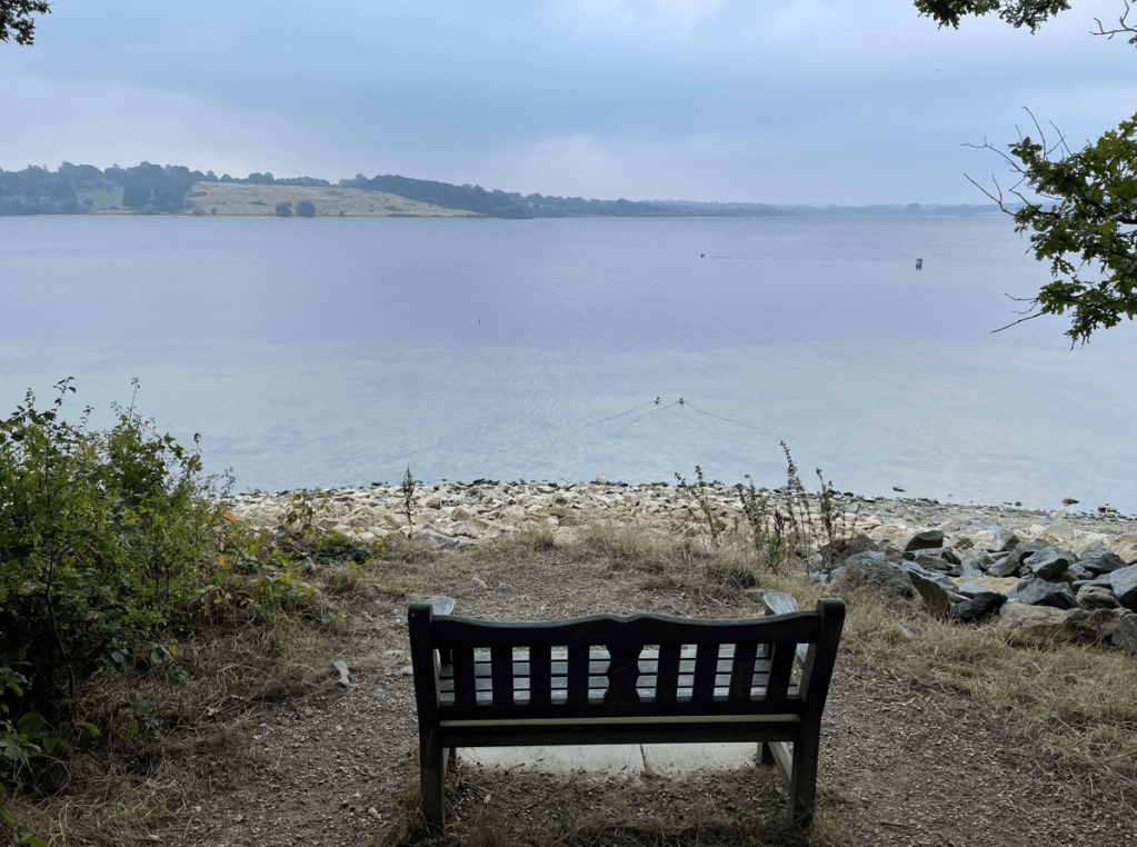
The path rolled around the peninsular passing small beaches/bays and through wooded areas. I stopped at one of the many benches scattered along the route for a scotch egg and a drink enjoying the quiet and the view.
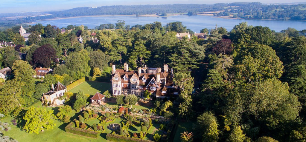
Further along I passed the old Hambleton hall – a fine building.
Old Hambleton Hall
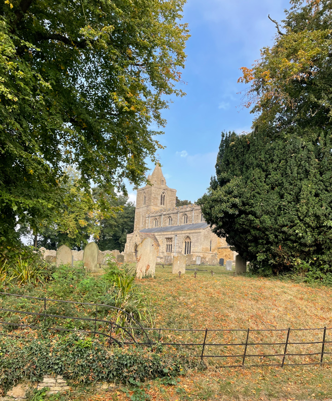
Three cyclists whizzed past me chatting away. I headed up a hill to the village passing St Andrews church (12th century).
St Andrews church
Soon, I was arriving back at my car. I had enjoyed my walk – it was definitely worth the effort.
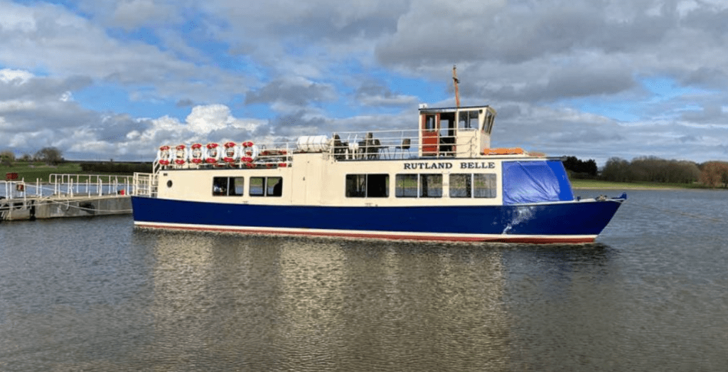
I will return to the area because I want to take a trip on The Rutland Belle that runs trips on the reservoir. https://rutlandwatercruises.com/