Today, I thought that I would share with you some more of the walks that I did in The West Highlands of Scotland.
A visit to the Glencoe visitor centre was very informative with a particularly good film about the history of Glen Coe (once an active volcano). The Scottish National Trust run the centre and have built a super replica of a traditional Highlanders cottage.
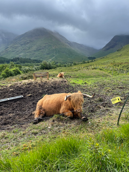
Highlanders cottageHighland Cows
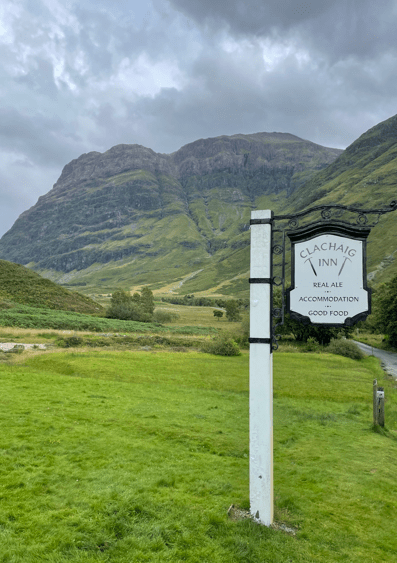
There is a good café, an excellent souvenir shop and a couple of cute Highland Cows. We took a walk through woodland paths from the visitors centre to the village of Glencoe, visited the scenic ‘Hospital Lochan’ and then on to the famous Clachaig Inn for a pint (£6 a pint!). It was an 8 mile walk. The Wee Beasties i.e the Midges were not too active on this holiday which was good.
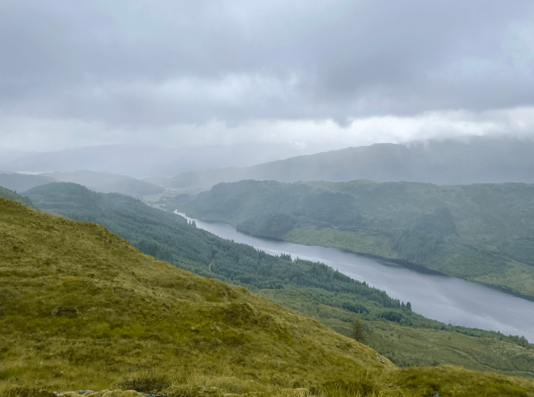
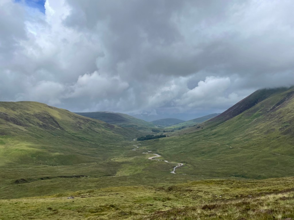
On another day we took the Corran ferry across Loch Linnhe to the Ardgour peninsular. Starting from the village of Strontian we ascended an ancient coffin-carrying route to Bealach nan Cairn. The ground was very boggy and we had rain but nice views between the swirling mist.
Loch ShielGreat scenery
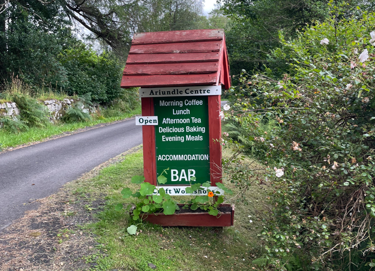
We descended passing through the long-abandoned Bellgrove lead mines before passing through the Ariundle Nature Reserve.
Our final stop was at the Tea Shop in the Ariundle Centre – a nice spot.
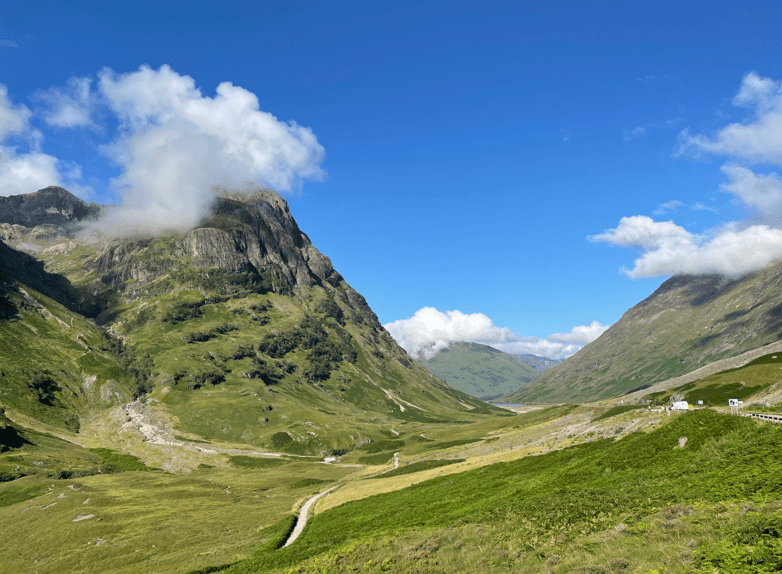
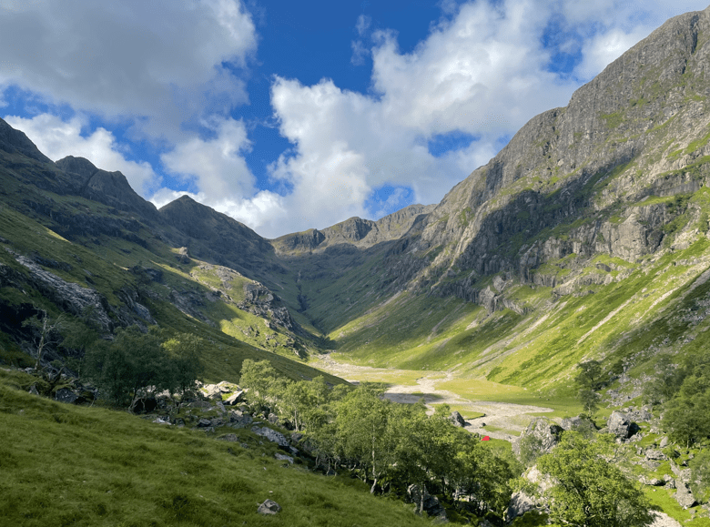
It was a lovely sunny morning as myself and Angela set off for the Hidden Valley in the magnificent glen of Glen Coe in the West Highlands of Scotland.
A view along Glen Coe
The valley was used by Clan MacDonald as a hiding place for stolen cattle and as a refuge for those who escaped the 1692 Massacre of Glen Coe.
Half way along the A82 that runs through Glen Coe there is a reasonably sized carpark – we were there early, and I was glad that we were because it was nearly full when we arrived.
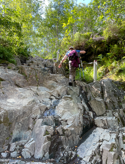
We followed the path from the car park, climbed down some metal steps, crossed a wooden bridge over a stream and then a steep uphill section across boulders.
Angela climbing the boulders
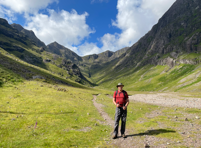
As we continued upwards through the gorge we had rocky paths, a scramble and a stream crossing until, after about 1.5 miles, we reached our destination and what a lovely sight it was, surrounded by high peaks.
The Hidden Valley
I do wonder about the story of cattle being kept there because I cannot imagine cattle getting up the gorge to reach the valley.
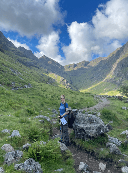
In the Hidden ValleyAngela entering the Hidden Valley
Angela took the opportunity to have a paddle in stream to cool her feet. We had some lunch then headed back down the gorge, being very careful with our footing.
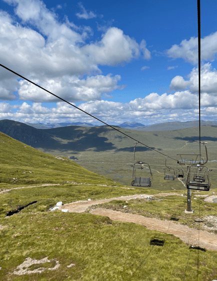
Arriving back at the car we decided to visit The Glencoe Ski Centre and after a couple of coffees took a ride in the chair lift (£17 per person).
The ride was great fun and after reaching the top we did a 15min walk to get some more views. We had magnificent views across Rannoch Moor and in the distance could see the peaks of the Nevis range, including Ben Nevis (usually shrouded in mist).
View across Rannoch Moor
The return trip on the chair lift gave us some more lovely views. What was also nice was that the Ski Centre was not too busy.
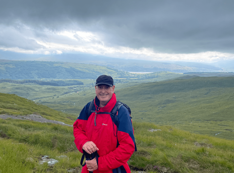
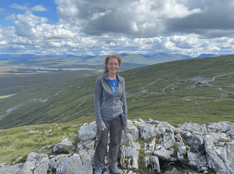
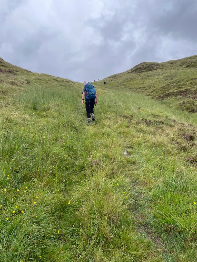
Today finds me in the West Highlands of Scotland, near Glen Coe and on a break with the Walking Company, HF Holidays https://www.hfholidays.co.uk/. I started a walk with a group today but after getting to the top of the first stage of ascent decided to change to another group because I was holding the group back -clearly I am not fit enough for mountain hikes having done very little hill walking this year.
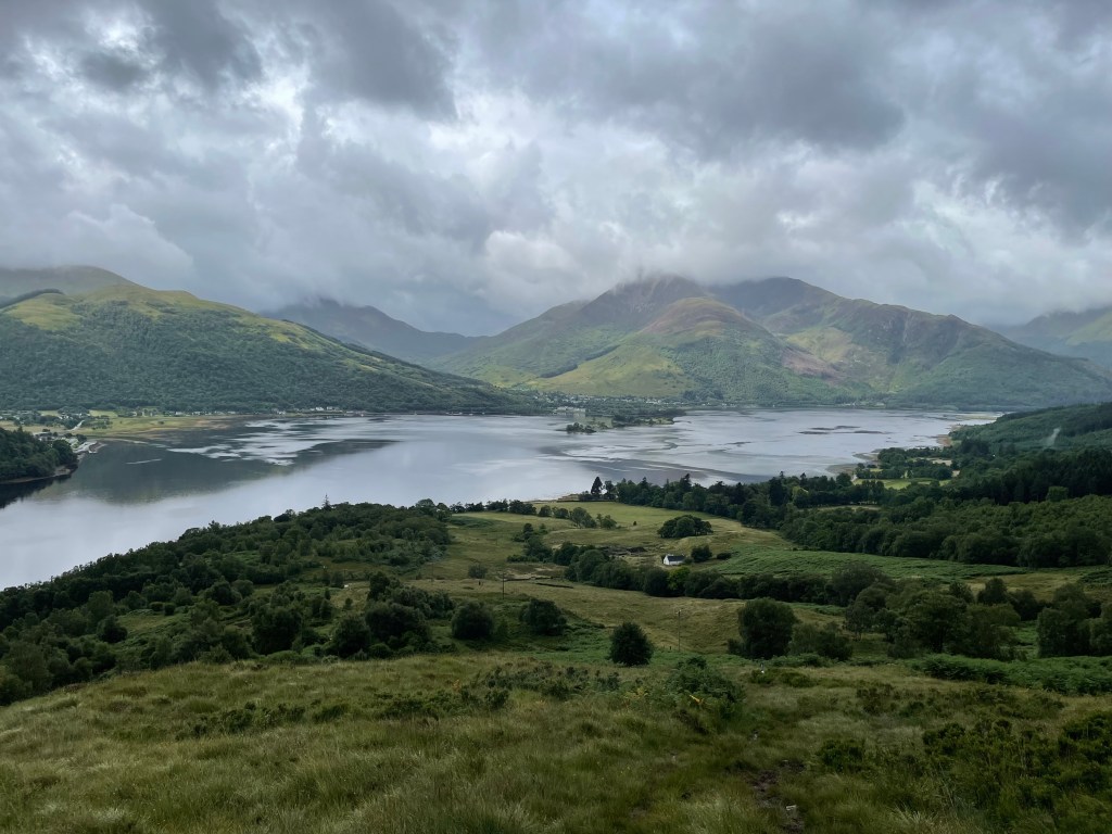
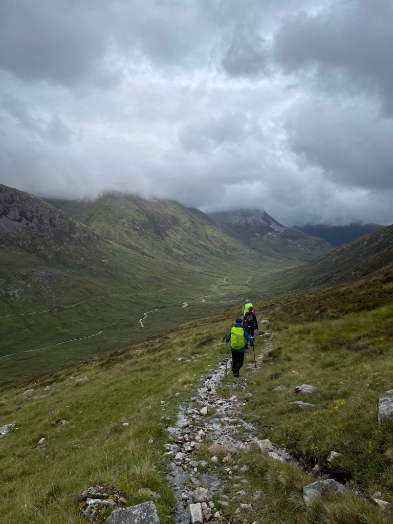
The walk started part way along Loch Leven and ascended steeply up the hill through the very boggy ground. The walk would eventually take us to Kinlochleven along the West Highland Way.
View back to Loch LevenThe steep ascent
Having decided to change groups I waited for the new group to arrive in a stone shelter, sheltered from the cold wind, eating an early lunch.
In my stone wall shelter awaiting the arrival of the new group
Angela was walking with the new group so it was good to see her again. Our route would take us downhill to the valley bottom where we would have to cross a stream – we got wet feet!
view from my stone wall shelter
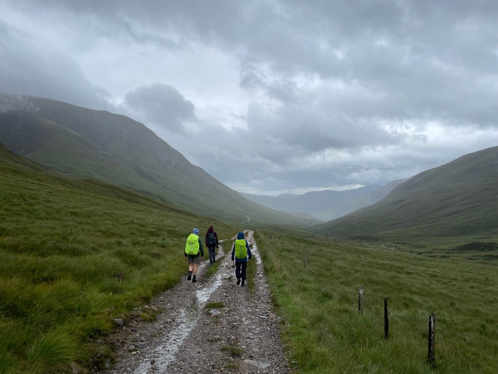
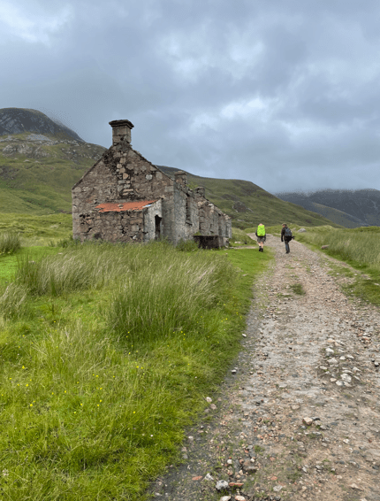
Having crossed the stream we met the West Highland Way and followed that to Kinlochleven.
Descending down the valley to reach the streamWalking on The West Highland WayA derelict house on The West Highland WayView of Loch Leven and the Pap of Glencoe
Soon we were arriving into Kinlochleven where we had a quick pub stop before getting the coach back to our accommodation.
This morning myself and Mick did a boggy 12 mile circular walk beginning in Branston and taking in the villages of Eaton, Eastwell, Hose, Stathern and back to Branston.
It was a sunny and slightly chilly morning when we met outside St Guthlac’s Church in Branston. It was great that it wasn’t raining – we have had plenty this week.
We set off by a path adjacent to the village pub and it wasn’t long till we saw Eaton in the distance. Mick pointed out a red kite circling in the blue sky overhead . We stood and watched.
Eaton in the distance
Dropping down via an unusual set of metal steps we headed for the village.
Mick descending the stepsArriving in Eaton village
Eaton is a pleasant little village – narrow lanes and quite hilly. We walked through the village and left via fields for Eastwell. The fields were very boggy as expected.
A boggy path with Eastwell in the distanceVery boggy here
At one stage in the field we stopped for a moment to chat and when I tried to walk again my feet wouldn’t move and I nearly fell flat on my face. It was a strange feeling and took some effort to free my feet from the suction of the mud – lesson learnt, keep moving and don’t stop!
Arriving in Eastwell we stopped for a cuppa in a handy bus shelter next to a nice coach house.
Time for a cuppaThe Coach House
Leaving Eastwell we had a little difficulty finding our way through a field which had been divided up into horse pens but we managed it. We picked up the Cross Britain Way and followed the path down a hill through a wood.
Mick heading downhill on the Cross Britain Way
Leaving the woods we had a nice view over the Vale of Belvoir.
View across the Vale of BelvoirThe wooded escarpment (Harby hills) now behind us.
We passed across a dismantled railway line and headed for Hose.
The dismantled railway line looking leftThe dismantled railway line looking right
We skirted around Hose and followed a very straight track for quite a while . We couldn’t help noticing some leaning telephone poles.
I wonder when it will topple over?
Eventually we reached the end of the path and found our way barred by an electric fence placed there by an unfriendly farmer. We managed to climb over it without getting a shock.
After the boggy walk we had just had we were glad to do some road walking and sat on a handy bench for a break. The weather was on the turn.
The road to Stathern
We walked into Stathern, past the library and hit the track taking us uphill to the escarpment.
The village sign in StathernVillage librarytrack up to the top of the escarpmentThe track continues.
We were feeling quite tired at this stage. Slip sliding through muddy fields is quite tiring and our walking pace was much reduced. From the top of escarpment we picked up The Jubilee Way and made our way towards Branston.
On the Jubilee Way headed for Branston
The walk had one more steep climb for us to land us back at the church in Branston.
Arrived back in Branston
The walk had felt quite long and having to concentrate on where you are placing your feet, to try and avoid slipping over, did mean the chance to just chill and walk was reduced. Still we had walked some new sections so that was good.
We also chatted about walking the ‘Leicestershire Round’ when the weather improves – this is a 100 mile walk around the county of Leicestershire which can be done in stages. I am looking forward to this walk – it should make for some interesting blogs. https://www.lfa.org.uk/leicestershireround