The extremely wet weather persists here in the UK. This has unfortunately resulted in the curtailing of my walking. We have now entered meteorological spring so I am hoping for some drier weather – fingers crossed.
The forecast for today was dry so myself and Angela got out early and drove to the National Trust property at Dunham Massey close to Manchester. It was a grey chilly 2 Deg C. This is a regular haunt of ours but it can get busy.
Dunham Massey house and stablesDeer in the park
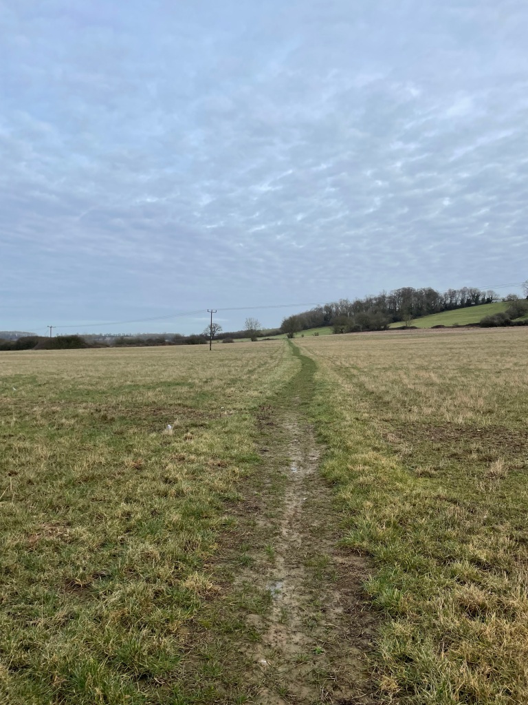
The park has numerous good paths through wooded areas so is a good place to avoid boggy footpaths.
Empty footpath at DunhamNice empty footpath at Dunham
Dunham Massey is also a deer park and the deer roam around freely which is nice to see. Today, there were a few joggers taking advantage of the park.
Some more Deer
Angela said ‘Can you hear that? it sounds like a woodpecker’, I replied ‘No, its not a woodpecker, that’s my teeth chattering!!’ Well, it was a cold morning😊. However, it did indeed turn out to be a woodpecker and we actually saw it high up in a tree.
Angela trying to locate the woodpecker
We saw two herons close to a pond but they flew off when we approached- unexpected but great to see. A couple of noisy geese flew over honking as they passed over.
The flying geese
The sun was burning off the cloud and blue skies were in evidence.
Barriers surround the tree trunks to protect them from the deer.
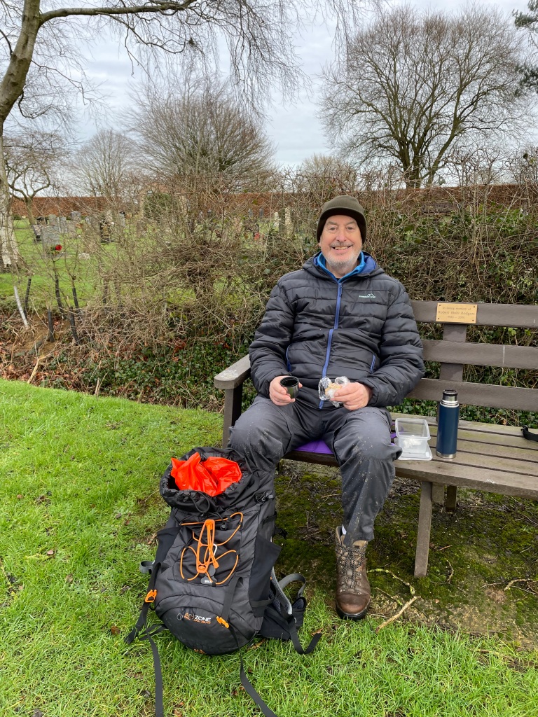
‘Time for a coffee?’ suggested Angela. ‘Most definitely’ I replied and we headed to the nice café in the main building and enjoyed a couple of large Lattes.
It had been a nice 6 mile walk and a good way to begin our day.
Yesterday, myself and Angela took a walk along the Grantham Canal on a section that Angela had not walked before. She is gradually walking the full length of the canal (33 miles) in stages. After all the muddy walks this week, I was keen to do a walk where I knew we would have decent paths.
The previous day we managed a short 5 mile walk as the weather threatened rain. The clouds were very moody looking but it was surprisingly mild.
Rain clouds with a shaft of sunlight stealing through
A bonus at the end of our walk was a magnificent double rainbow – one of natures wonders.
There was no rain forecast for our new walk 😊. We parked the car near the A46 and walked along the towpath through Cotgrave Country Park to reach Tollerton bridge. We then returned taking a different path through the park to reach a high point with a view towards Nottingham.
On our way to the Country Park we passed a couple of derelict locks that are awaiting restoration.
Some parts of the canal were dry and reedy. Others held water. The path was dry 😊.
Entering the Country Park we passed a new lock then crossed over a bridge to visit a coffee vendor that we had spotted.
The coffee vendor whose business is named ‘Ginger and Blue’ (she has ginger hair) was selling from a blue van with a steady stream of customer arriving. https://www.gingerandbluecoffee.co.uk/
The coffee vanInside the coffee van
The coffee served was excellent and we will definitely visit again.
Enjoying the coffee
On our way out of the park now, we passed another derelict lock and a nice lock-keepers cottage.
Another derelict lock awaiting restorationSkinners lock-keepers cottage
There were quite a few water fowl living on the canal- mallards and coots as well as swans. Some mallards looked as though they were nesting.
Can you spot the female mallard ? – she is well camouflagedFriendly Swans
The tranquillity beside the canal was broken as we continued along the path. We were passing by Tollerton Airfield which had helicopters and small planes continually taking off and landing. The helicopters were particularly grating – they seemed to be buzzing around like flies. We stood for a while watching the small aircraft coming in to land.
Watching the planes land at Tollerton AirfieldPlane on approach to Tollerton Airfield
Further along the canal we saw a spot where some reinforcing had been put in place to protect the bank from breaching.
Metal sheets piled into the bank to prevent it from breaching
At this stage Angela was looking for a bench to sit on whilst having some lunch – alas, there were none. We reached Tollerton bridge and turned around. It is interesting how things look different when you come from a different direction.
At the Country Park we left the towpath and followed signs up through the Park to a high point hoping for a good view. We got a view across Nottingham but it wasn’t clear because the sky was dull/cloudy. There were, however, four benches so Angela was happy!
We came off the hill and re-joined the towpath and eventually were back at the car. We were a step closer to Angela’s goal.
Today myself and Angela did a 12.5 mile circular walk beginning in Walton-on-the -Wolds and taking in Croxton Kerrial, Branston, Eaton, Goadby Marwood and then returning to Walton.
It was a surprisingly mild day (15 deg C) and we had no rain. We parked by the church in Walton-on-the -Wolds.
Walton-on-the -Wolds
After a little trouble finding our route we set off across fields to reach a military (?) radio station.
Heading out of Walton-on-the-WoldsThe radio station – a military installation?
We passed by the radio station and walked beside horse gallops.
We then took a detour into the hamlet of Bescaby where there was a nice house and ponds to view.
The walking was good at this stage and we hadn’t encountered the dreaded mud.
A nice path to follow.
Soon after leaving the good path we were into very boggy fields and by the time we reached Croxton Kerrial we were pleased to take a break. Slip sliding through muddy paths/fields saps your energy.
We visited the village shop in Croxton Kerrial and got ourselves a coffee. Angela said that the owners had given her a warm welcome.
A hot-cross bun at Croxton KerrialThe excellent village shopAngela enjoying a break
Heading out of Croxton Kerrial we were on our way to Branston. We passed a house with a very impressive entrance.
The paths to Branston were good and the sun had made an appearance which was very welcome. We were feeling quite chipper. Leaving Branston via a route new to us we headed for Eaton. At one point we had to climb down a metal ladder which I thought was quite unusual.
Descending an unusual ladder
We could see Eaton village in the distance.
Arriving on the outskirts of Eaton village we had another coffee stop sat on a bench enjoying the sun on our faces.
Arriving into Eaton village – another hill to climb.
There was quite a lot of undulation on this walk which we were savouring. Eaton is a very picturesque village and we enjoyed walking through it. Leaving across fields we headed towards Goady Marwood.
leaving the village of Easton
The footpath turned muddy again and the going was difficult. Sadly, we passed a memorial plaque to the fallen crew of a Lancaster bomber – I have lost count of the number of these I have seen and again, we noted the crew were so young.
Memorial plaque for crew of a Lancaster bomber which crashed near byOn the way to Goadby MarwoodOn the way to Goadby Marwood
On the way to Goadby Marwood Angela needed a plaster for a cut to her finger from a thorn bush by a stile- she will survive😊. We arrived in Goadby Marwood to find that the footpath signposts may have been pointing the direction of the path but, after following the sign and going up someone’s driveway it was clear they had closed off the path – most irritating.
We did a detour past a grand house Goadby hall.
Goadby hall
Walking through the village we looked for the path away from the village.
Goadby Marwood village
The path back to Walton-on-the Wolds was tedious (mud and numerous stiles) and we were glad to reach the car. Perhaps the mud clouded our view of this last section?
Overall we had both enjoyed the walk apart from the mud. The difficulty is, right now in the UK, there is nowhere you can walk without encountering the dreaded mud. So, we best get on with it!
This morning myself and Angela decided to take a walk along a section of the Grantham canal ( a canal under restoration after years of neglect) that Angela had not walked before. The forecast was rain towards late morning but we decided to get out early and chance it – turned out to be a good decision.
Parking in a layby by Dove Cottage Tea Rooms near Harby we headed west along the towpath.
View of the canal from bridge by the start of the walk.
The towpath was quite muddy to begin with and gradually got worse as we made our way towards Harby. After roughly a mile we reached Harby and the towpath was much improved. It is just as well because we were quite deflated by the condition of the towpath.
We passed an old warehouse that would have been used in the canals heyday. The remnants of a windmill were also visible.
Old warehouse and remains of a windmill
There was some interestingly coloured algae on the waters surface – normally green this variety was reddish in colour.
Unusually coloured Algae.Heading along the canal towards the village of Hose.
It was the usual people- free walk along the canal. The water level in the canal was high after months of rain- there were plenty of waterlogged fields to see and we wondered how they will recover.
Flooded fields adjacent to the canal.
The swans were friendly and paddled across to visit us.
Along the section past the village of Hose and on our way to Hickling, there were a number of nice swingbridges to explore.
Swingbridge
Close to Hickling we passed under a bridge that had been restored in 2006. I do appreciate a nice canal bridge.
Clarks bridge near Hickling
A little further we passed a restored lengthmans hut – a lengthman was an employee of the canal company who maintained a particular length of canal and its towpath, cutting back vegetation and watching for potential breaches.
Lengthmans hut – duck to enter!
Chimney was rebuilt
The Canal and River Trust have done a good job on this hut. A little further on we reached the canal basin at Hickling – it was bustling with people.
Myself and Angela found a bench, enjoyed a cuppa and watched the world go by. Heading back on our return leg now the rain clouds were gathering.
We were lucky to only encounter light rain. At the end of our Valentines Day walk we were planning to visit the tea rooms close to where we parked, but predictably, when we got there the car park was full – maybe next time.
Today I met up with Mick and Chris to do a circular 7 mile walk starting in the Leicestershire village of Branston. We passed through the villages of Croxton Kerrial, Harston and Knipton before landing back in Branston.
It was a slightly chilly day with light rain forecast towards lunchtime. We parked outside the Church at Branston and followed the route through the village and then, disconcertingly, through somebody’s front garden, to pick up a track headed towards Croxton Kerrial. Fields were either side and red kites glided in the sky.
The track leaving Branston
As we neared Croxton Kerrial, at the sewage works (no smells 😊), the path turned to a concrete road.
Heading into Croxton Kerrial
We had been walking uphill most of the way when Chris chimed ‘I’m just saying, but there is a lot of uphill in this walk!’ Indeed there was, with more undulations to come.
Reaching the village, and opposite the church of St Botolph & St John the Baptist, we visited the site of an Anglo Saxon encampment.
The church in Croxton KerrialThe Anglo Saxon encampment ruins
We walked along the lane by the church and picked up a footpath that took us across a field and then down towards a small wooded area.
A clear path across a field.Headed towards the wooded area.
Passing through the wood we found fallen trees. In the spring the wood is carpeted with lovely bluebell’s.
Exiting the field we faced a trek across a wet field. Our boots were certainly covered in mud after this.
A muddy field to cross.
Having crossed the field we then passed by a valley where historically Ironstone had been mined using opencast methods. There used to be many opencast Ironstone mines in the area . It had its own railway line to haul the ore to the steel smelters in Scunthorpe or Corby. Chris pointed out an old railway building that is still standing. There is an interesting YouTube video about Ironstone Quarries in Leicestershire here https://www.youtube.com/watch?v=Qb5vAMma5lg&t=47s
Site of a previous opencast ironstone ore mine
In Harston we passed a horse friendly house.
feeding and drink stations for horses
The rain was coming down lightly at this stage. We followed the road out of Harston and headed towards Knipton passing by the cricket ground.
On the way to KniptonThe cricket ground clubhouseThe cricket club with Belvoir castle in the background
Walking through Knipton we passed the war memorial where there was a bench – a stop for a cuppa? Its still raining – Mick remembered that there was a covered shelter further along the village so we headed for that and had a break in the dry.
Knipton village war memorial
Mick spotted a photo opportunity at the village water pump – a cows tail pump according to Chris due to the shape of the handle!
Knipton village water pump
We left Knipton suitable refreshed and headed along the road up to Branston passing by a house that has a nice view of Knipton Reservoir. We spotted a buzzard and a kestrel as well as more Red Kites.
Knipton Reservoir
We had one more uphill section before arriving back at our cars .
It had been a cracking walk despite the gloomy weather.
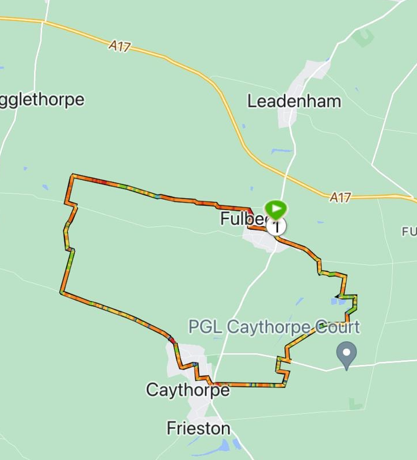
This morning myself and Mick did a 9 mile circular walk from the Lincolnshire village of Fulbeck to Caythorpe and back.
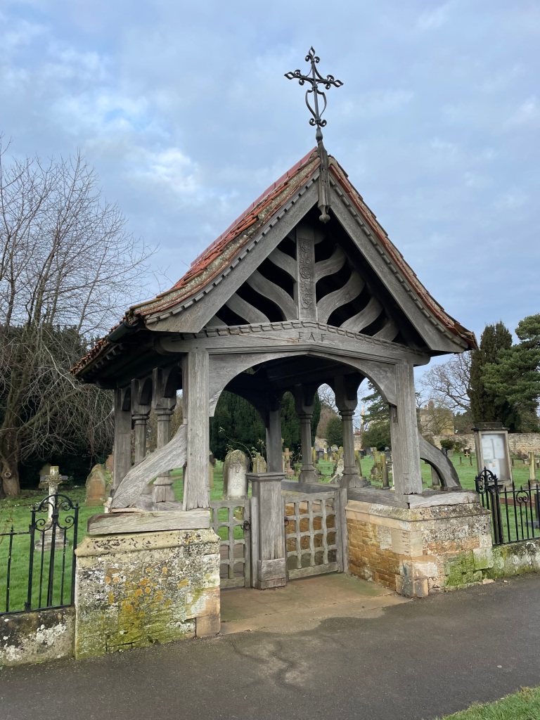
We parked in the Sports Club car park, opposite the church, on a chilly morning.
Village war memorialLychgate for churchVillage sign
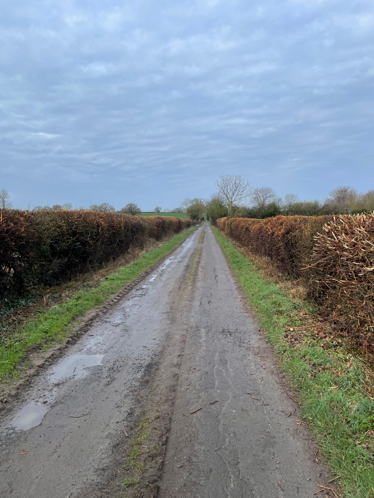
We set off through the village and soon we found a lane that led away from the village.
walking away from Fulbeck
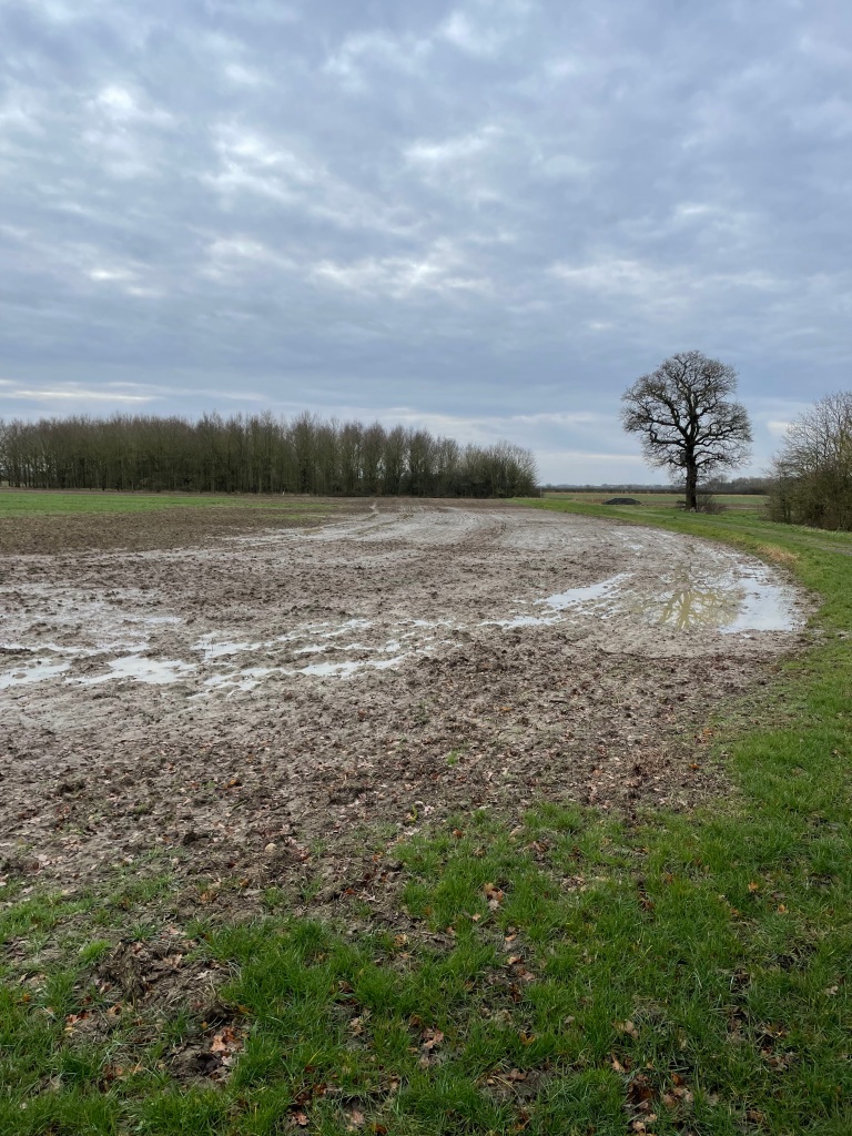
There were lots of noisy small birds flying in and out of the hedgerows. Eventually the lane gave way to fields that were very boggy after the heavy rain overnight. Squelch, squelch, squelch we made our way across the fields.
‘Look over there!’ Mick said pointing to two Roe deer crossing the field. They looked at us nonchalantly and then bounded off.
Wet field
Leaving the fields we reached a road and headed up the hill that brought us towards Caythorpe village.
Nearly at the top of the hill leading to Caythorpe.
On the outskirts of Caythorpe we stopped for a cuppa on a welcome bench by the cemetery.
Walking through Caythorpe we saw some nice murals on a house.
Deer in the muralPaddington bear parachuting into Caythorpe
Having passed through Caythorpe we headed up a lane passing a farm. Mick spotted some new born lambs in a shed – they were a joy to see.
Little Lambs
Further along the lane we could see how wet the fields were.
very wet field
On our way back to Fulbeck now, we had an uphill section to walk.
Turn right past the trees
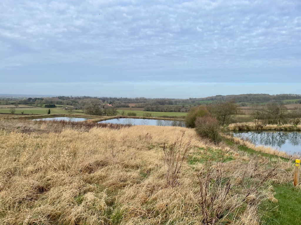
Passing a grand house we walked past three large ponds.
Agricultural ponds
On the way past the ponds Mick spotted 3 more Roe deer. They took to their heels and bounded away, white tails twitching.
We were close to Fulbeck now and soon we were walking through the village to pick up the car. It was a cracking walk and good that it had some ‘up’ sections. It was particularly nice to see the lambs.
This morning I met up with Mick and Chris and we did a 10 mile circular walk beginning in the small Lincolnshire village of Ropsley.
A nice wooden sign greets you in the village
We parked up on the high street and put on our walking gear. Chris was already in a mutinous frame of mind, saying ‘I didn’t sign up for this!’ referring to the drizzle mizzle that was enveloping us. It was also a chilly 7 Deg C.
I wondered what state the fields were going to be in and hoped (fingers crossed) that they would be passable.
Setting off down the high street we passed a cottage where Richard Fox, the founder of Corpus Christi college, Oxford had been born. There was a plaque high up on the wall.
I always feel a sense of history when walking in old villages like this – how many people had trodden the road before us?
Towards the end of the village we saw the footpath sign that led us up a drive between two houses. I worry when walking so close to other peoples property – it almost feels as though you are intruding. The path took us through a narrow lane, hedged either side, and eventually brought us into open fields.
It wasn’t long before we found out that the fields were still very wet and boggy. Oh dear! Good job I had waxed my boots yesterday.
We passed the first of a number of wooden bridges on the walk today.
Myself and Mick had walked this route back in the lovely sunshine of last August so I ‘sort of’ remembered the route. I say ‘sort of’ because we had reached a point where there was no clear path (at least in my mind) and confidently I said , ‘the route is this way’ and headed off over the field. Mick piped up that he was sure we were going in the wrong direction and we needed to be heading in a westerly direction. No yellow way markers were visible across the field. As is usually the case, Mick was correct, and after reaching the opposite side of the field, I ate some humble pie and said that Mick had been right – infuriatingly, he has the uncanny knack of remembering our previous routes!
Having got on track we headed across fields to reach the small hamlet of Little Humby.
Little Humby
We passed through an empty ford where we could see that there had been plenty of water recently.
Little Humby Ford with footbridge to the right.Little Humby Ford
Heading out of Little Humby along a tarmac road that was part of The Cross Britain Way, we passed a field where the sheep were enjoying a late breakfast (or maybe an early lunch!).
Along The Cross Britain WayLate breakfast or early lunch?
We reached a good farm track, with open fields either side that took us up towards Ingoldsby Wood. The light rain had eased off but it was still misty restricting long views.
Heading for Ingoldsby Wood
Through the woods we walked – slip slip, slide, slip slip, slide in a steady rhythm. The path was quite muddy. Lincolnshire is renowned for its muddy paths.
Ingoldsby Wood
After a mile or so we left the woods and entered more open country as we made our way towards Boothby Pagnell.
Out of the woods heading for Boothby Pagnell
There was a glimmer of blue sky in the almost grey vista and wondrously, all of a sudden, there was a rainbow. Things are looking up boy’s ! and we will soon be at Boothby Pagnell for a cuppa.
Walking at pace for our break at Boothby Pagnell
Along the way Chris was getting his binoculars out to check out the bird life – we were seeing red kites and other species that I cannot quite remember right now.
Arriving at Boothby Pagnell we sat on a wooden bench opposite the church and slurped some tea and some of us had a butty or two – Chris is being ‘good’ and trying to control his food intake so disappeared for a closer inspection of the church graveyard. Having seen nothing interesting he joined us on the bench, sat down, pulled out his flask and an extra large china mug and proceeded to enjoy a large cup of tea!
View from our bench
So far we had met only one other person – a jogger- along our route.
Leaving Boothby Pagnell we crossed some open fields and found ourselves walking along side Kirton Wood, once more along muddy paths. It is a bit like walking in platform shoes as the mud layers build up and then release themselves as gravity overcomes the stickiness.
Further on we had a good stone path for a while before returning to muddy fields.
Good stone path
I have noted that during our walks there seems to be a theme in the chatting. Todays was alcoholic beverages which was far better than the chat on our previous walk which was Death!
It wasn’t long before we were heading back into Boothby Pagnell where we met a friendly dog walker who enquired where we had been walking.
Nearly back at Boothby Pagnell
There was an interesting bell tower in the local school.
So, the three amigos arrived back at their cars with Chris on a mission to buy a breathable waterproof jacket in readiness for our next adventure. I think there was mention of him going for a swim followed by a sauna later- its all right for some!
If you have managed to read to this point in my blog thank you very much and I hope that you enjoyed it?
Following storm Isha at the weekend we had another storm overnight called Jocelyn – the 10th named storm of the season. The strong winds battered my house overnight and I was feeling slightly tired this morning after being woken by the strong gusts of wind during the night.
I should share with you the sunrise yesterday which was spectacular.
I met Mick at the Dirty Duck pub in Woolsthorpe-by-Belvoir and we did a 9 mile circular walk along good paths taking in part of The Viking Way, the old Ironstone Railway line and the Grantham Canal.
Start of the walk by The Dirty Duck pubSign on The Viking Way
After walking a short section by the canal we crossed over the canal via a bridge and headed uphill along The Viking Way.
Heading uphill along The Viking Way
There was still a stiff breeze blowing so despite the increased temperature it took a while to warm up. At the top of the hill we passed by the gates and a gatehouse for Belvoir Castle.
Passing by the Belvoir Castle estate
It was great to see little Snowdrops starting to pop up – a sign that spring is not far away.
Snowdrops
By this time the sun had made a welcome appearance as we strode along some nice footpaths.
Good farm track
There were plenty of broken branches strewn across our paths – the results of the overnight storm.
Broken branches
It was time for a quick stop for coffee and a scotch egg at a handy fallen tree😊.
A welcome break.
Revitalised, we continued following the old Limestone railway passing under a bridge and through tree lined vistas.
Bridge on the former Ironstone railway lineOur route along the old Ironstone Railway line
We made our way back to the canal and had a look at the work that has been happening at Lock 13 where it is planned to renovate the lock.
Crossing the canal.Lock 14A tranquil canal scene
Nothing much was happening at Lock 13 so we headed back to our cars.
Lock keepers cottage
We had enjoyed some fresh air, lovely scenery and had a good chat. Also, we agreed on next weeks walk. 🚶♂️
This morning I met up with Mick and Chris to do a cracking 8 mile circular walk beginning along a ridge overlooking the Vale of Belvoir, passing through Branston, Knipton and then past the Belvoir Castle estate back to the start.
I awoke this morning to a lovely sunrise – it was going to be a sunny day!
It was a chilly start and the ground was frozen solid as we set off on a good tree lined path along the ridge.
The ridge footpath
Looking to our right we could see way across the Vale and point out distant land marks.
Leaving the ridge we turned onto a deeply rutted track (Toft’s Lane ) and followed this to pick up the Jubilee Way for a short distance. The sun was shining and there were great views to take in.
Tofts Lane
Chris and Mick were pointing out various species of birds along the way, of which there were many – red kites, buzzards in particular wheeling, gliding and soaring majestically in the clear blue sky. The crunchy cracking of the ice in puddles as we walked along accompanied us.
Track on the way to Branston
At the end of the farm track we turned right onto the road to walk up a moderate hill into Branston where we entered a farm and passed through a field of sheep going down a hill and over a rickety/icy bridge followed by a steep climb up out of the valley.
This brought us to a field where we caught glimpses of Knipton Reservoir as we followed the clear path across.
Exiting the field brought us on to a road that had very little traffic. This would take us towards Knipton village. The road was white with frost so care was needed when placing your feet.
On the road to KniptonA view on the road to Knipton
We caught another glimpse of the reservoir along the road.
Knipton Reservoir at the end of the field
Myself and Mick have done this walk many times and tradition dictates that we stop at the village Post Office and buy a hot drink and maybe some snacks. We then sit on a bench adjacent to the lovely babbling brook and enjoy our purchases. Today, we both chose a hot Bovril and it went down very well I can tell you!.
Knipton VillageThe babbling brookA welcome cup of Bovril
Suitably refreshed we followed the road out of Knipton towards Belvoir castle soaking up more nice frost filled views.
I think we were probably aware that the weather is changing back to wet and windy over the weekend so it was nice to enjoy the sunny weather today. Soon we were back on the ridge and heading for the cars.
Back on the ridge
We all had enjoyed the walk and particularly being the in fresh air and the sunshine. The miles had passed very quickly with the chat speeding us along.
Today myself and Angela had a walk at Skipwith Common – a national nature reserve in North Yorkshire. It is an ancient landscape with 270 hectares of open heath, ponds and woodlands.
Nice path through the woodslowland heath
There are numerous paths through and around the common. Today there was plenty of water from the recent rain in evidence.
The heathland was formed at Skipwith about 3,500 years ago when settlers tamed the ancient woodland with fire. Their descendants grazed sheep and cattle preventing trees invading open areas thereby allowing heathland plants to thrive. Peat digging created many of the ponds on the common.
One of the many ponds
During World War 2 in,1942, the Common and some of adjoining Ricall Common was the site of RAF Ricall – a base for training aircrew to learn how to fly four engine Hadley Page Halifax bombers. There were 32 aircraft and almost a thousand men stationed there until the war ended in 1945 when the base was decommissioned. It remained as a storage facility until 1960 when the final off-Common parts were sold.
A memorial (based on a propeller) was raised in 2010 dedicated to members of RAF Ricall who lost their lives in accidents.
War memorialOne of the many bunded areas where former RAF buildings resided
We walked along some nice wooden walkways that led to wildlife viewing points.
We only had time for a brief but enjoyable visit.
Walking back to the carparkSilver Birch trees
All being well, myself and Angela should walk a new section of the Bridgewater canal over the weekend. I am looking forward to that.