Hello and welcome back to my Blog 😊- the first for 2025.
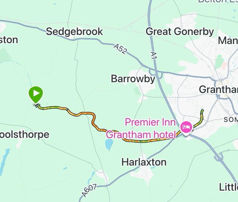
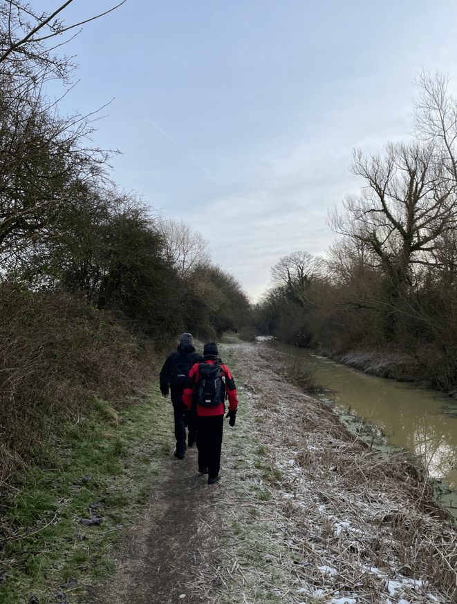
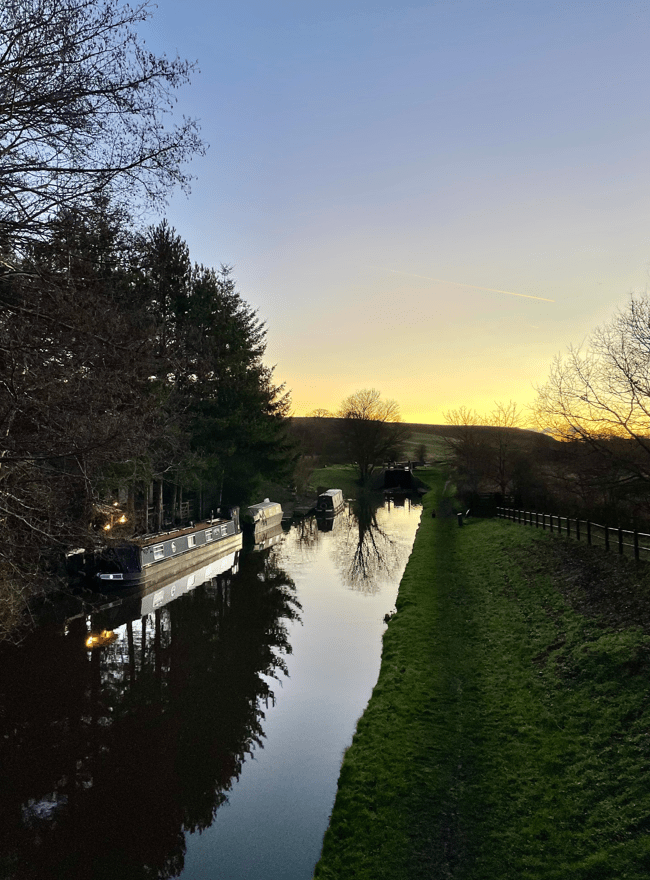
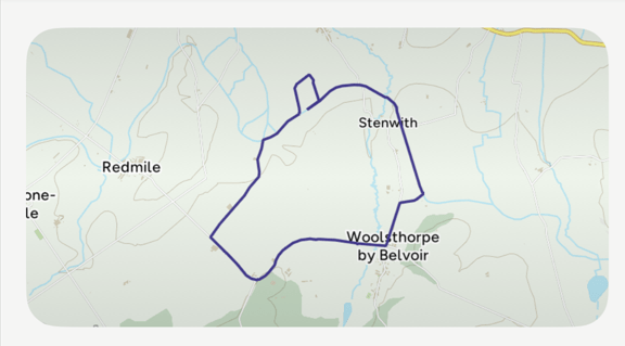
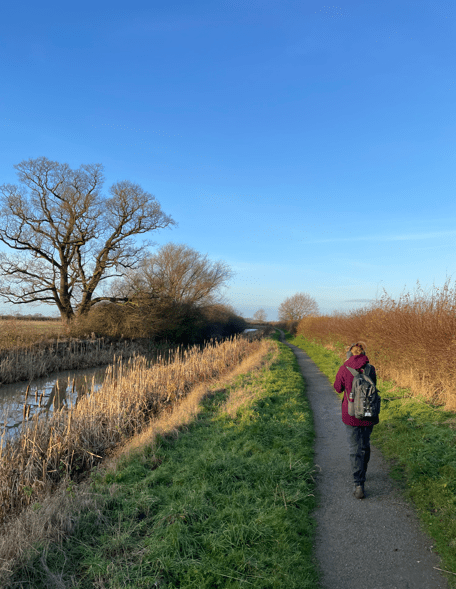
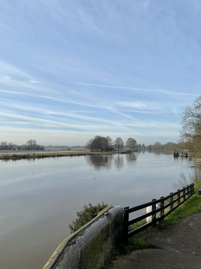
Today the Three Amigos met up at Woolsthorpe-by-Belvoir and enjoyed a 10 mile walk along the Grantham canal to Grantham and back.
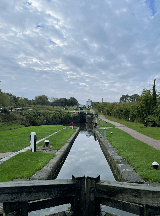
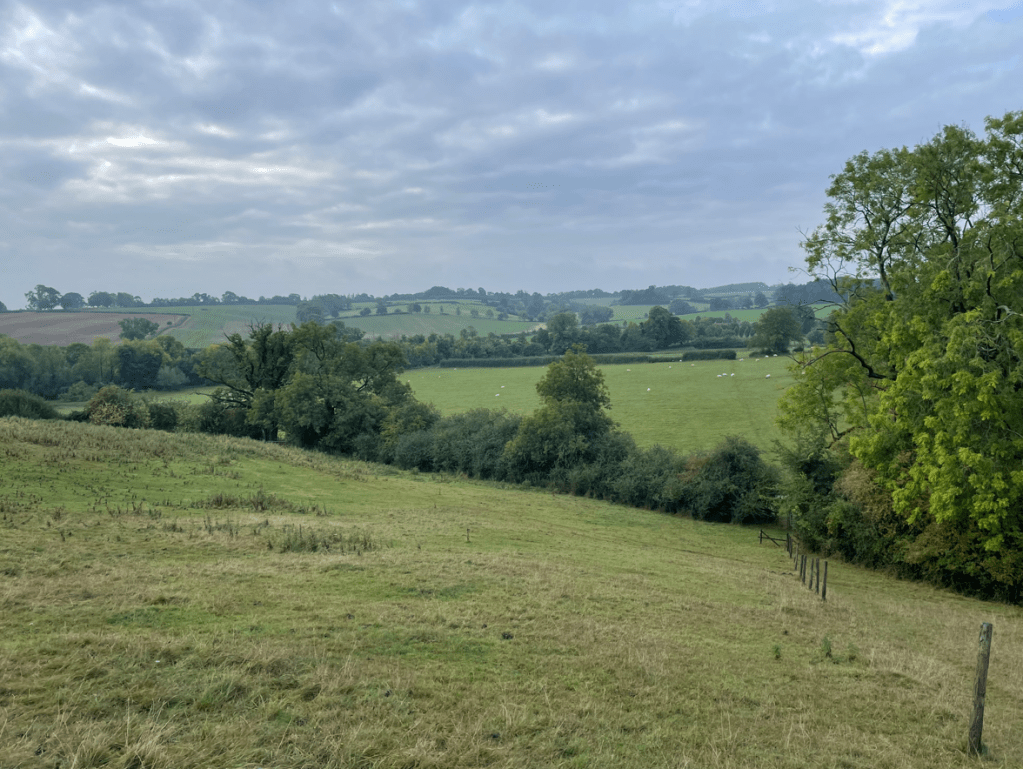
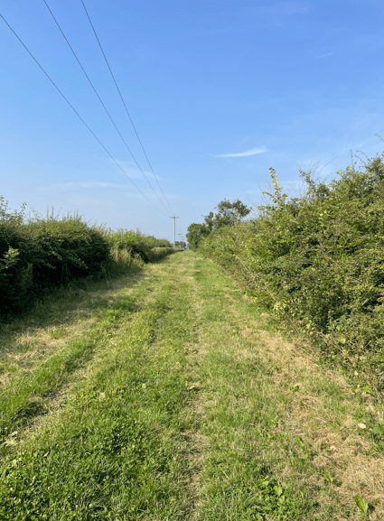
The route
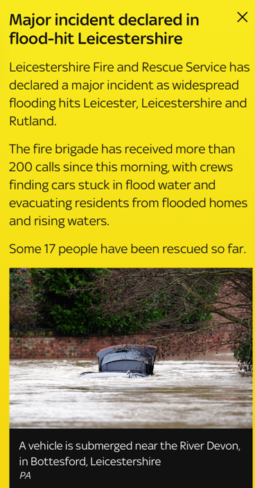
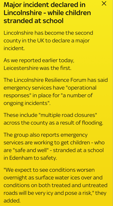
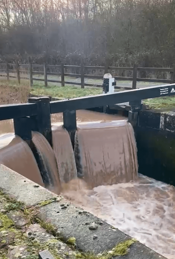
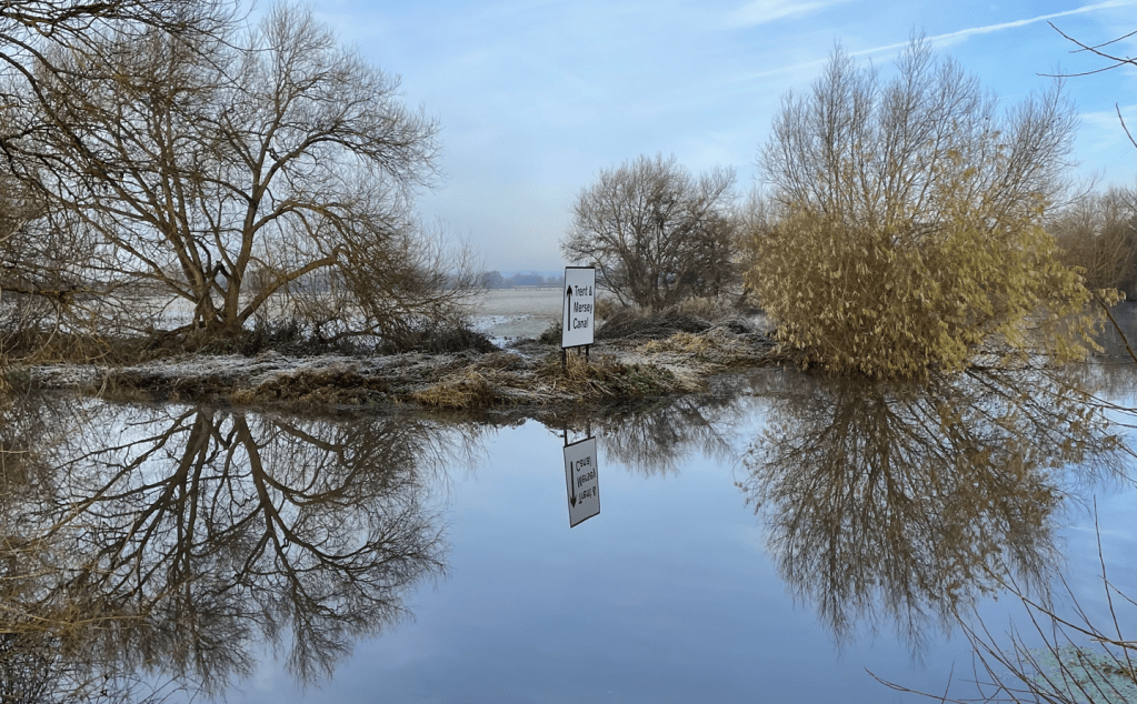
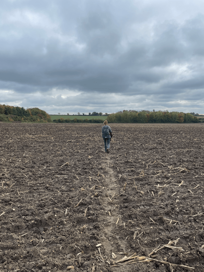
Choices of where to walk today were limited, with much of Lincolnshire and Leicestershire suffering from flooding.
Mick had done a recce at Cropwell Bishop Country Park yesterday to see whether we could walk by the canal there, but sadly, the towpath was flooded. There was also a lot of water in the canal.
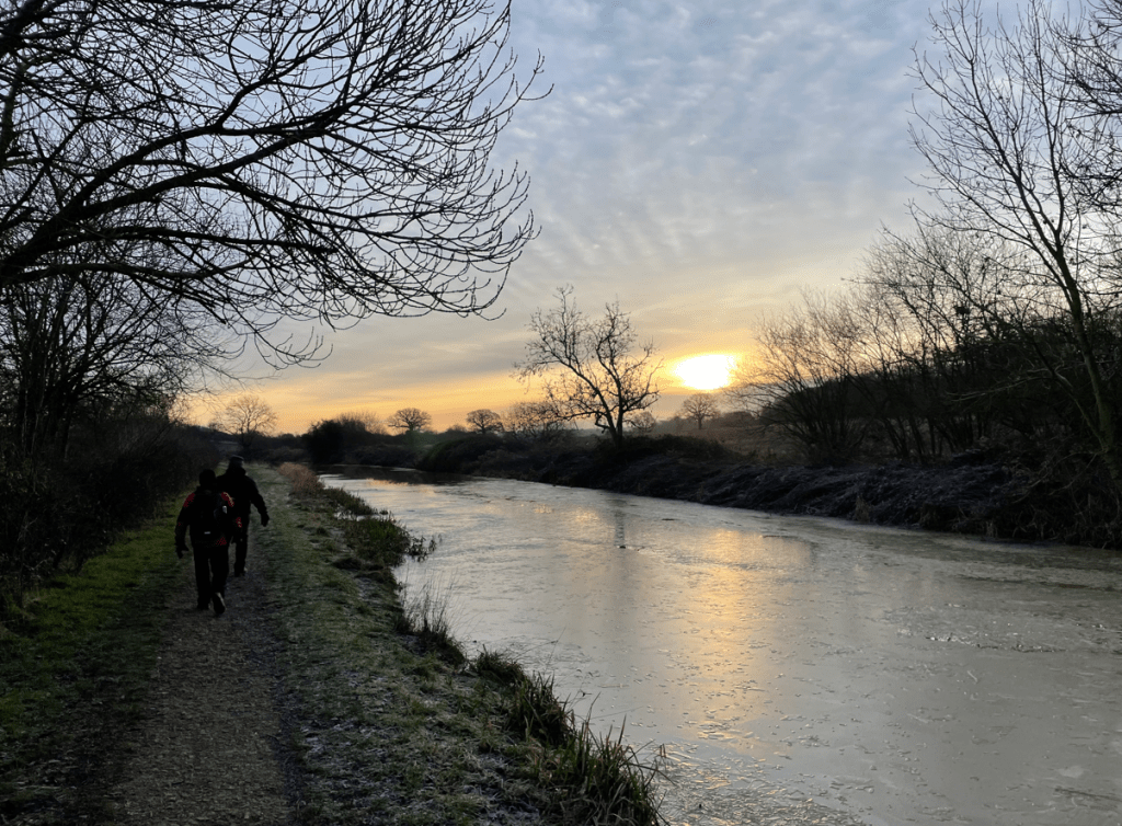
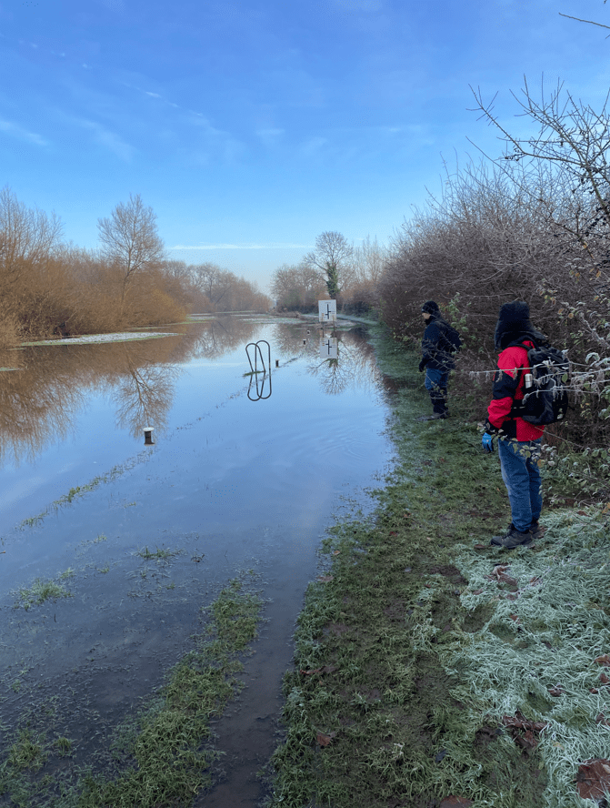
We arrived at Woolsthorpe after navigating icy roads – the temperature was below zero. Walking along the road to the canal was ‘interesting’ with black ice everywhere.
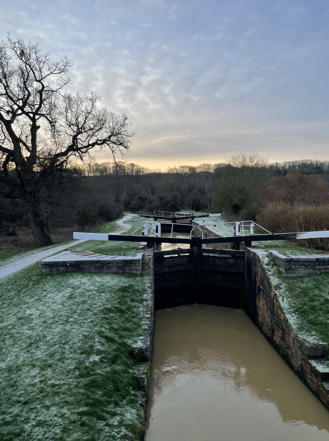
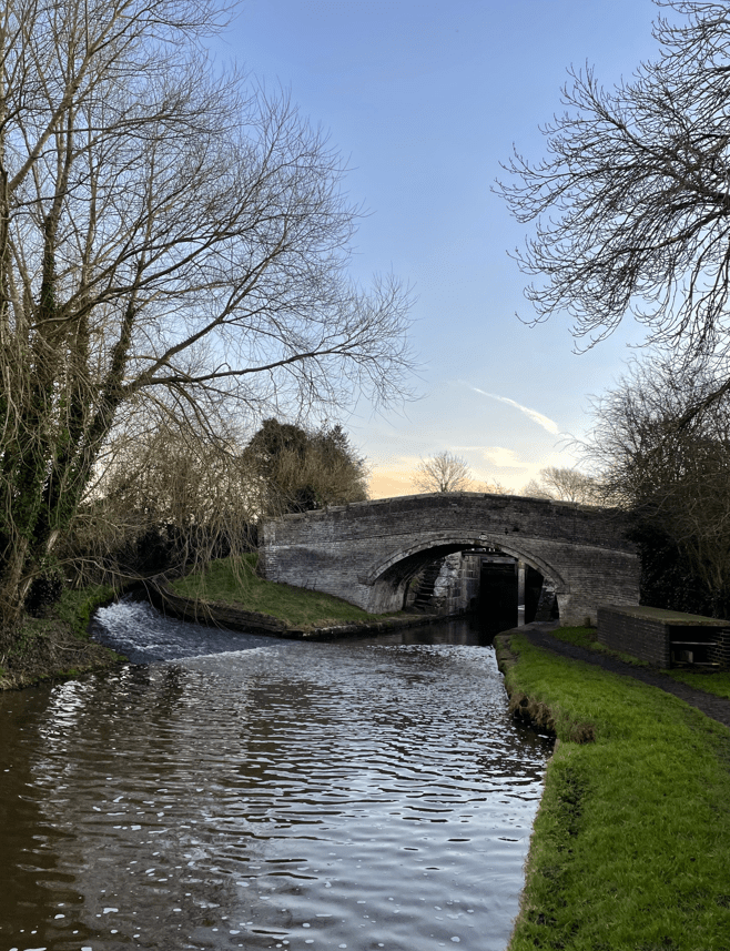
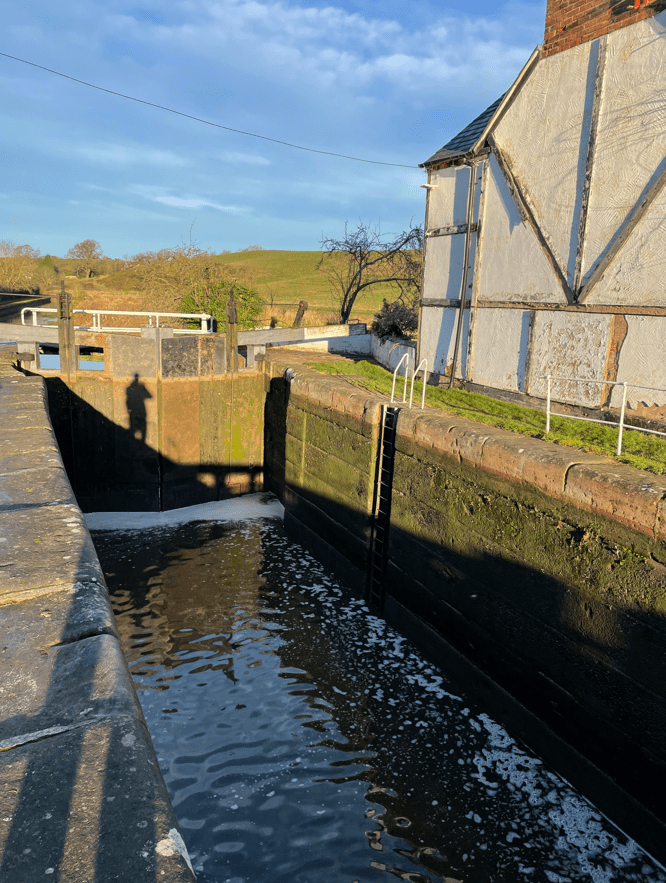
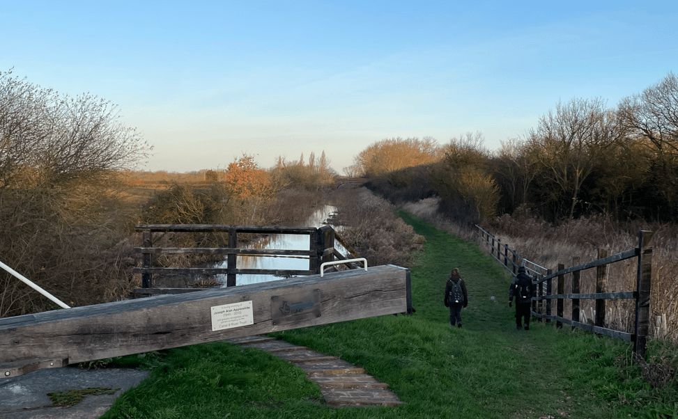
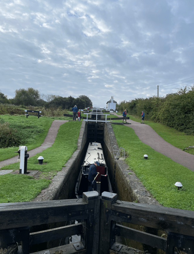
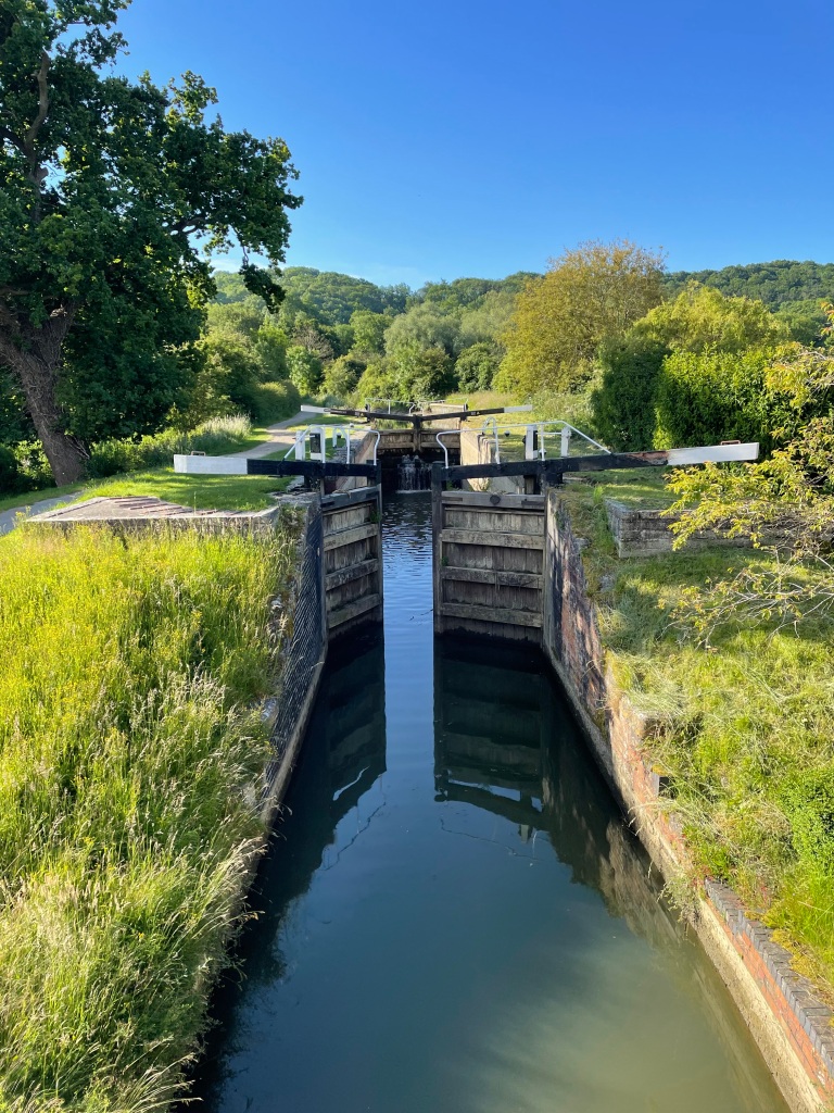
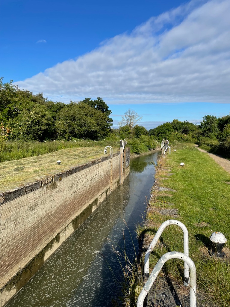
Lock 17
There was some ice on the towpath but it was much safer than walking on the tarmac road. We noted some ice on the canal. We were pleased to see the sun making an appearance- maybe it would be a sunny day?
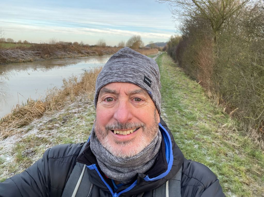
Oldblokewalking
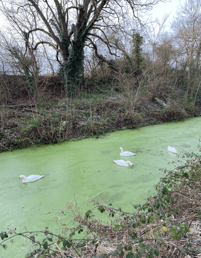
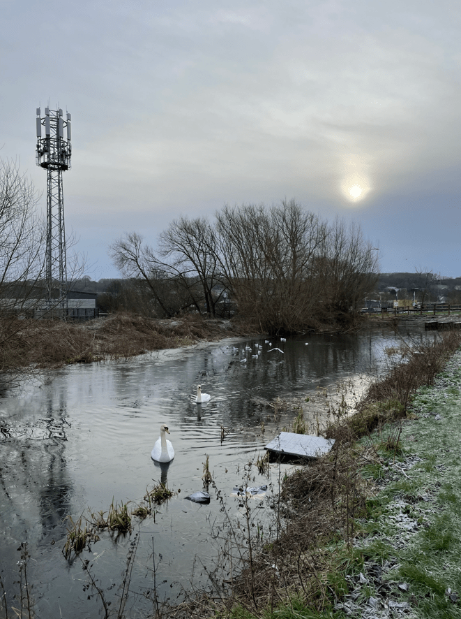
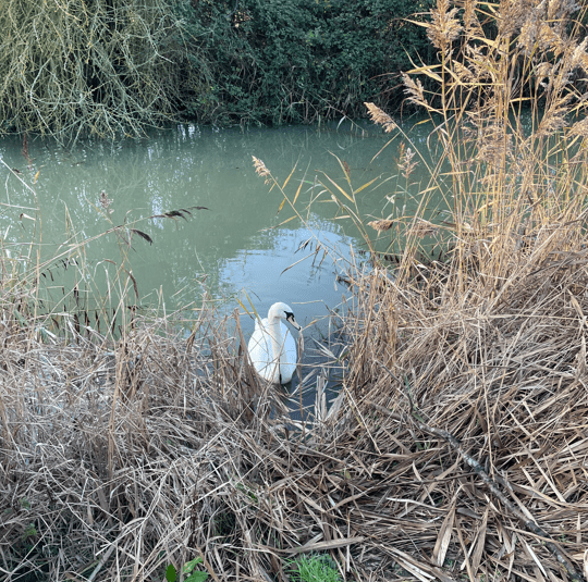
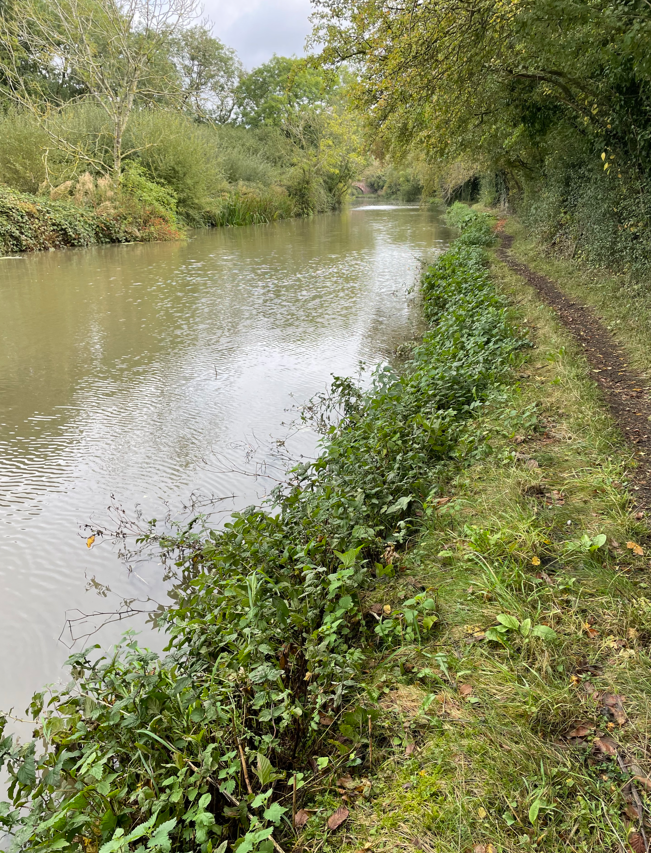
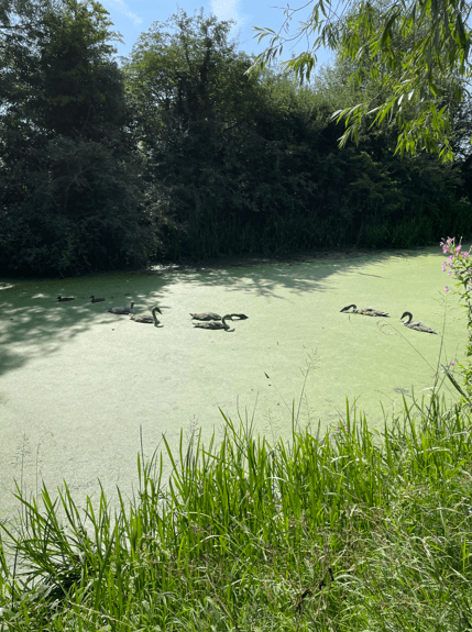
The towpath was quiet – we met more people on our return leg. We wondered how the swans cope with the cold water.
Naturally, the Three Amigos had a good old catch up. The latest Wallace and Gromit film ‘Vengeance Most Foul’ was discussed, particularly because, towards the end, there are canal boats and canals involved in the plot. It was agreed that it was very good film. Highly recommended.
Chris setting a fast pace
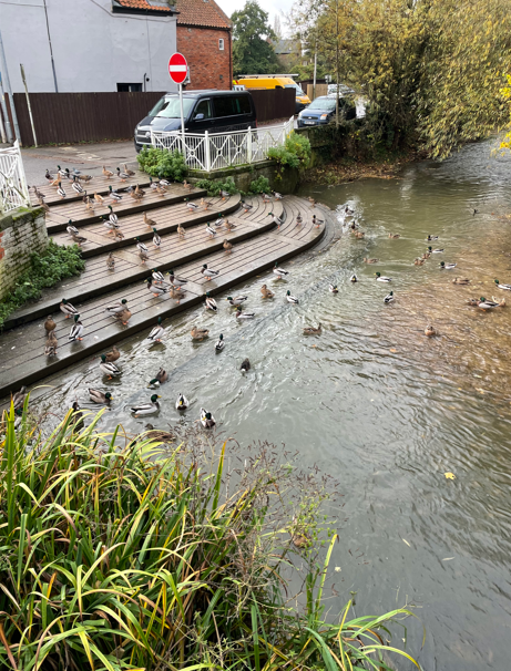
Chris was on a mission to set a fast pace so we pressed on and soon were arriving into Grantham. There were plenty of wild birds in evidence here, which was nice to see.
Grantham bird life
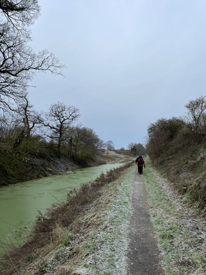
We stopped for a cuppa and a bite to eat. The sun had disappeared into the cloud which was a shame. Refreshed after our stop, but feeling chilly, we set off on our return leg.
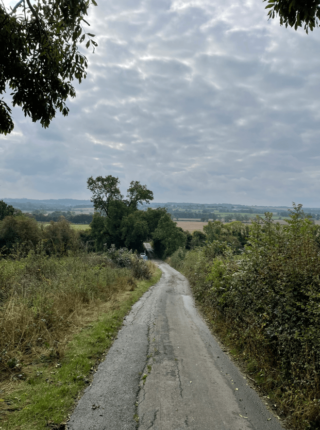
The return leg
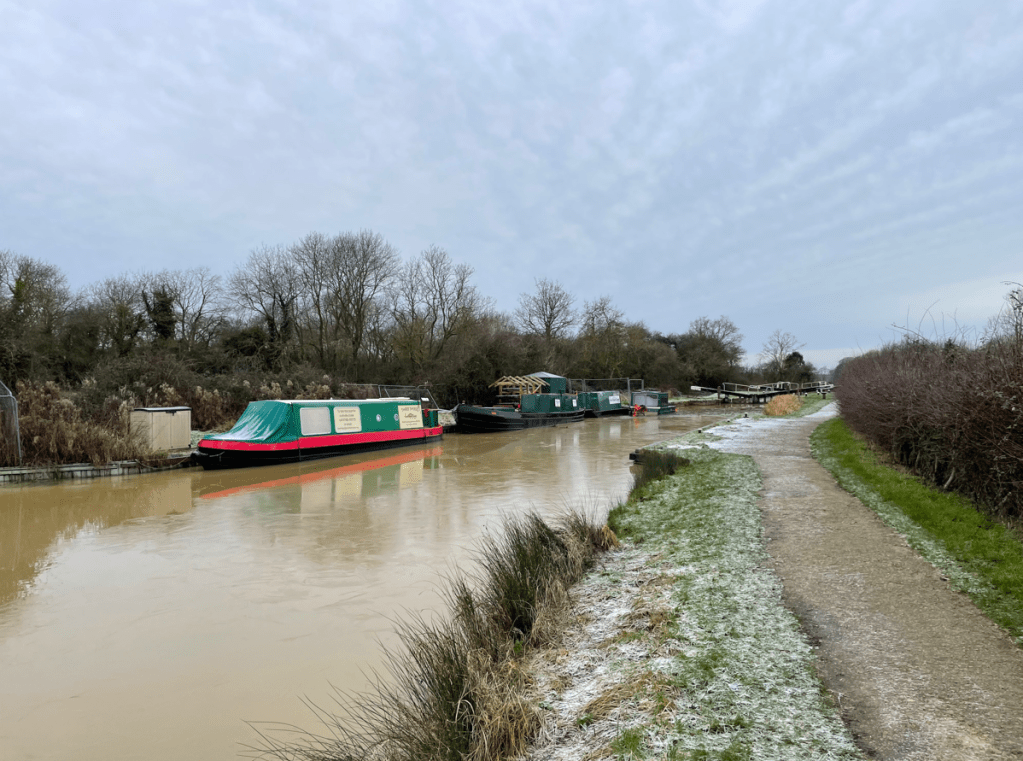
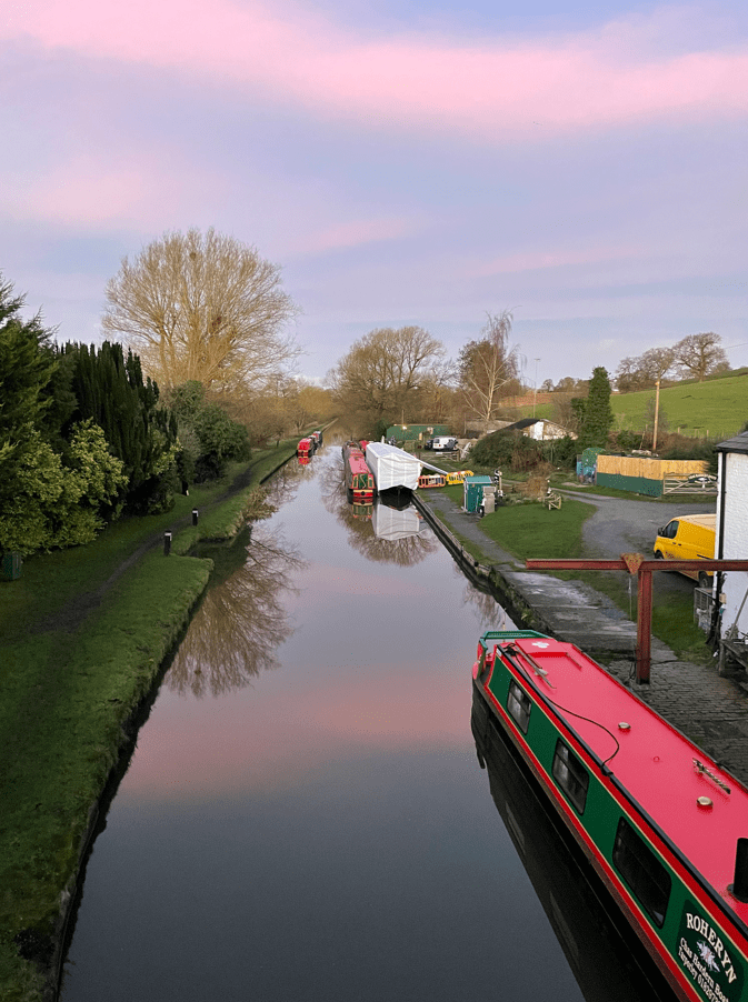
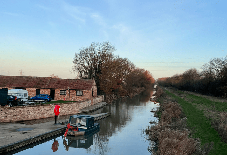
The towpath was good and mud free so we were very happy about that. Soon, we were arriving back in Woolsthorpe, passing the flotilla of Grantham Canal Society boats.
The Flotilla
It was a good walk to begin the year. Looking forward to some nice walking in the coming months – weather permitting!
Today myself and Angela enjoyed a 5-mile walk along the Shropshire Union Canal followed by a visit to the National Waterways Museum at Ellesmere Port. It was dark when we set off from the house to drive to Tiverton, but the sun was just rising as we parked up in a lay-by close to the canal.
The towpath was grass/mud and quite uneven in places. We strolled along looking at the bird life – there was the usual Heron fishing and plenty of Mallard Ducks. The canal could obviously take boats larger than the current narrow boats – it was wide and the locks/bridges were sized for much larger boats.
Whartons Bridge
We visited a lock called the Beeston Iron Lock and another called the Beeston Stone Lock. The former was lined with steel sheets and the latter had large stone blocks instead of brick. So,quite unusual locks.
Beeston Iron LockBeeston Stone Lock
It was great to have a sunny morning after the totally gloomy recent weather.
A large winding hole
We walked past a section of canal where a temporary (permanent?) repair to a breached bank had been carried out using sand bags.
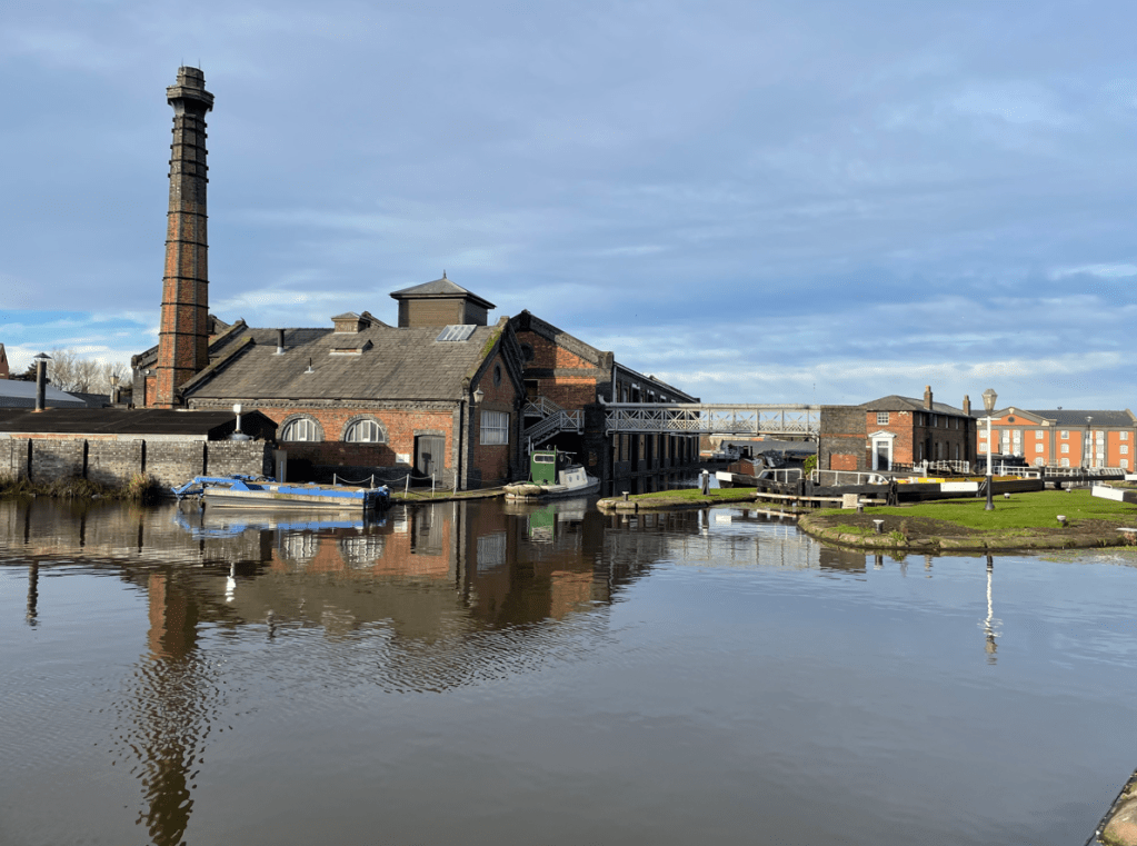
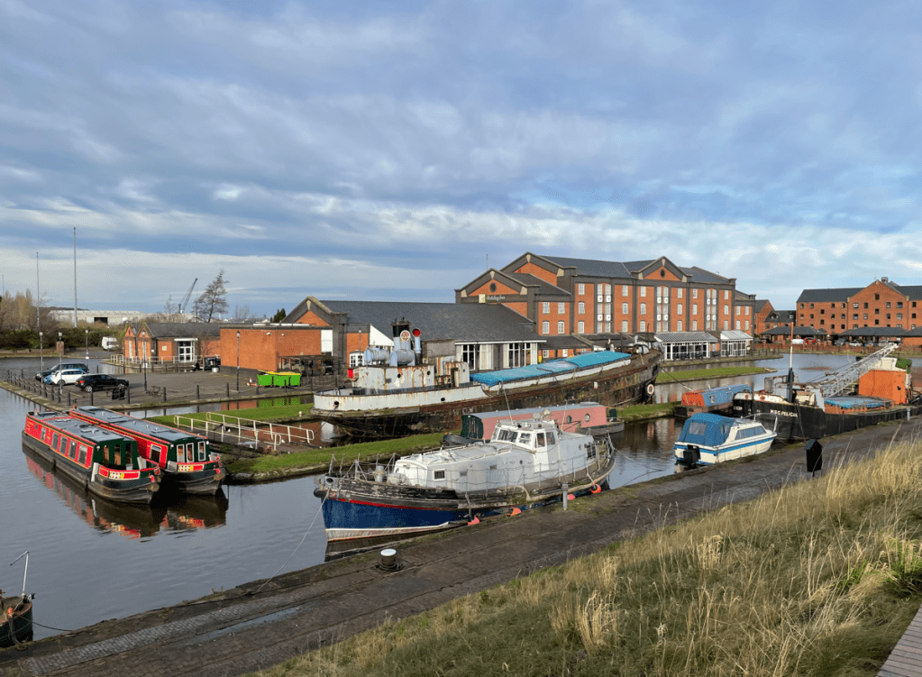
We found a café and decided to get a coffee – our timing was off because two large families had just beaten us to order and it would be a long wait we were told. We decided to press on and go to the Canal Museum at Ellesmere Port.
Canal museum
We had visited the museum in February when unfortunately it was cold and raining. So it was nice to be able to walk around today and get a better look at things in the sunshine 😊.
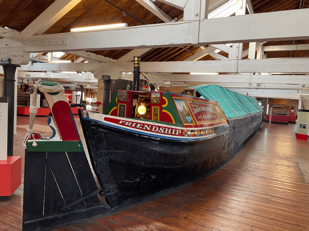
We were particularly keen to visit the Island Warehouse exhibition which houses many artifacts including complete boats.
I was interested to see the ice-breaking boat which was used to break the ice in the canal during particularly cold spells. The museum is first class and does a great job in preserving canal heritage.
We made our usual coffee stop in the excellent café and headed home after a thoroughly enjoyable day out.
This morning myself and Angela met up with Mick and enjoyed a 7-mile circular walk in the Vale-of Belvoir. It was a sunny but chilly morning following heavy rain overnight.
We started our walk at Woolsthorpe- by- Belvoir and walked westwards along the rather muddy towpath of the Grantham Canal.
The weeds along the canal were dying back which allowed a clearer view of the canal. A friendly swan swam over to say hello.
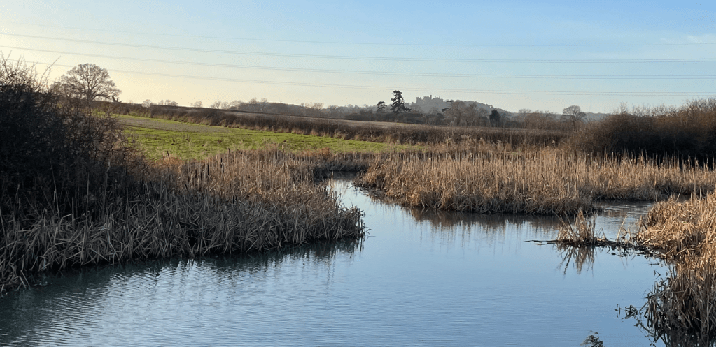
After about a mile and a half the towpath reverted to stone rather than grass so it was less muddy underfoot.
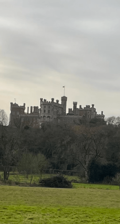
All along this stretch of the canal we could see Belvoir Castle standing on its hill in the distance – the castle has a great view of its surrounding lands. The castle is home to the Duke and Duchess of Rutland.
Belvoir castle in the background
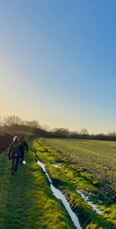
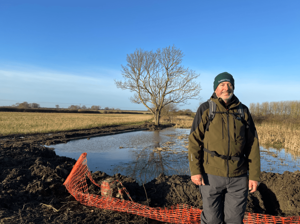
A little further on we halted. The towpath was flooded where the canal had overflowed.
We decided that, because we could not see how deep the water was ahead, we would look for an alternative route around. Unfortunately, this took us through muddy fields so it was a good job we were all wearing gaiters!
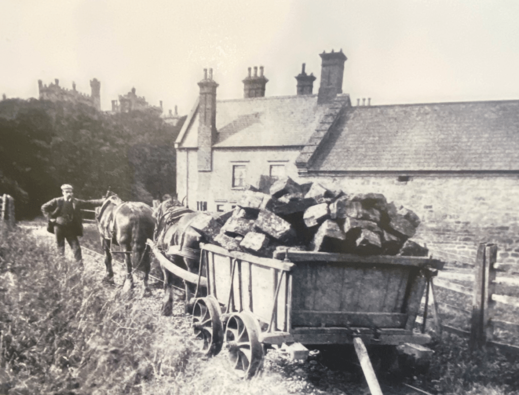
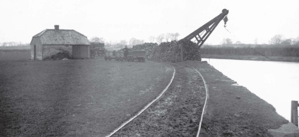
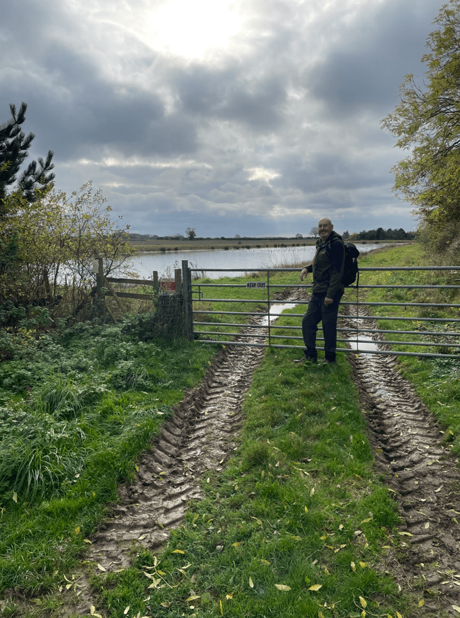
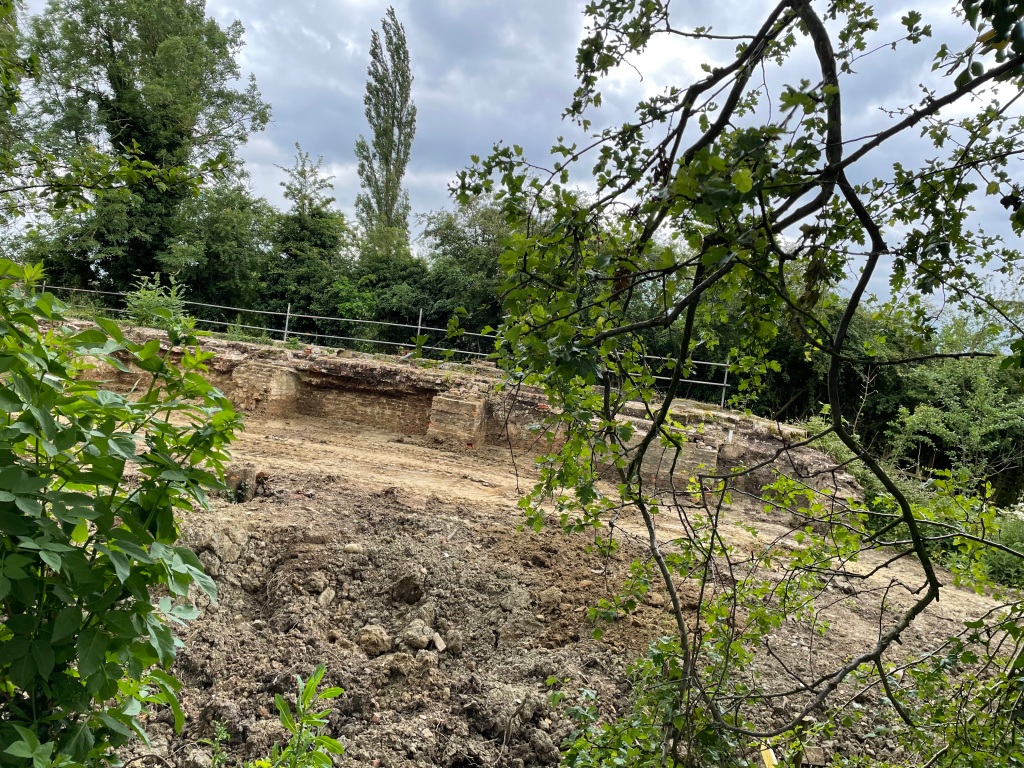
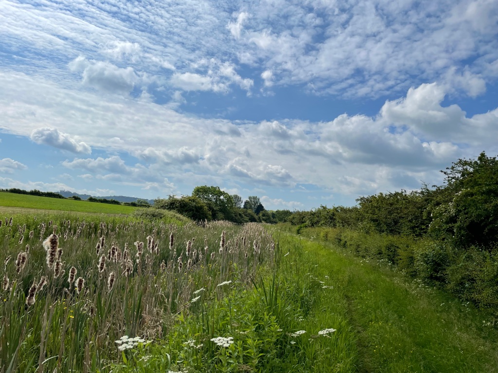
Re-joining the towpath we got to Muston Gorse and were able to view the work being carried out by The Grantham Canal Society at a site of historical interest known as ‘The Dukes Wharf’.
Soon after the canal was built (1797) by the famous canal engineer William Jessop, the Duke of Rutland asked whether an extension to the canal could be made to bring goods up to the castle. Knowing how many locks would be needed and that the amount of water needed to operate them would be prohibitive, Jessop came up with a proposal for a tramway. Uniquely, he fabricated metal fish-belly rails in his own foundry (previous tramways in the country had used wooden rails). The tramway was built in 1815 and operated for over 100 years. The wharf where the canal boats unloaded was known as The Dukes Wharf and it contained a weigh house (to check the weights of the good’s (e.g coal) received.
The Dukes Wharf
The National Railway Museum in York has a tramway truck on display.
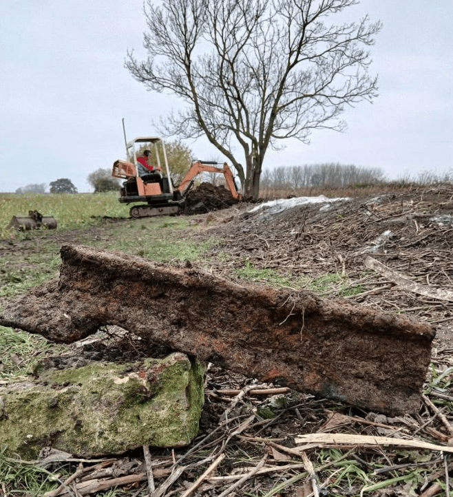
Recently, the Grantham Canal Society has been working here to expose the original wharf. They have even found a piece of rail. The crane used for unloading has long gone.
Coping stones on the original wharfFish-belly rail
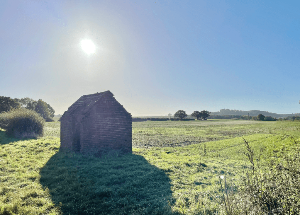
There is an building nearby which is thought to have been the weigh house. The Society hope to restore this area.
The weigh houseThe Dukes Wharf
Leaving The Dukes Wharf we headed up the hill towards Belvoir Castle.
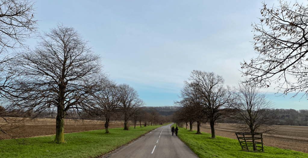
We walked past a small retail centre called ‘The Engine Yard’ and headed down the scenic, tree lined road, crossing the river Devon to enter Woolsthorpe-by-Belvoir.
It was a short walk to where we had parked our car. Mick headed off home and myself and Angela popped into ‘The Duck’, a recently re-opened pub, where we enjoyed a warm welcome from the staff and a lovely hot couple of coffees. In was nice to get into a warm pub after the cold walk.
Today ‘The Three Amigos’ did a fabulous walk beside water – and on occasions through water (but not on the water!). A consequence of the recent Storm Bert.
A flooded path beside the canal
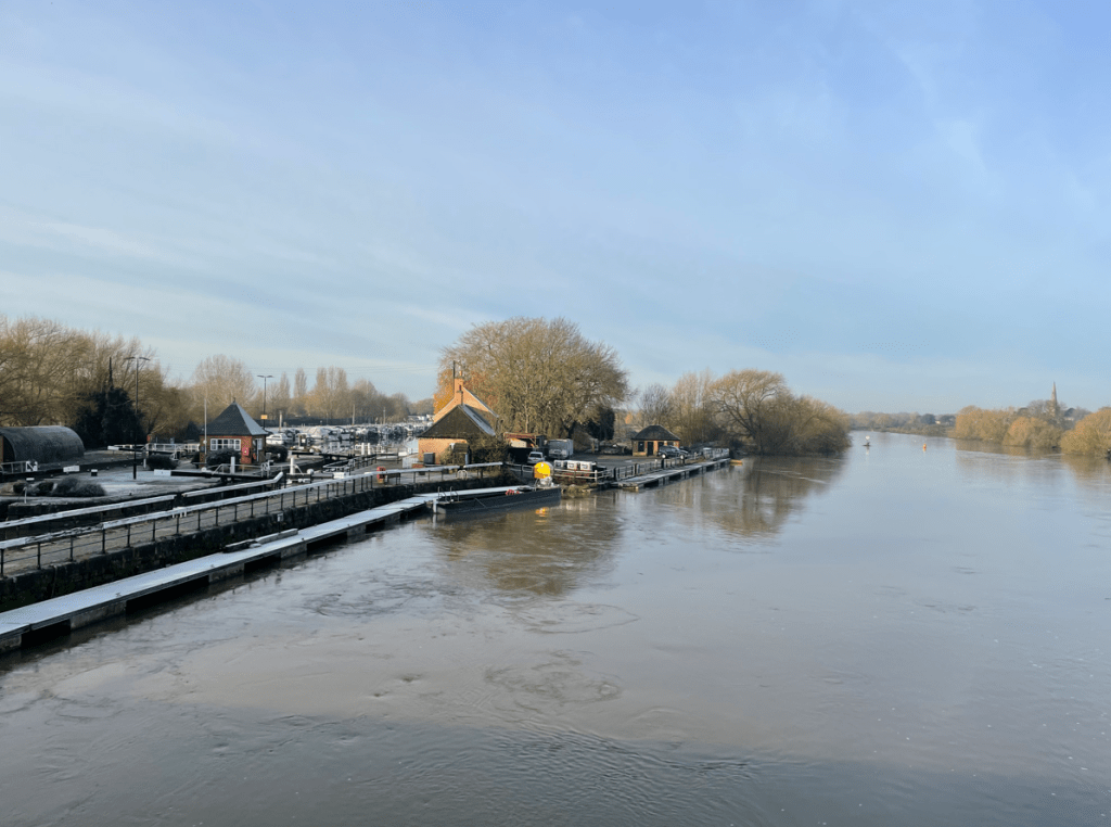
Our route took us from Shardlow, and the Trent and Mersey canal, to Cranfleet Lock – an 8.5 mile there and back walk.
It was a stressful drive around Nottingham to get to Shardlow and well done to Chris for safely navigating the icy roads, flooded bridges and horrific rush hour traffic jams.
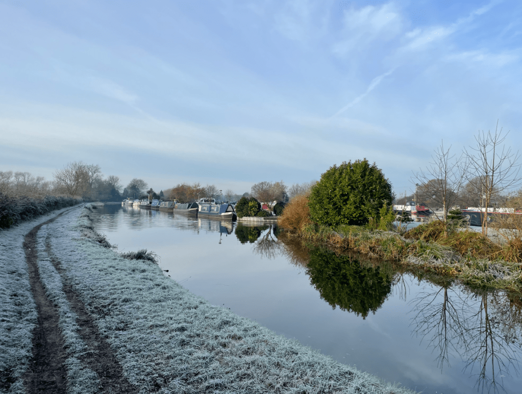
The temperature was just above zero and the sun was shining as we left the car park and set off optimistically, for a nice walk.
The Trent and Mersey Canal
The frost lay white and crisp upon the grass and it looked a typical wintery vista.
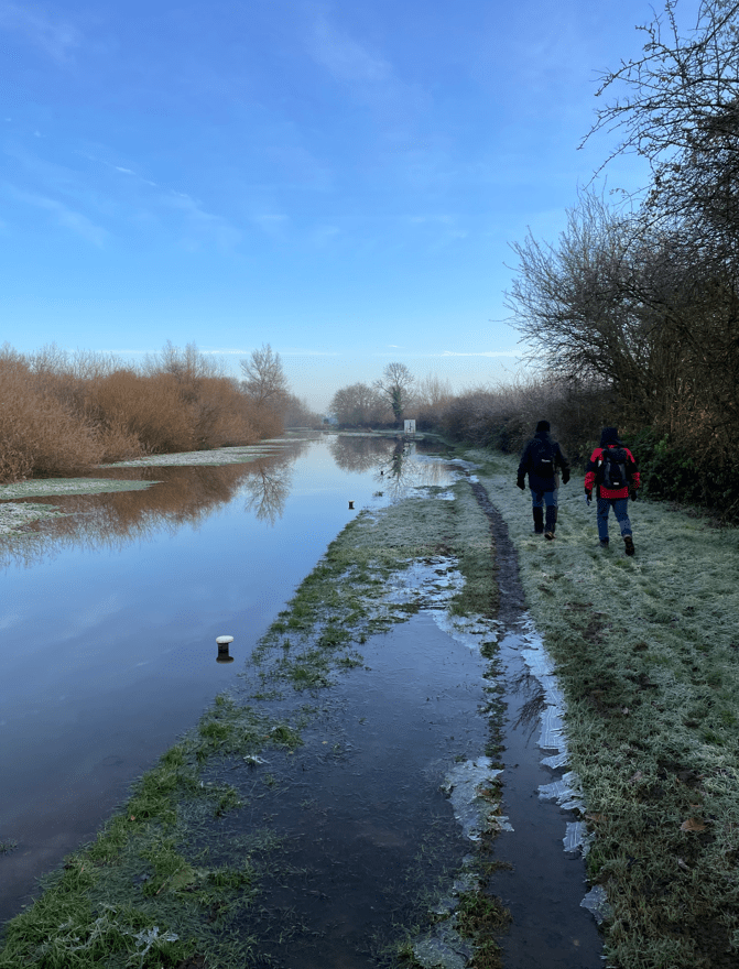
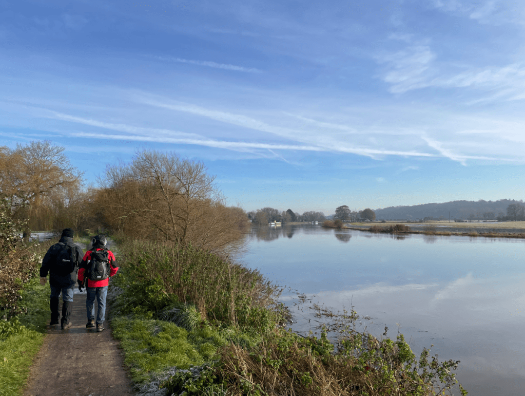
We hadn’t being walking for too long when we met a dog walker who informed us that the canal had breached its bank further on. We pressed on to see whether it was passable.
A very full canal
Chris went forward and, after assessing the situation, decided that we could pass through safely. So that’s what we did, and although our boots were submerged, our feet mercifully remained relatively dry.
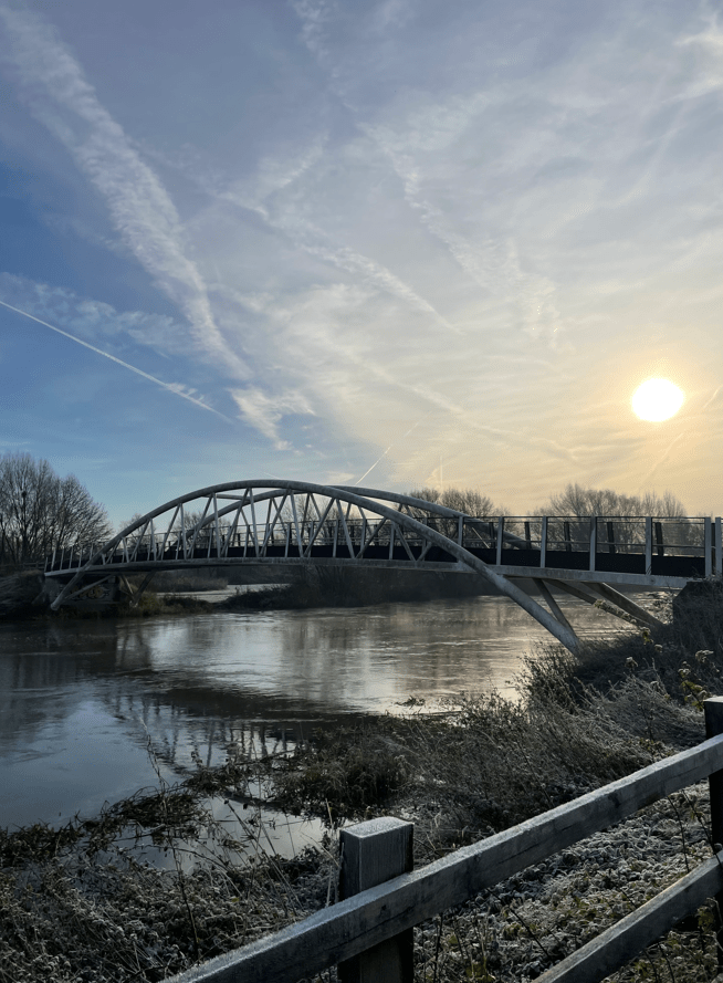
The canal would soon merge with the River Trent after passing through a lock. The river was very fast moving and the surrounding land flooded. We navigated our way across reeds to avoid another flooded path heading for a pedestrian bridge (Long Horse Bridge) to cross the river.
Heading to Long Horse bridgeAnother flooded pathRiver Trent
It was a good morning for capturing some nice images.
Long Horse Bridge
Our route took us under the M1 motorway.
The M1 Motorway
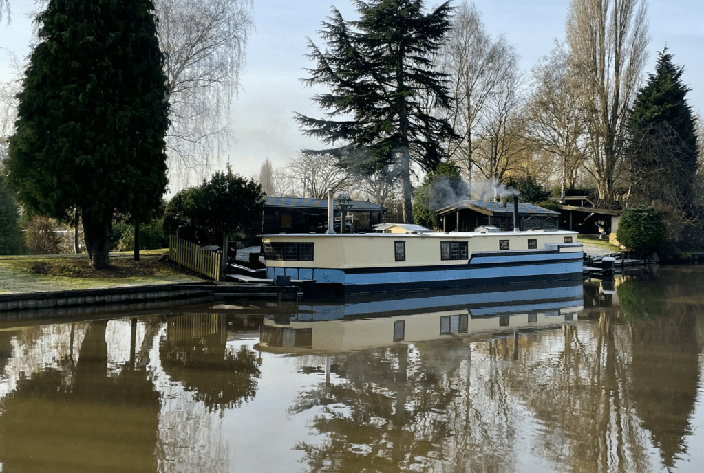
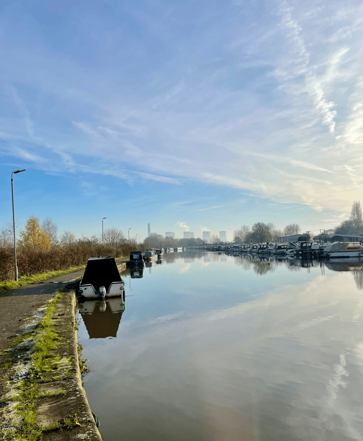
Continuing onwards we reached Sawley Marina where we found a great number of boats moored up. As we passed by it was nice to smell the aromatic wood smoke from the wood burners. There were some lovely boats moored there to admire.
A quaint looking house boat
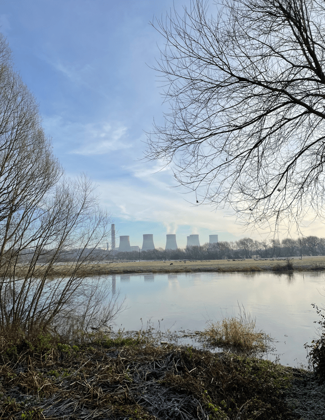
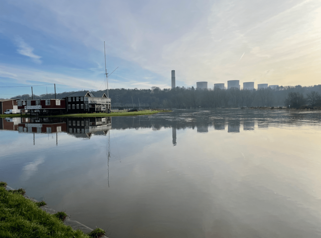
In the distance we could see the cooling towers of the recently closed power station at Ratcliffe-on-Soar. We could see what looked like steam coming from the cooling towers but, because the plant has closed, it must have been morning mist venting through the towers.
Sawley Marina
After passing Sawley Lock we crossed another bridge across the river Trent. The views of the fast moving river were impressive.
Sawley Lock on the left and the river TrentRatcliffe-on Soar Power StationWalking beside the river Trent
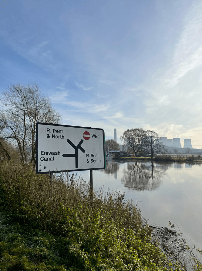
We were headed for Trent Lock which is a major waterway junction.
River Trent
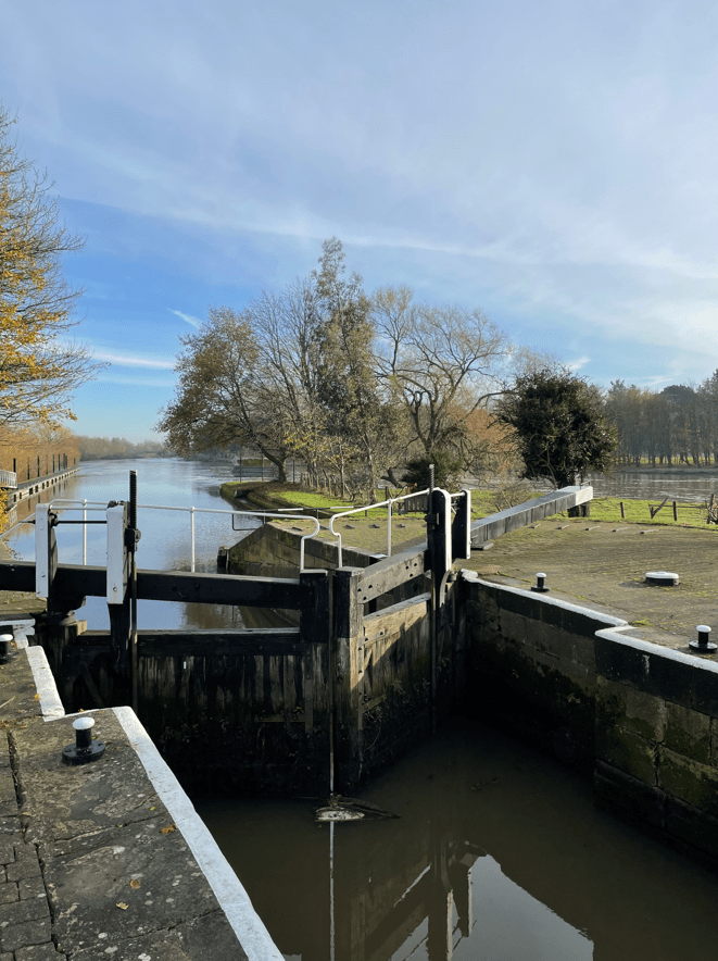
At Trent Lock there are two pubs and a tea room so I guess its a popular spot in good weather.
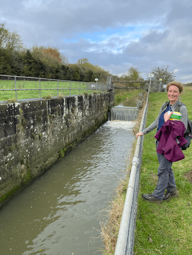
We stopped for a cuppa and a bite to eat here admiring the view. I do like walking beside water – its special. After our break we continued walking along the Cranfleet cut to reach the Cranfleet lock where we about turned and headed back.
Cranfleet Lock
Walking back we found that the flooded paths had receded slightly so that was a plus. I do wonder with global warming and the increased frequency and ferocity of storms how our waterways will cope in future years.
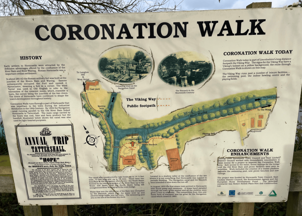
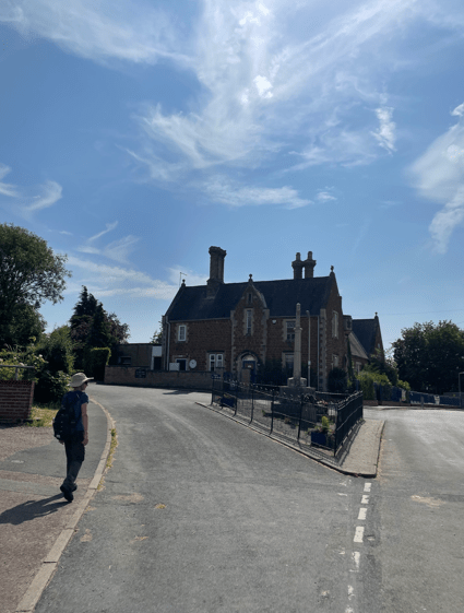
Today’s walk was a 10-mile circular walk starting in the market town of Horncastle. Myself and Angela parked the car in the Tescos supermarket long stay carpark and planned to follow a walk from the OS book ‘Lincolnshire and the Wolds – outstanding circular walks’.
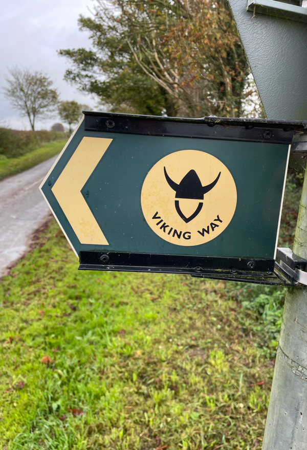
The walk was a wide circuit of the Bain valley to the north, west and south of Horncastle. We followed the Viking Way at the beginning and end of the walk.
Leaving the carpark nice and early in the morning the local ducks were making a lot of noise as we made our way to the market square – we wondered whether it was feeding time.
In the market square there was a grand monument, built by the people of Horncastle, to Edward Stanhope – a respected benefactor to the town.
Stanhope Memorial
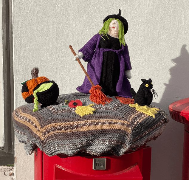
Outside the Post Office in the market square there was a nice knitted cover on top of a post box – Halloween themed.
Navigating our way through Horncastle we walked beside the little River Waring.
River Waring
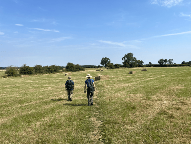
After walking along a track beside housing estates we emerged on to a road and then, after a short road walk, started across fields.
The grass was wetter than anticipated. The day had turned cloudy. After a stretch across field paths we came to a road section. This was not enjoyable because there was just too many cars/lorries passing along it. We wondered whether the walk had been designed years ago before road traffic was as heavy as it is today and hedges were not so big.
A very brief quiet spell on the busy road
The road passed over the River Bain.
River Bain
We were glad to leave the road and head across fields again.
The walk was pretty uninspiring from a scenic perspective, however, we were enjoying being out walking and getting some miles in.
Eventually we came to the disused Horncastle Navigation canal. In 1802 the canal linked Horncastle and Tattershall, running parallel to the Old River Bain. As I am interested in canals this was the highlight of the walk today.
A disused lockHorncastle navigation canal
We followed the canal, walking on the embankment to Coronation Walk in Horncastle, and on through town to the car.
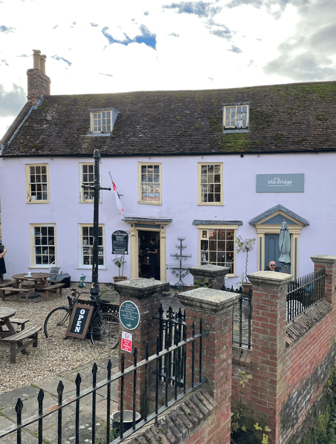
Angela had done some research and found a nice café to have lunch at – The Bridge. We enjoyed a super lunch there and can definitely recommend it.
Horncastle is a very civilised town. Why ? 1. It has public toilets and 2. They are free!! 😊.
Yesterday was a very wet day with heavy rain throughout. As I set off in my car this morning I wondered what will the roads would be like, and also, what will my planned walk route would be like?
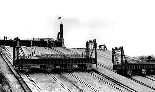
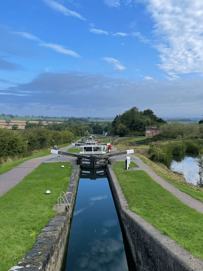
As a canal enthusiast I have been wanting to visit Foxton Locks ever since I had read about them. They are one of THE iconic sights of the canal network. Over 4,000 boats pass through Foxton Locks each year making it one of the busiest spots on the 2,000 mile canal network. Found on the Grand Union Canal the ten locks allow boats to ascend / descend 75 feet. It takes 45 mins for a boat to pass through the locks and uses 25,000 galls of water in the process. Built in 1810 they were superseded between 1900 and 1910, when an inclined plane, powered by steam engines and winches, was used to lift /lower large tanks (caissons) that contained the boats. However, the inclined plane lift proved uneconomic and was removed.
The inclined plane at Foxton
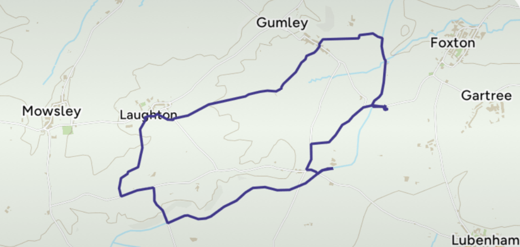
Today’s 7 mile circular walk would begin at Foxton Locks and take me across fields to the hilltop village of Gumley. After, it continued across the top of low Laughton Hills then descended to rejoin the canal. The last 2.5 miles would be along the canal towpath with fine views over the Welland valley.
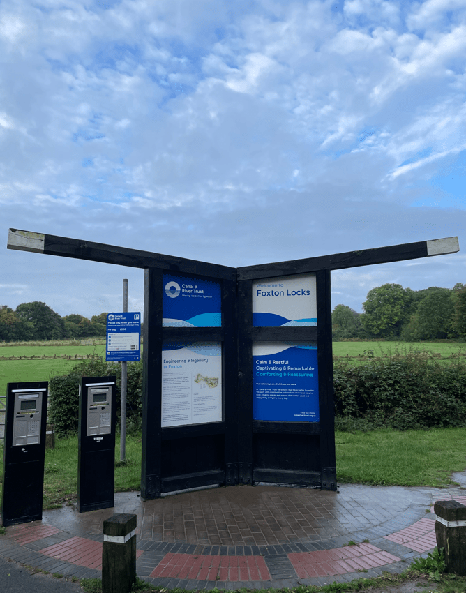
As it turned out, I had to pass through two sections of flooded road to get to the start of the walk – I took it slowly driving through the water. I parked in the long stay car park at Foxton Locks, noting the lock gates by the parking machines.
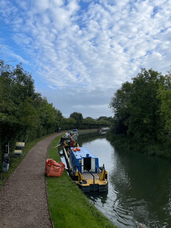
Leaving the car park (£3 all day) I followed a path which brought me to the canal towpath which I followed towards the locks.
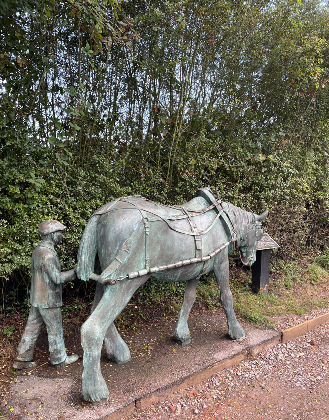
My first view of the Grand Union canalA nice sculpture
I passed a lovely sculpture of a horse and young lad – a nod to the days when the boats were horse drawn. Further on I reached the brow of a hill where the old locksmiths cottage (now a café but closed when I was there) stood and I gazed out at the wonderful sight of the locks. Awesome! – particularly when there were so few people about.
Foxton Locks Flight
I walked down the flight of locks watching a boat make its way upwards.
Boat travelling up the flight of locks
I was interested to see the ponds adjacent to the locks which supply water for the locks. Water is fed through two paddles- one red for filling the locks and one white for emptying the locks. You can see them on the photo above on the left hand side of the lock.
A previous lockkeeper painted the paddles red or white and had this famous rhyme “Red afore white and you’ll be alright, white afore red and you’ll wish you were dead!
At the bottom of the locks lies a canal basin and a pub! There is also another café but alas, it was closed.
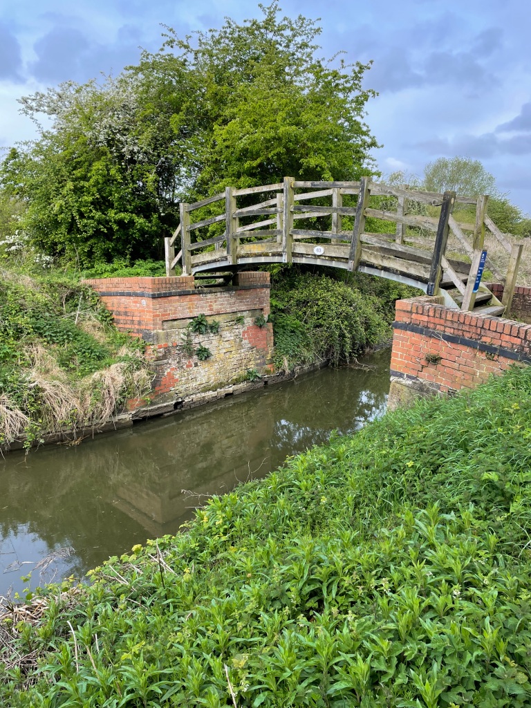
I continued along the towpath for a short while then crossed a bridge over the canal to reach a soggy field.
Over the bridge I go
I followed my route across fields, quite steep at times, to reach Gumley. Interestingly, this section from Foxton Locks to Gumley is part of the Leicestershire Round so I will be passing this way again. I was crossing through fields containing cows, horses and sheep (not all in the same field!)
There was only one field that I crossed which was particularly muddy. It was very wet and I was glad to get through it.
The muddy field
I was particularly careful crossing the many stiles which I found were slippery – especially with muddy boots.
Arriving into Laughton I liked the nice houses and found my path across another field of, thankfully, friendly cows 😊
Laughton
The next section took me along some narrow lanes and I descended steeply to reach the canal – There were nice views across the Welland valley on this descent.
Views across the Welland Valley
This is the Leicester branch of the Grand Union Canal which joins the main waterway near Daventry. Completed in 1814 it was built to provide a direct link from Leicester to London.
I didn’t meet a soul along the towpath although a few boats chugged by with the skippers giving a friendly wave.
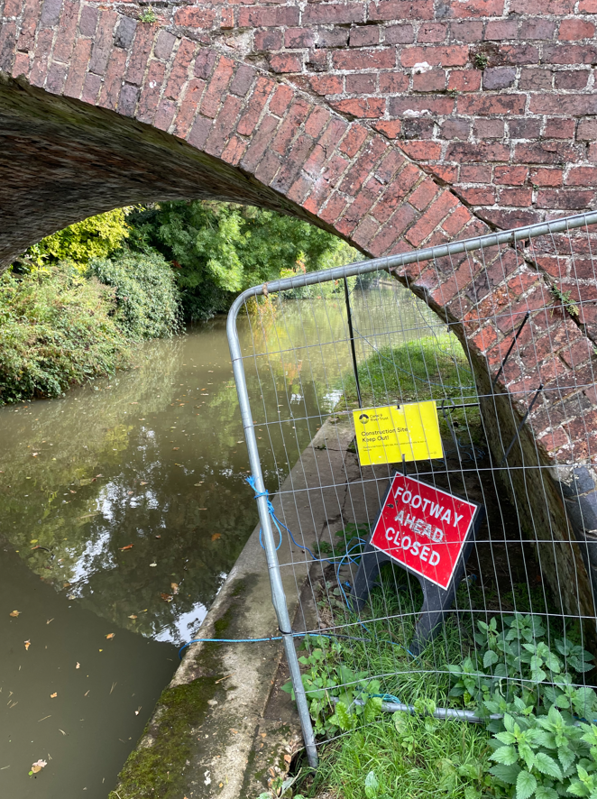
As I walked along, ducking to avoid low hanging folliage and lost in my thoughts I was enjoying the day. Passing by a bridge it had a sign on it saying towpath closure ahead – I wondered whether it would affect me. At the next bridge I found that it did – the path was barricaded off with no information about a diversion and, in fact, no way off the towpath! I had to turn around and go back to the previous bridge – how annoying!
I consulted my map and ended up doing a mile extra along lanes to get back to the canal. Not a happy chappy, but worst things happen at sea, as they say.
I arrived back at the car park to find that it was much busier than when I had left it. I am so chuffed to have seen Foxton Locks – a good day out.
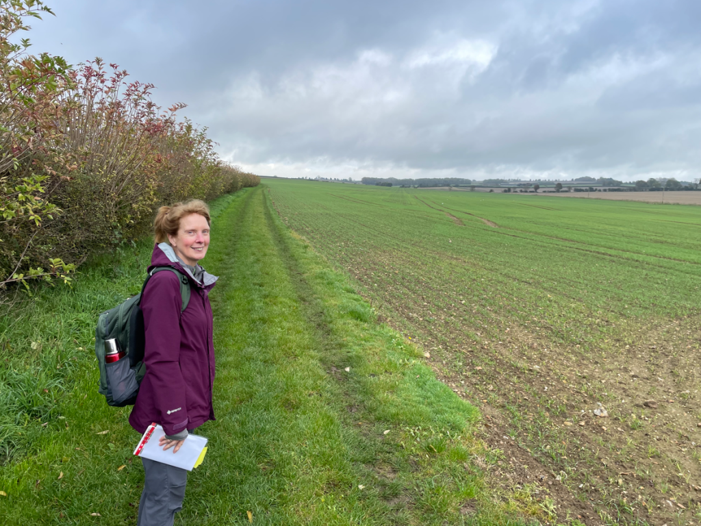
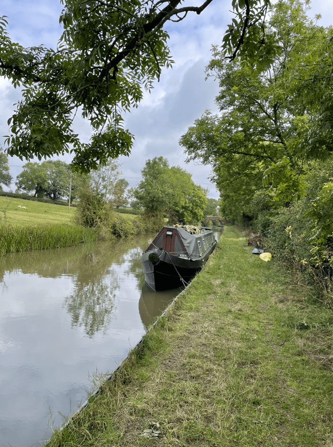
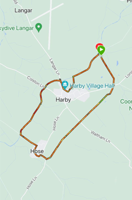
Today, myself and Angela met with Mick and we enjoyed a 6.5 mile circular walk in the Vale of Belvoir.
Our route
We started at Dove Cottage Tea Rooms, followed paths across fields to Hose, then, after walking through Hose, joined The Grantham Canal towpath towards Harby. We walked through Harby and re-joined the towpath taking us back to the start. It was a lovely summers day and a joy to be out walking.
Heading to HoseOnwards to Hose
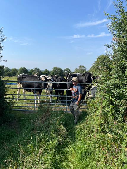
Arriving into Hose Mick had a chat with some curious cattle 😊.
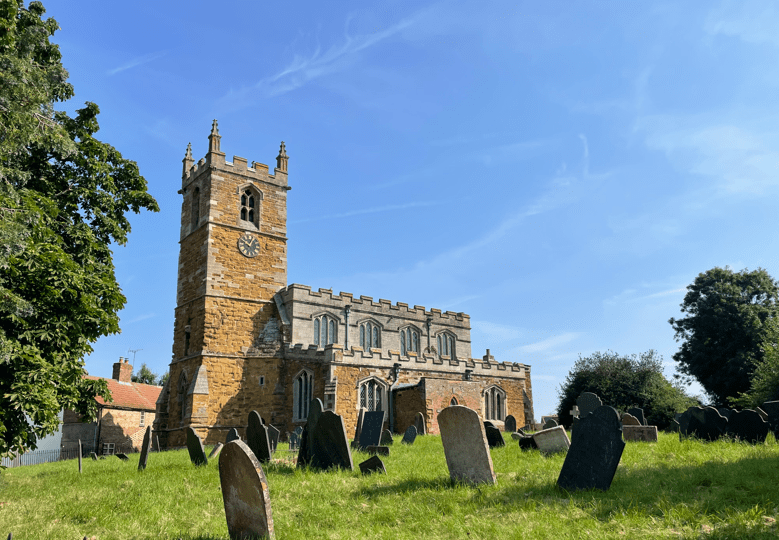
We passed the church of St Michael & All Angels.
St Michael & All Angels Church
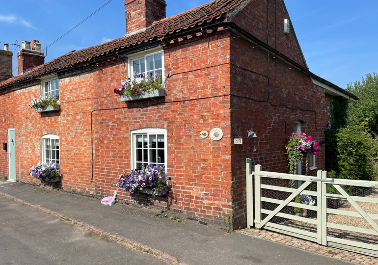
Walking past a cottage with some lovely flowers displayed in window boxes we stood and admired them.
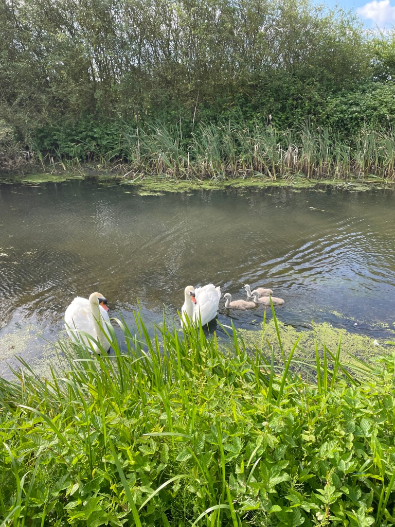
Leaving Hose we walked down a lane to join the Grantham Canal towpath and headed West towards Harby. Along the way we encountered a swan family and the male swan began hissing at us and raising his wings. His six signets trotted into the canal. We managed to get past safely without upsetting Mr Swan too much.
Signet’sAlong the good towpath towards Harby
We walked through Harby looking at the nice cottages and pub, then headed past the village church to pick up a path across fields leading back to the canal. We saw a nice display of roses along the way.
Walking through HarbyHeading back to the canal
A half mile walk along the towpath brought us back to our starting point. The temperature was increasing so we were pleased to have completed this short walk. Plenty of water was drunk along the way.
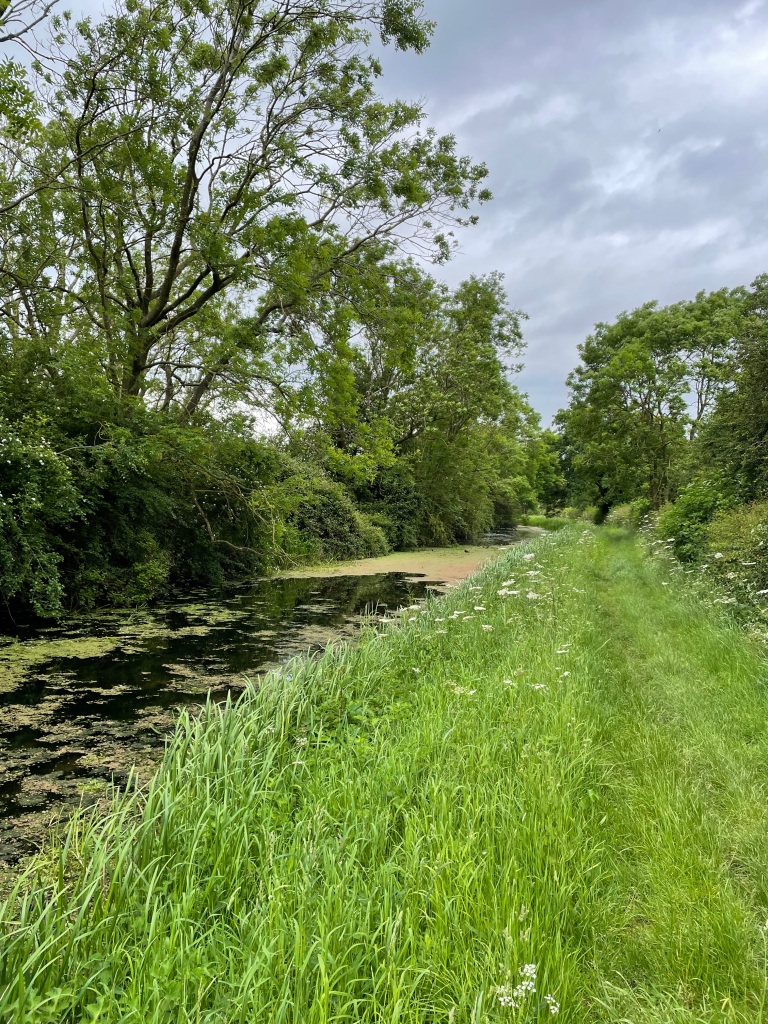
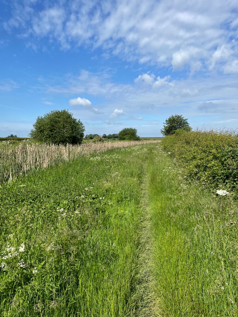
Summer has finally arrived and I was looking forward to going out walking early this morning on a familiar 8-mile circular route taking in The Grantham Canal, Denton Reservoir and the old Ironstone Railway track.
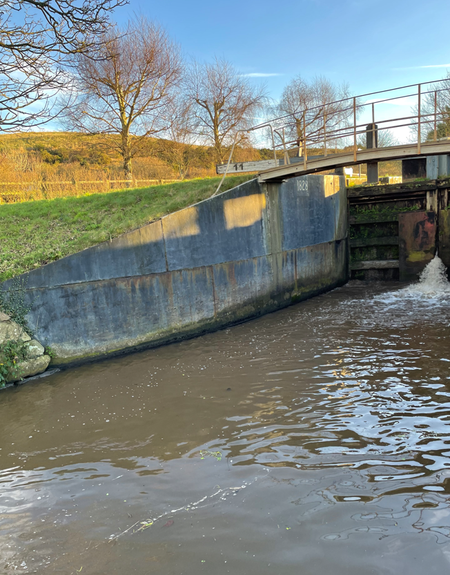
Lock 17
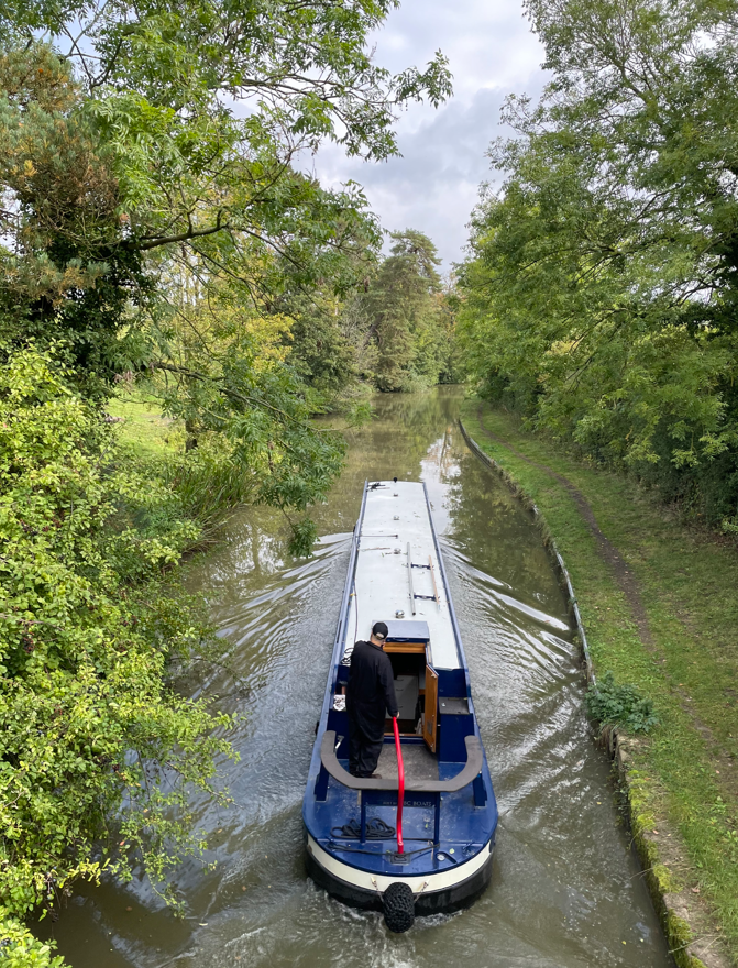
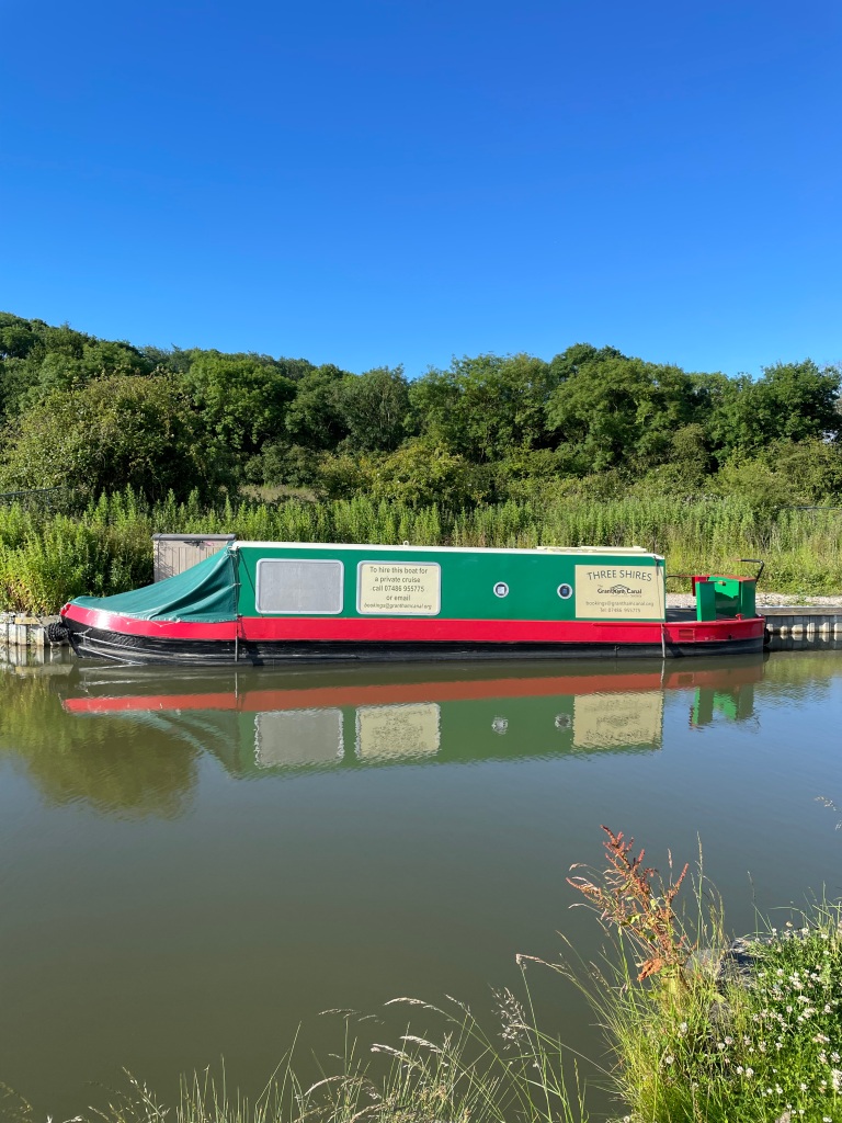
I parked on the road next to The Dirty Duck pub at Woolsthorpe by Belvoir and set off following the towpath past locks 17 & 18. The Grantham Canal Society ‘Three Shires’ cruise boat was moored close to lock 18.
Lock 18The Three Shires Cruise boat
The sun was warm on my face and the towpath was clear – wonderful!
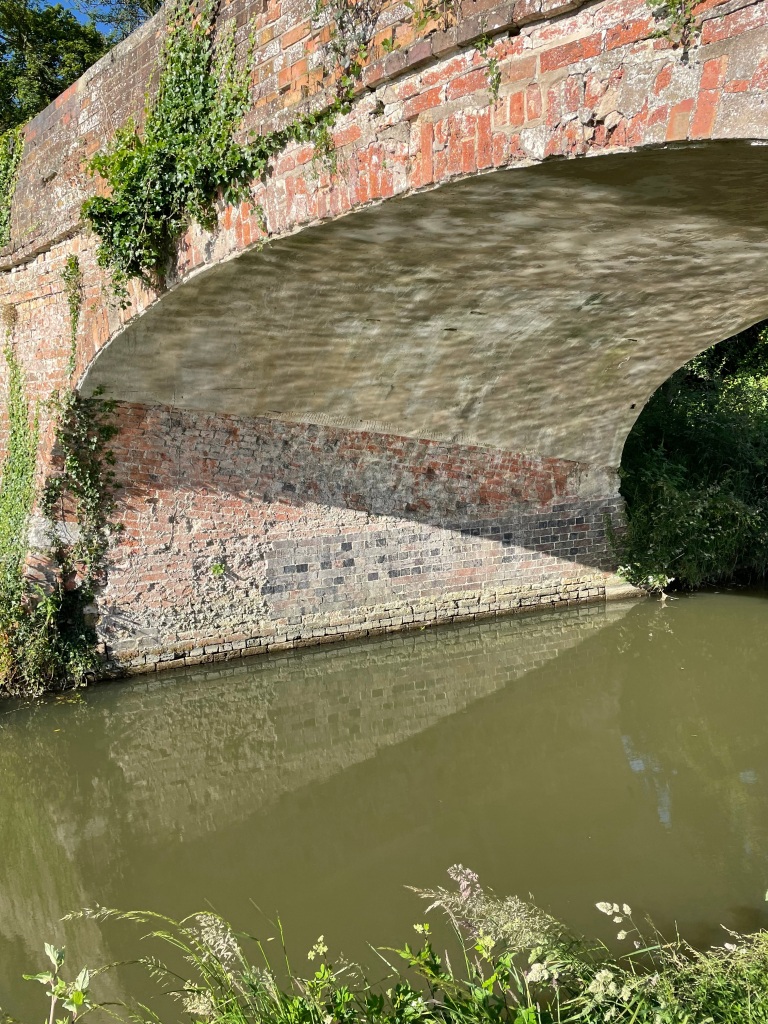
I was soon passing under Longmoor bridge which is a fine example of a skew bridge – the bridge does not sit at 90 degrees to the canal and the brick courses under the arch are skewed which gives the bridge greater strength. There are also slots in the roof to allow bats to roost.
Longmoor bridge – a skewed bridge.
Next up was my favourite bridge along the canal- the Casthorpe bridle bridge. I think I like it because it reminds me of the Mathematical Bridge at Cambridge.https://en.wikipedia.org/wiki/Mathematical_Bridge
Casthorpe bridle bridgeThe Mathematical Bridge, Queens college Cambridge
As I walked further along I spotted a ‘weed-berg’ floating on the surface of the canal – these could get wrapped around the prop of a canal boat and are best avoided.
A ‘weed-berg’ in the canal
I passed four groups of Duke of Edinburgh award students navigating their way along the canal.
As I neared Harlaxton the vegetation along the towpath was crowding in and the sense of openness I had felt earlier on the walk disappeared.
I left the canal at Harlaxton bridge, peering into the murky waters of the canal as I crossed.
The canal at Harlaxton
A nice walk across fields (I remember the same fields in spring being sodden with mud) brought me to the open expanse of Denton Reservoir – built to supply water (it has a capacity of 60 million gallons) to the canal.
Denton Reservoir
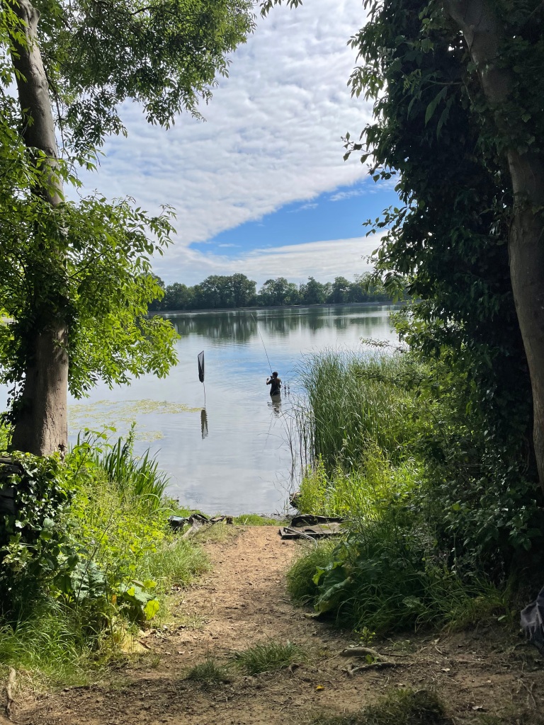
I sat for a break taking in the quiet and the view. Anglers could be seen dotted around the outside of the reservoir.
An angler reeling in his catch
Leaving the reservoir I passed through the village of Denton and headed up the road to pick up the dismantled track of the former Ironstone railway by a bridge.
My access from the road to the old railway track
It was a nice walk along the track, partially in the shade and no one to be seen.
The old Ironstone railway track
Passing through the support pillars of a dismantled railway bridge I picked up the Viking Way which brought me back to the canal.
A short walk along the canal brought me back to the car and the end of todays walk.
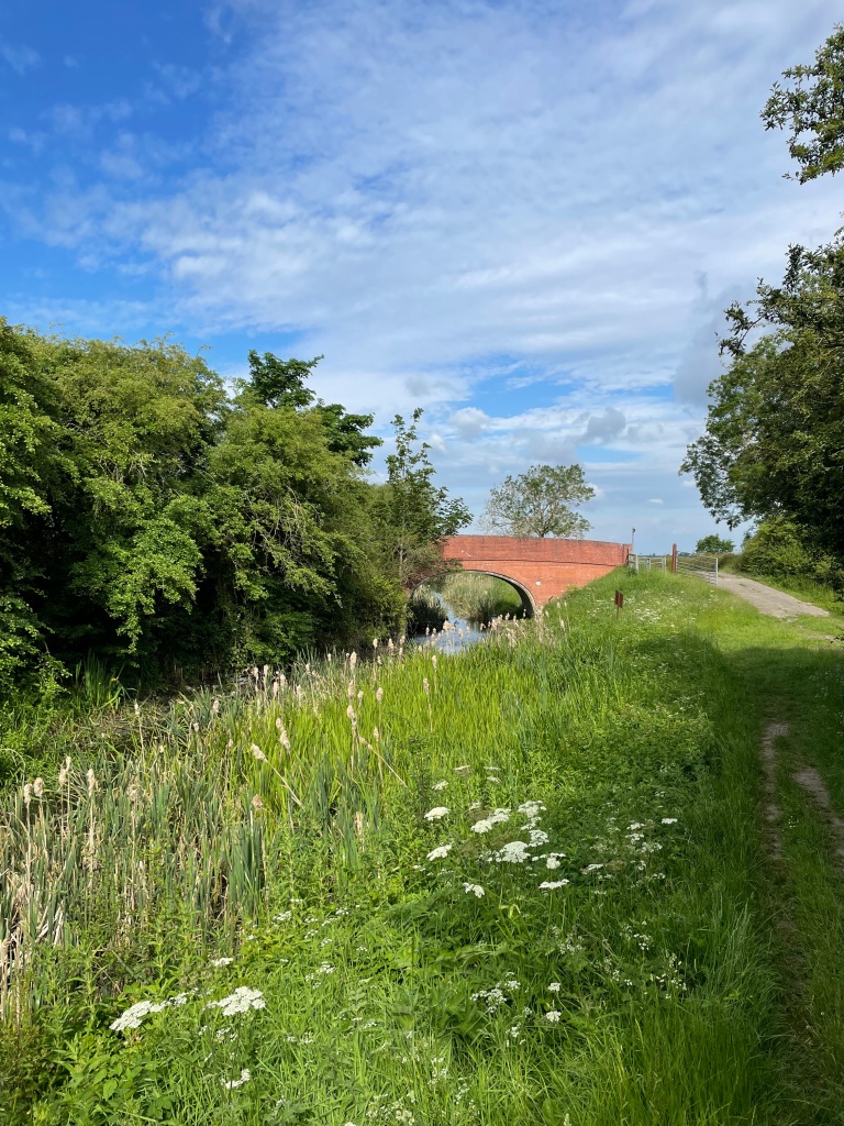
It was sunny but on the chilly side this morning as I set off on an 18 mile walk along The Grantham Canal. I would be doing a ‘there and back’ starting in Woolsthorpe- by- Belvoir and going to Dove Cottage Tea rooms near Harby.
A canal view today
Why did I walk 18 miles? -you might well ask. Well, on the 29th June I am taking part in a 26 mile sponsored walk along the canal, from Gamston to the Grantham Canal Society depot at Woolsthorpe, in order to raise funds for the Society. http://www.justgiving.com/crowdfunding/granthamcanalsociety
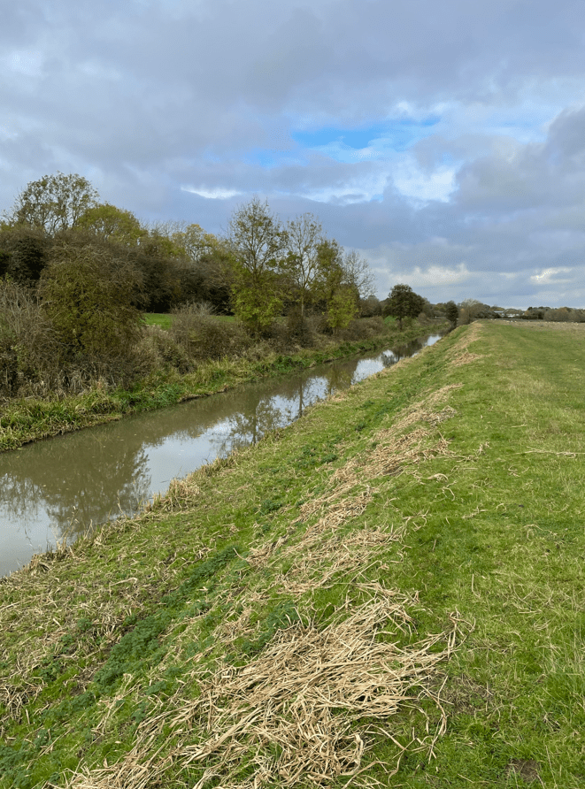
The Grantham Canal runs 33 miles from Grantham to the river Trent in Nottingham. With the coming of the railways, sadly, the canal fell into disuse. The canal is gradually being restored by The Grantham Canal Society but there is still a long way to go.
Today I wanted to do a longer than usual walk to condition myself to the longer distance.
It was a perfect walking day – not too hot and a gentle breeze, as I set off from the depot.
The canal society depot at Woolsthorpe
I walked past a series of locks that have been restored by the Society.
Lock 16
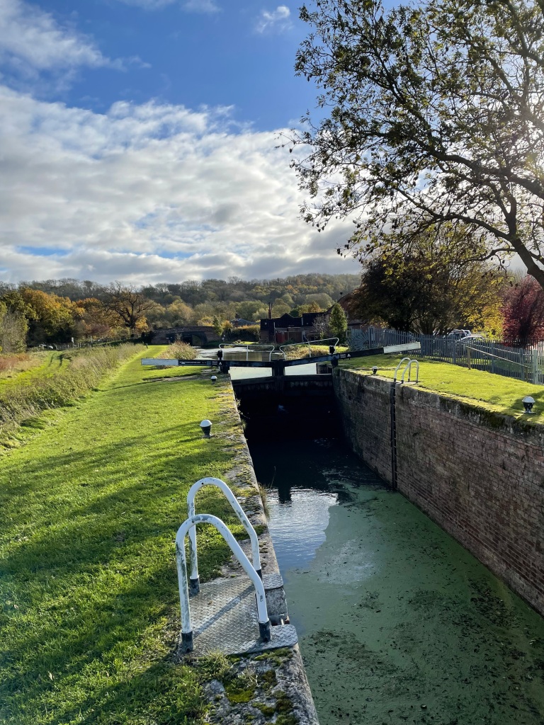
When I reached lock 13 there was a detour off of the towpath because this is the lock that is currently at the early stages of restoration.
Exposed side walls on Lock 13
One thing that I did notice is how much the grass and weeds on the towpath has grown in the last few weeks, not to mention the weed in parts of the canal. The wet and warm weather has certainly allowed nature to flourish.
I passed a couple of swans with their three Cygnets – lovely to see!
As I walked along the canal I realised how much I was enjoying it because navigation was simple and there were no worries from traffic. I had nice chats with a number of people who I met along the towpath who were also enjoying a walk.
The highlight of the walk was hearing cuckoos in the distance, its not often you hear a cuckoo and there were a plenty along my walk today.
I passed another Lancaster bomber crash site memorial – so sad.
Along the way I stopped for a break a couple of times. I definitely needed to take on board fluids. Finishing the walk I was pleased that I was feeling strong so that gives me confidence to tackle the 26 miles on the 29th June. I wonder what the weather will be like on that day?
I had enjoyed the walk and achieved my objective for today 😊.
This morning the ‘Three Amigos’ met up and did a 10.6 mile walk from Woolsthorpe -by-Belvoir to Grantham along the Grantham Canal and back again. The Grantham canal is being restored by The Grantham Canal Society https://www.granthamcanal.org/
Parking the cars near the Dirty Duck pub, Belvoir Castle loomed large on the hillside dominating the area. Chris was 15 mins ‘late’ to meet up – ‘How come I am 15 mins early and I am still last ?’ he asked.
We had chosen to do a canal walk because of the recent rain and we wanted to avoid boggy fields. Water levels in the canal were low we noted as we peered over the bridge by the pub.
We set off along the towpath heading East towards Grantham. Light rain was forecast but nothing drastic.
Passing the ‘Three Shires’ hire boat.Casthorpe bridge – a nice wooden pedestrian bridge
It was odd seeing the low level of water in the canal as it is not usually that low. So, we were on the lookout for any evidence of leaks from the canal as we walked along.
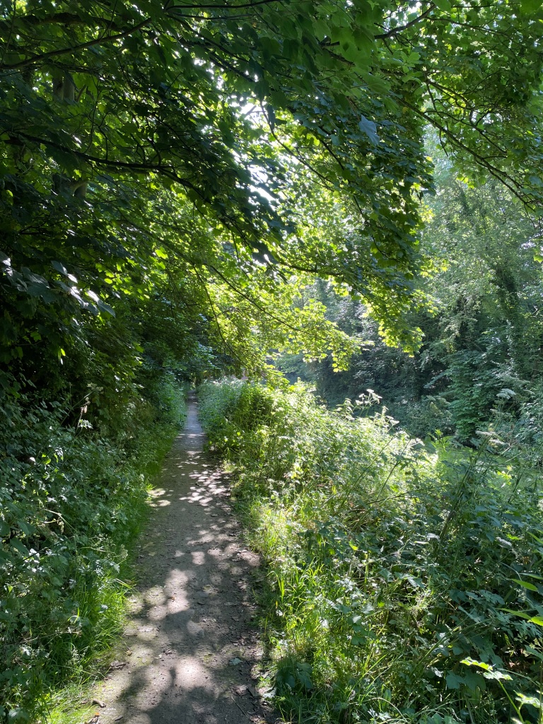
The path lies ahead
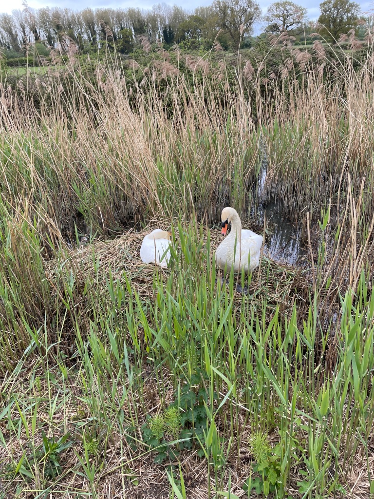
We passed a nesting swan – majestic birds- and a couple of Mallard ducklings. New life along the cut.
Chris was coughing and spluttering alot and clearly only firing on two cylinders. It was quiet along the canal with just the odd few cyclists, runners and dog’s walking their humans. If only the cyclists would ring a bell before frightening you half to death!
Denton Winding Hole
The green foliage was particularly striking this morning – spring was in full swing.
A cluster of Bluebells and a cycle trail sign
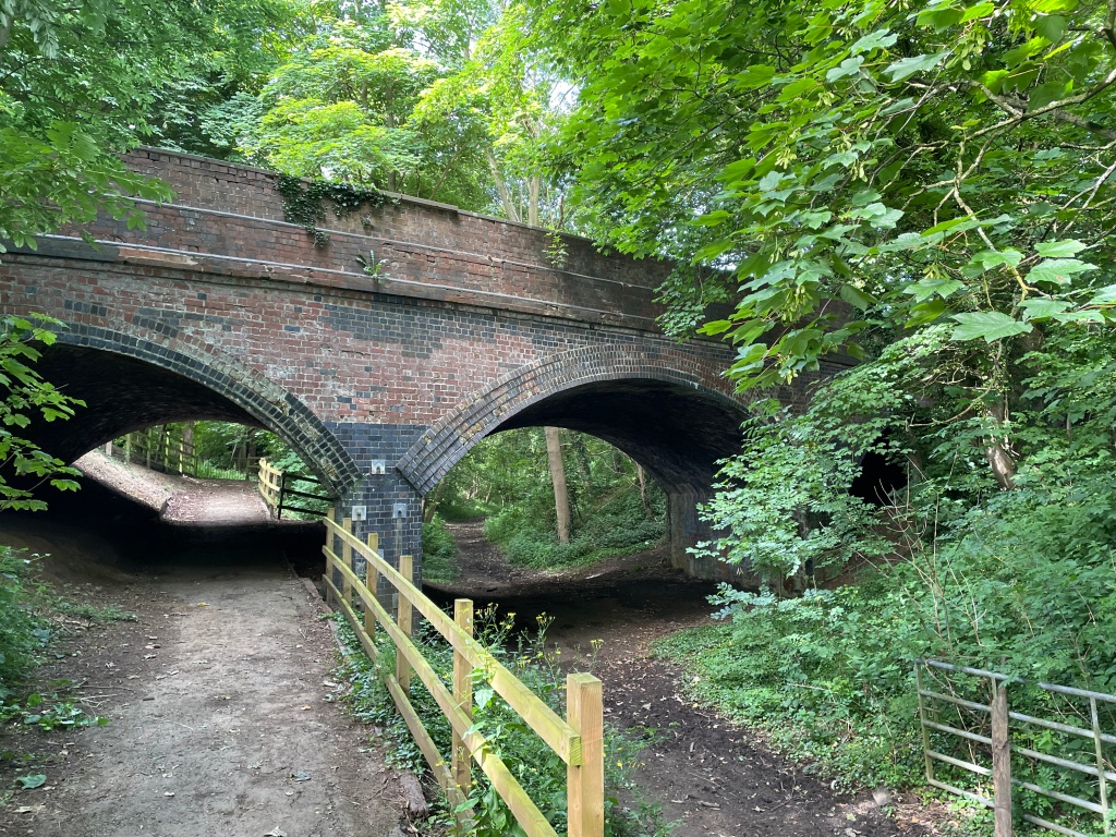
We passed under a number of brick humpback bridges along the way. I always enjoy looking at the brickwork.
Vincents Bridge
We reached the point where the A1 cuts across the canal and walked along Barrowby road to rejoin the canal in Grantham at Swingbridge Lane. We had left a rural area and were most definitely in urban territory.
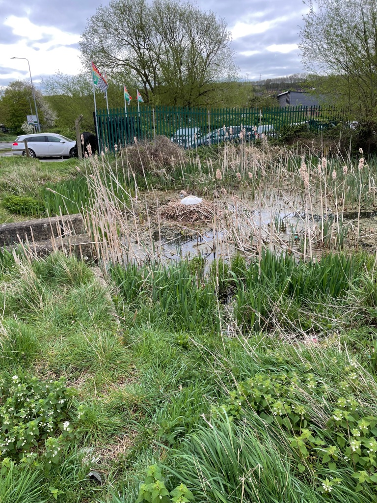
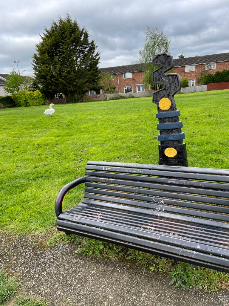
Walking to the end of the canal at Earlesfield Lane we passed another nesting swan and found a handy bench for a cuppa.
A handy bench for a cuppa
After a refreshing Bovril we headed back. Light drizzly rain accompanied us along our way. The main topics of Three Amigo talk this morning were canal water levels, Jury service and Guitar playing!
We had thoroughly enjoyed the walk. We never found a leak, but I later found out that over the weekend there had been some boat movements and locks opened/closed. Water from Denton reservoir, which supplies the canal, has now been turned on so it won’t be long before the water level returns to normal 😊.